Ellicott, Colorado
Ellicott is an unincorporated community and a census-designated place (CDP) located in and governed by El Paso County, Colorado, United States. The CDP is a part of the Colorado Springs, CO Metropolitan Statistical Area. The population of the Ellicott CDP was 1,131 at the United States Census 2010.[4] The Calhan post office (Zip Code 80808) serves the area.[3]
Ellicott, Colorado | |
|---|---|
 Ellicott Grocery in Ellicott. | |
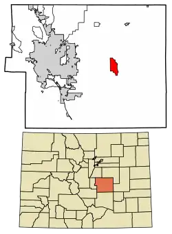 Location of the Ellicott CDP in El Paso County, Colorado. | |
 Ellicott Location of the Ellicott CDP in the United States. | |
| Coordinates: 38°49′32″N 104°22′58″W[1] | |
| Country | |
| State | |
| County | El Paso County |
| Area | |
| • Total | 10.922 sq mi (28.287 km2) |
| • Land | 10.922 sq mi (28.287 km2) |
| • Water | 0.000 sq mi (0.000 km2) |
| Elevation | 5,974 ft (1,821 m) |
| Population (2010) | |
| • Total | 1,131 |
| • Density | 104/sq mi (40/km2) |
| Time zone | UTC-7 (MST) |
| • Summer (DST) | UTC-6 (MDT) |
| ZIP code[3] | Calhan 80808 |
| Area code(s) | 719 |
| GNIS feature[2] | Ellicott CDP |
Geography
The Ellicott CDP has an area of 6,990 acres (28.287 km2), all land.[1]
Demographics
The United States Census Bureau initially defined the Ellicott CDP for the United States Census 2010.
| Year | Pop. | ±% |
|---|---|---|
| 2010 | 1,131 | — |
| 2020 | — | |
| Source: United States Census Bureau | ||
Education
Students are served by the Ellicott School District 22.
See also
- Outline of Colorado
- State of Colorado
- Colorado cities and towns
- Colorado counties
- Colorado metropolitan areas
References
- "State of Colorado Census Designated Places - BAS20 - Data as of January 1, 2020". United States Census Bureau. Retrieved December 21, 2020.
- "U.S. Board on Geographic Names: Domestic Names". United States Geological Survey. Retrieved December 13, 2020.
- "Look Up a ZIP Code". United States Postal Service. Retrieved December 13, 2020.
- "2010: DEC Summary File 1". United States Census Bureau. Retrieved December 22, 2020.
External links
- Ellicott @ Colorado.com
- Elicott School District
- Ellicott, Colorado Mining Claims
- El Paso County website
Municipalities and communities of El Paso County, Colorado, United States | ||
|---|---|---|
| Cities | 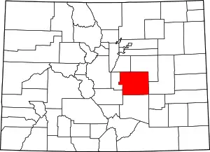 Map of Colorado highlighting El Paso County | |
| Towns | ||
| CDPs | ||
| Unincorporated communities | ||
| Ghost towns |
| |
| Footnotes | ‡This populated place also has portions in an adjacent county or counties | |
| ||
This article is issued from Wikipedia. The text is licensed under Creative Commons - Attribution - Sharealike. Additional terms may apply for the media files.