Rock Creek Park, Colorado
Rock Creek Park is an unincorporated community and a census-designated place (CDP) located in and governed by El Paso County, Colorado, United States. The CDP is a part of the Colorado Springs, CO Metropolitan Statistical Area. The population of the Rock Creek Park CDP was 58 at the United States Census 2010.[4] The Colorado Springs post office (Zip Code 80926) serves the area.[3]
Rock Creek Park, Colorado | |
|---|---|
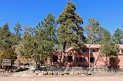 The May Natural History Museum in Rock Creek Park. | |
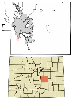 Location of the Rock Creek Park CDP in El Paso County, Colorado. | |
 Rock Creek Park Location of the Rock Creek Park CDP in the United States. | |
| Coordinates: 38°42′04″N 104°50′05″W[1] | |
| Country | |
| State | |
| County | El Paso County |
| Government | |
| • Type | unincorporated community |
| Area | |
| • Total | 0.266 sq mi (0.688 km2) |
| • Land | 0.266 sq mi (0.688 km2) |
| • Water | 0.000 sq mi (0.000 km2) |
| Elevation | 6,263 ft (1,909 m) |
| Population (2010) | |
| • Total | 58 |
| • Density | 218/sq mi (84/km2) |
| Time zone | UTC-7 (MST) |
| • Summer (DST) | UTC-6 (MDT) |
| ZIP Code[3] | Colorado Springs 80926 |
| Area code(s) | 719 |
| GNIS feature[2] | Rock Creek Park CDP |
Geography
Rock Creek Park is located on Colorado State Highway 115 south of Cheyenne Mountain State Park.
The Rock Creek Park CDP has an area of 170 acres (0.688 km2), all land.[1]
Demographics
The United States Census Bureau initially defined the Rock Creek Park CDP for the United States Census 2010.
| Year | Pop. | ±% |
|---|---|---|
| 2010 | 58 | — |
| 2020 | — | |
| Source: United States Census Bureau | ||
Attractions
- May Natural History Museum
- The May Museum of Space Exploration[5][6]
See also
- Outline of Colorado
- State of Colorado
- Colorado cities and towns
- Colorado counties
- Colorado metropolitan areas
References
- "State of Colorado Census Designated Places - BAS20 - Data as of January 1, 2020". United States Census Bureau. Retrieved December 21, 2020.
- "U.S. Board on Geographic Names: Domestic Names". United States Geological Survey. Retrieved December 14, 2020.
- "Zip Code 80926 Map and Profile". zipdatamaps.com. 2020. Retrieved December 22, 2020.
- "2010: DEC Summary File 1". United States Census Bureau. Retrieved December 22, 2020.
- "John May RV Park and Museum Center". Retrieved 15 May 2012.
- Staff. "JOHN MAY MUSEUM CENTER". LAND USE DATABASE. THE CENTER FOR LAND USE INTERPRETATION. Retrieved 18 May 2012.
External links
Municipalities and communities of El Paso County, Colorado, United States | ||
|---|---|---|
| Cities | 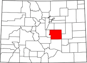 Map of Colorado highlighting El Paso County | |
| Towns | ||
| CDPs | ||
| Unincorporated communities | ||
| Ghost towns |
| |
| Footnotes | ‡This populated place also has portions in an adjacent county or counties | |
| ||
This article is issued from Wikipedia. The text is licensed under Creative Commons - Attribution - Sharealike. Additional terms may apply for the media files.