Gleneagle, Colorado
Gleneagle is an unincorporated community and a census-designated place (CDP) located in El Paso County, Colorado, United States. The population of the Gleneagle CDP was 6,611 at the United States Census 2010.[4] El Paso County governs the unincorporated community. The Colorado Springs post office (Zip Code 80921) serves the area.[3]
Gleneagle, Colorado | |
|---|---|
 The Gleneagle Square shopping center in Gleneagle, looking across at the Rampart Range | |
 Location of the Gleneagle CDP in El Paso County, Colorado. | |
 Gleneagle Location of the Gleneagle CDP in the United States. | |
| Coordinates: 39°02′43″N 104°49′43″W[1] | |
| Country | |
| State | |
| County | El Paso County |
| Government | |
| • Type | unincorporated community |
| Area | |
| • Total | 2.343 sq mi (6.069 km2) |
| • Land | 2.338 sq mi (6.056 km2) |
| • Water | 0.005 sq mi (0.013 km2) |
| Elevation | 6,857 ft (2,090 m) |
| Population (2010) | |
| • Total | 6,611 |
| • Density | 2,828/sq mi (1,092/km2) |
| Time zone | UTC-7 (MST) |
| • Summer (DST) | UTC-6 (MDT) |
| ZIP Code[3] | Colorado Springs 80921 |
| Area code(s) | 719 |
| GNIS feature[2] | Gleneagle CDP |
Geography
The Gleneagle CDP has an area of 1,500 acres (6.069 km2), including 3.2 acres (0.013 km2) of water.[1]
Demographics
The United States Census Bureau initially defined the Gleneagle CDP for the 1990 United States Census.
| Year | Pop. | ±% |
|---|---|---|
| 1990 | 1,661 | — |
| 2000 | 4,246 | +155.6% |
| 2010 | 6,611 | +55.7% |
| 2020 | — | |
| Source: United States Census Bureau | ||
Politics
In the Colorado General Assembly Gleneagle is located in the 4th Senate District, represented by Republican Jim Smallwood, and in the 20th House District, represented by Republican Terri Carver. Federally, Gleneagle is located in Colorado's 5th congressional district, which has a Cook PVI of R +14 and is represented by Republican Doug Lamborn.
Media
Gleneagle is served by Colorado Springs radio and television stations.
Newspapers
- The Gazette (Colorado Springs)
- The Tri-Lakes Tribune
See also
- Outline of Colorado
- State of Colorado
- Colorado cities and towns
- Colorado counties
- Colorado metropolitan areas
References
- "State of Colorado Census Designated Places - BAS20 - Data as of January 1, 2020". United States Census Bureau. Retrieved December 21, 2020.
- "U.S. Board on Geographic Names: Domestic Names". United States Geological Survey. Retrieved December 16, 2020.
- "Look Up a ZIP Code". United States Postal Service. Retrieved December 16, 2020.
- "2010: DEC Summary File 1". United States Census Bureau. Retrieved December 22, 2020.
External links
Municipalities and communities of El Paso County, Colorado, United States | ||
|---|---|---|
| Cities | 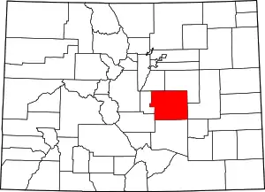 Map of Colorado highlighting El Paso County | |
| Towns | ||
| CDPs | ||
| Unincorporated communities | ||
| Ghost towns |
| |
| Footnotes | ‡This populated place also has portions in an adjacent county or counties | |
| ||
| Authority control |
|
|---|