Stratmoor, Colorado
Stratmoor (commonly known as Stratmoor Hills) is an unincorporated community and a census-designated place (CDP) located in and governed by El Paso County, Colorado, United States. The CDP is a part of the Colorado Springs, CO Metropolitan Statistical Area. The population of the Stratmoor CDP was 6,900 at the United States Census 2010.[4] The Colorado Springs post office (Zip Codes 80906, 80910, and 80911) serves the area.[3]
Stratmoor, Colorado | |
|---|---|
 Ths sign for the Stratmoor Hills subdivision in Stratmoor. | |
 Location of the Stratmoor CDP in El Paso County, Colorado.Colorado | |
 Stratmoor Location of the Stratmoor CDP in the United States. | |
| Coordinates: 38°46′23″N 104°46′43″W[1] | |
| Country | |
| State | |
| County | El Paso County |
| Government | |
| • Type | unincorporated community |
| Area | |
| • Total | 2.654 sq mi (6.874 km2) |
| • Land | 2.633 sq mi (6.819 km2) |
| • Water | 0.021 sq mi (0.055 km2) |
| Elevation | 5,787 ft (1,764 m) |
| Population (2010) | |
| • Total | 6,900 |
| • Density | 2,621/sq mi (1,012/km2) |
| Time zone | UTC-7 (MST) |
| • Summer (DST) | UTC-6 (MDT) |
| ZIP Code[3] | Colorado Springs 80906, 80910, and 80911 |
| Area code(s) | 719 |
| GNIS feature[2] | Stratmoor CDP |
History
Partial annexation by the City of Fountain
A portion of the Stratmoor CDP was annexed by the City of Fountain in 2014. Specifically, the area annexed was a 60-acre parcel just to the west of Interstate 25 at Exit 135 and north of South Academy Boulevard. The annexed land now includes a Walmart store, a Sam's Club, and a strip mall.[5][6]
Geography
The Stratmoor CDP has an area of 1,699 acres (6.874 km2), including 14 acres (0.055 km2) of water.[1]
Demographics
The United States Census Bureau initially defined the Stratmoor CDP for the 1980 United States Census.
| Year | Pop. | ±% |
|---|---|---|
| 1980 | 5,519 | — |
| 1990 | 5,854 | +6.1% |
| 2000 | 6,650 | +13.6% |
| 2010 | 6,900 | +3.8% |
| 2020 | — | |
| Source: United States Census Bureau | ||
Education
The Harrison School District 2 serves Stratmoor Hills.
See also
- Outline of Colorado
- State of Colorado
- Colorado cities and towns
- Colorado counties
- Colorado metropolitan areas
References
- "State of Colorado Census Designated Places - BAS20 - Data as of January 1, 2020". United States Census Bureau. Retrieved December 21, 2020.
- "U.S. Board on Geographic Names: Domestic Names". United States Geological Survey. Retrieved December 22, 2020.
- "Look Up a ZIP Code". United States Postal Service. Retrieved December 22, 2020.
- "2010: DEC Summary File 1". United States Census Bureau. Retrieved December 22, 2020.
- "City of Fountain 2019 –2020 biennial budget". City of Fountain, Colorado. 2018-12-11. Retrieved 2019-05-06.
In 2014, the City annexed in approximately 60 acres off of I-25 Exit 135 known as the South Academy Highlands. This land is being developed as a commercial district, and retail giants Walmart and Sam’s Club opened in 2015. An additional strip mall opened in the South Academy Highlands Area in 2017 with retailers including US Patriot Tactical Gear, Sally Beauty Supply, 5-Star Nutrition, and Go Wireless. New fast-food chain restaurants including Mod Pizza, Qdoba Mexican Grill, and Starbucks also opened during 2017 and 2018 in the Highlands area.
- "General city [map]". City of Fountain, Geographical Information Systems. City of Fountain. Retrieved 2019-05-06.
External links
- The Stratmoor Hills Neighborhood Association
- Stratmoor Hills Water District & Stratmoor Hills Sanitation District
- Stratmoor Hills Fire Protection District
- Harrison School District Two
- El Paso County website
Municipalities and communities of El Paso County, Colorado, United States | ||
|---|---|---|
| Cities | 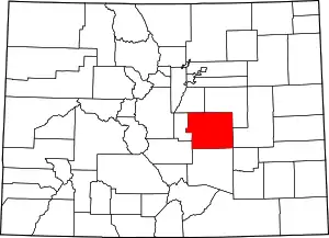 Map of Colorado highlighting El Paso County | |
| Towns | ||
| CDPs | ||
| Unincorporated communities | ||
| Ghost towns |
| |
| Footnotes | ‡This populated place also has portions in an adjacent county or counties | |
| ||