Cocherel
Cocherel is a commune in the Seine-et-Marne department in the Île-de-France region in north-central France.[2]
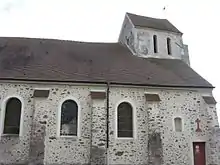
The Church of St. Christopher and St. James the Greater
Cocherel | |
|---|---|
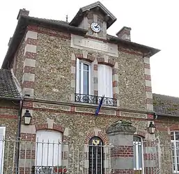 The town hall in Cocherel | |
Location of Cocherel 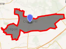
| |
 Cocherel  Cocherel | |
| Coordinates: 49°01′16″N 3°06′07″E | |
| Country | France |
| Region | Île-de-France |
| Department | Seine-et-Marne |
| Arrondissement | Meaux |
| Canton | La Ferté-sous-Jouarre |
| Intercommunality | CC Pays de l'Ourcq |
| Government | |
| • Mayor (2008–2014) | Pierre Eelbode |
| Area 1 | 8.27 km2 (3.19 sq mi) |
| Population (2017-01-01)[1] | 635 |
| • Density | 77/km2 (200/sq mi) |
| Time zone | UTC+01:00 (CET) |
| • Summer (DST) | UTC+02:00 (CEST) |
| INSEE/Postal code | 77120 /77440 |
| Elevation | 97–209 m (318–686 ft) |
| 1 French Land Register data, which excludes lakes, ponds, glaciers > 1 km2 (0.386 sq mi or 247 acres) and river estuaries. | |
History
Cocherel and Crépoil (Cocherellium, Crispolium) formed two distinct parishes before 1790 and until 1842 two distinct communes. A royal ordinance of 11 December 1887 united them in a single unit, the chief place of which was fixed at Cocherel.
Geography
Cocherel is at an altitude that reaches 209 meters near the wood of Montjay. It is, after Saint-Georges, of the commune of Verdot, the highest point of the department of Seine-et-Marne; there is no super-permanent watercourse, but only rivers (la Vanche, Méranne, Plants), which roll rain-water and lead them to the Ourcq river.
References
- "Populations légales 2017". INSEE. Retrieved 6 January 2020.
- (http://gallica.bnf.fr/ark:/12148/bpt6k5545878k/f39.item.texteImage)
External links
| Wikimedia Commons has media related to Cocherel. |
- 1999 Land Use, from IAURIF (Institute for Urban Planning and Development of the Paris-Île-de-France région) (in English)
| Authority control |
|---|
This article is issued from Wikipedia. The text is licensed under Creative Commons - Attribution - Sharealike. Additional terms may apply for the media files.
