Cosmos, Minnesota
Cosmos is a city in Meeker County, Minnesota, United States, along the South Fork of the Crow River. The population was 473 at the 2010 census.[6]
Cosmos | |
|---|---|
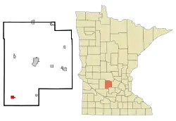 Location of Cosmos within Meeker County, Minnesota | |
| Coordinates: 44°56′14″N 94°41′51″W | |
| Country | United States |
| State | Minnesota |
| County | Meeker |
| Area | |
| • Total | 1.13 sq mi (2.93 km2) |
| • Land | 1.11 sq mi (2.87 km2) |
| • Water | 0.02 sq mi (0.06 km2) |
| Elevation | 1,112 ft (339 m) |
| Population | |
| • Total | 473 |
| • Estimate (2019)[3] | 449 |
| • Density | 405.23/sq mi (156.48/km2) |
| Time zone | UTC-6 (Central (CST)) |
| • Summer (DST) | UTC-5 (CDT) |
| ZIP code | 56228 |
| Area code(s) | 320 |
| FIPS code | 27-13420[4] |
| GNIS feature ID | 0641518[5] |
| Website | www.cosmos-mn.com |
History
Cosmos was first settled by Daniel Jackman in 1867. Several others followed that first year, such as Isaac L. Layton or Leighton from Maine, Hansom W. Young from New Brunswick, and Daniel Hoyt from Massachusetts. The first two were the first farmers and they planted wheat. Hoyt suggested the name when the Township was organized on January 25, 1870. He had come in 1867 as a surveyor, and he was elected the first township clerk. He froze to death in February 1870, trying to walk on foot to the Minnesota River. Cosmos is an ancient Greek word meaning “order and harmony in the universe”. The city was incorporated as a village on September 21, 1926, and finally as a city in 1969. A post office was established as in Renville County in 1870, then to McLeod County in 1871, and finally, it was transferred to Meeker County in 1872. Isaac Layton was the postmaster. The post office closed in 1906 and re-opened in 1924. The town had a railway station serving several rail lines including the Minnesota and Western Railroad. The town sits along the South Fork of the Crow River. The population was 473 at the 2010 census.[7] The banks in Meeker County starting improving their security systems in March 1925 after there was a rash of bank break-ins in Cold Spring, Prinsburg, Cosmos and Svea in 1924 and 1925. Three men made an attempt to rob the Cosmos First State Bank on Tuesday, April 21, 1924. The bandits parked out of town and walked into the sleepy little community where they got into the bank through a basement window. Before they came into town a little after one in the morning, they cut all the telephone and telegraph wires leading in and out of the town. One man was left to stand guard outside the bank. Inside the bank, the other two packed the safe with explosives and set them off. The door opened, but the thieves were confronted with an upper and a lower compartment inside. Eeny meeny, miney moe...the duo opted for “moe”, the lower one, which they then blew open too. Unfortunately, the bank's $5,000 in cash was in “miney”, the upper compartment. The money had been received just the night before to pay the members of the local creamery. Do you suppose a creamery employee was involved in the attempted heist, tipping off some buddies? The noise from the first explosion aroused garage owner Emil August Hackbarth from his sleep. He lived right across the street from the bank. Apparently, Emil didn't like to be woke up. He reached for his revolver, which he conveniently kept near his bed, and went to his window facing the bank. He calmly fired off a shot. I don't know if he even saw the lookout there or not, but J. H. Jerabek, who lived a couple of houses down the street certainly did. Jerabek, the bank cashier, lit a lamp and stepped out onto his porch, where he ran into a shotgun. “Get back in there, or I’ll blow your damned head off,” Jerabek was told. He went back in but inside he immediately grabbed his own shotgun, but he couldn't find any shells. Alerted by the lookout that the town was waking up, the two men inside the bank opened a window and climbed out. The three of them then ran off to their car and sped off, never to be seen or heard of again.
Minnesota State Highways 4 (Milkyway Street) and 7 (Astro Blvd.) are the two of the main routes in the town. In keeping with the community's space theme, all streets are named after planets and all avenues are named after constellations. On the third weekend in July, the city holds the Cosmos Space Festival. It features Minn-E-Rods, a softball tournament, a volleyball tournament, an antique tractor pull, meals in the park, pig races, a Space Festival parade, fireworks, a pancake breakfast, a pork chop dinner, church in the park, music entertainment, crafters, a pedal tractor pull, a disc golf tournament, laser tag, a bean bag tournament, citywide garage sales, drawings, and many other activities.
Geography
According to the United States Census Bureau, the city has a total area of 1.14 square miles (2.95 km2), of which 1.12 square miles (2.90 km2) is land and 0.02 square miles (0.05 km2) is water.[8]
Cosmos is located along the South Fork of the Crow River.
Demographics
| Historical population | |||
|---|---|---|---|
| Census | Pop. | %± | |
| 1930 | 230 | — | |
| 1940 | 357 | 55.2% | |
| 1950 | 382 | 7.0% | |
| 1960 | 487 | 27.5% | |
| 1970 | 570 | 17.0% | |
| 1980 | 571 | 0.2% | |
| 1990 | 610 | 6.8% | |
| 2000 | 582 | −4.6% | |
| 2010 | 473 | −18.7% | |
| 2019 (est.) | 449 | [3] | −5.1% |
| U.S. Decennial Census[9] | |||
2010 census
As of the census[2] of 2010, there were 473 people, 229 households, and 120 families residing in the city. The population density was 422.3 inhabitants per square mile (163.1/km2). There were 261 housing units at an average density of 233.0 per square mile (90.0/km2). The racial makeup of the city was 97.5% White, 0.2% African American, 0.2% Native American, 0.2% Pacific Islander, 1.5% from other races, and 0.4% from two or more races. Hispanic or Latino of any race were 1.7% of the population.
There were 229 households, of which 23.6% had children under the age of 18 living with them, 38.9% were married couples living together, 10.9% had a female householder with no husband present, 2.6% had a male householder with no wife present, and 47.6% were non-families. 38.0% of all households were made up of individuals, and 14.9% had someone living alone who was 65 years of age or older. The average household size was 2.07 and the average family size was 2.78.
The median age in the city was 45.2 years. 19.9% of residents were under the age of 18; 6.8% were between the ages of 18 and 24; 23.3% were from 25 to 44; 30.7% were from 45 to 64, and 19.5% were 65 years of age or older. The gender makeup of the city was 49.0% male and 51.0% female.
2000 census
As of the census[4] of 2000, there were 582 people, 240 households, and 154 families residing in the city. The population density was 519.3 people per square mile (200.6/km2). There were 261 housing units at an average density of 232.9 per square mile (90.0/km2). The racial makeup of the city was 98.28% White. Four persons (0.69%) identified as Asian, one (0.17%) as Pacific Islander, two (0.34%) from other races, and three (0.52%) from two or more races. Two persons (0.34%) were Hispanic or Latino of any race.
There were 240 households, out of which 27.5% had children under the age of 18 living with them, 52.5% were married couples living together, 8.3% had a female householder with no husband present, and 35.8% were non-families. 28.8% of all households were made up of individuals, and 11.3% had someone living alone who was 65 years of age or older. The average household size was 2.26 and the average family size was 2.73.
In the city, the population was spread out, with 20.8% under the age of 18, 7.9% from 18 to 24, 26.8% from 25 to 44, 21.1% from 45 to 64, and 23.4% who were 65 years of age or older. The median age was 42 years. For every 100 females, there were 90.8 males. For every 100 females age 18 and over, there were 90.5 males.
The median income for a household in the city was $30,278, and the median income for a family was $36,750. Males had a median income of $31,364 versus $23,125 for females. The per capita income for the city was $15,447. About 5.8% of families and 10.0% of the population were below the poverty line, including 4.1% of those under age 18 and 22.0% of those age 65 or over.
Notes
- "2019 U.S. Gazetteer Files". United States Census Bureau. Retrieved July 26, 2020.
- "U.S. Census website". United States Census Bureau. Retrieved 2012-11-13.
- "Population and Housing Unit Estimates". United States Census Bureau. May 24, 2020. Retrieved May 27, 2020.
- "U.S. Census website". United States Census Bureau. Retrieved 2008-01-31.
- "US Board on Geographic Names". United States Geological Survey. 2007-10-25. Retrieved 2008-01-31.
- "2010 Census Redistricting Data (Public Law 94-171) Summary File". American FactFinder. U.S. Census Bureau, 2010 Census. Retrieved 23 April 2011.
- "Archived copy". Archived from the original on 2018-05-09. Retrieved 2014-12-17.CS1 maint: archived copy as title (link)
- "US Gazetteer files 2010". United States Census Bureau. Archived from the original on 2012-07-02. Retrieved 2012-11-13.
- "Census of Population and Housing". Census.gov. Retrieved June 4, 2015.
External links
Municipalities and communities of Meeker County, Minnesota, United States | ||
|---|---|---|
| Cities |  Map of Minnesota highlighting Meeker County | |
| Townships | ||
| Unincorporated communities | ||
| Footnotes | ‡This populated place also has portions in an adjacent county or counties | |
| ||
| Authority control |
|---|