Kingston, Minnesota
Kingston is a city in Meeker County, Minnesota, United States, located along the North Fork of the Crow River. The population was 161 at the 2010 census.[6]
Kingston | |
|---|---|
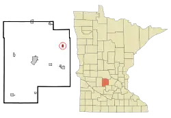 Location of Kingston within Meeker County, Minnesota | |
| Coordinates: 45°12′N 94°19′W | |
| Country | United States |
| State | Minnesota |
| County | Meeker |
| Area | |
| • Total | 0.55 sq mi (1.43 km2) |
| • Land | 0.55 sq mi (1.43 km2) |
| • Water | 0.00 sq mi (0.00 km2) |
| Elevation | 1,033 ft (315 m) |
| Population | |
| • Total | 161 |
| • Estimate (2019)[3] | 162 |
| • Density | 293.48/sq mi (113.30/km2) |
| Time zone | UTC-6 (Central (CST)) |
| • Summer (DST) | UTC-5 (CDT) |
| ZIP code | 55325 |
| Area code(s) | 320 |
| FIPS code | 27-33344[4] |
| GNIS feature ID | 0646171[5] |
History
Tuesday afternoon, August 19, the day after the Sioux Uprising massacre at Acton in 1862, word was received that the outbreak was widespread and would extend all along the border. That evening, the frightened settlers held a council meeting, and they decided to send all the women and children to Clearwater. Jesse V. Branham, Jr., the future first Council President for Litchfield (Mayor), was appointed to take charge of the wagon train of loved ones. Wednesday morning, the wagon train started on the journey to safety. It was made up of animal teams of every description and was a half a mile in length. Jesse V. Branham, Jr., led them about halfway through the “Big Woods,” when he turned the train over to a couple of other gentlemen, bade his family good-bye, and returned to Kingston. There he talked with a number of the leading citizens, gave them his idea of a stockade, and on the following morning, with his team, he hauled the first logs for the Kingston fortifications.
Kingston is a city along the North Fork of the Crow River was settled in 1856 and platted in 1857. A post office was established at Kingston that year, changed to a rural branch through 1907 to 1910, and was reestablished as a community post office in 1954. The town was organized on April 5, 1858, and the name was proposed by George A. Nourse, a lawyer of St. Anthony (Minneapolis). The city in section 22 was platted in 1871 and incorporated as a village on September 13, 1961. Twenty-five other states, and also the Canadian provinces of Ontario and New Brunswick, have villages or cities and townships of that name. State Highway 15 serves as the main route in and out of the community, and Minnesota State Highway 24 is nearby.
There's always differences of opinion as to the first this or the first that. Most history books say that the first settler in Meeker County was Benjamin F. Dorman, who, in 1856, broke prairie sod between Kingston and Forest City, so that he could make a land claim, which he started farming. Morris Powers was the next to follow suit, but he died the next season.
Jonathan Burnett Salisbury was working at doing public surveys for the government in various parts of Iowa, Wisconsin, and Minnesota. In the summer of 1855, while running township lines through what is now Meeker County, Jonathan was so much pleased with the country that he stuck a claim stake in sections 18 and 19, in what is now Kingston Township. At that time, there were no other people there, except those of the surveying parties, within the limits of Meeker County. Returning to his home in Scott County, Iowa in October 1855, he stayed there until the spring of 1856, when he came back to Kingston with his family. Salisbury had brought all his possessions with him, and the trip took about one month. To one large, wide tracked wagon were hitched four yoke of oxen, and to another wagon, a team of horses. A good share of the time was spent in getting through the “big woods,” because there was no road other than a trail, and a good deal of chopping was necessary. This trail had been cut so that one team could barely get through, and was for years known as the “Old Territorial Road.”
The party, however, finally reached the claim, and their first job was to put up a little cabin. This was one of the first houses erected in Meeker County. At the time of the Indian outbreak, Salisbury and his family left the farm and went into the village of Kingston, which Jonathan helped to fortify. For two weeks, his family occupied someone's house, and then all the refugees who had gathered in the village spent the nights in the grist mill, which was being used as a fort. Salisbury and his family stayed in Kingston for about one month, at which time he sent his family to their old home in Iowa. Salisbury enlisted in the “Mounted Rangers,” or the First Minnesota Cavalry, and he served through the Indian War for one year. He then enlisted in Hatch's Independent Battalion of Minnesota Cavalry for three years and served on the frontier. Upon being honorably discharged in the spring of 1866, he sent to Iowa for his family and again returned to their Kingston farm and cultivated it until June 1875, when they moved to Litchfield. In 1868, Salisbury was elected to represent his district in the Legislature.
Mark Cates came to Meeker County in 1856, and upon the filing of his claim in April of that year, he went back to Maine, where he got married, and then he returned and settled upon his land that same year. His property was located on section 20, Kingston township. Orrin Whitney came in March 1857, with his brother, Albion P. Whitney, Samuel B. Hutchins, and some others, and Orrin settled at Kingston. He helped build the mill put up by him and Averill & Hutchins in 1857 and 1858. It was the first grist-mill in the county. Also in 1857, Samuel A. Dorman came to Kingston and settled on section 17.
F. V. DeCoster came in the spring of 1858 and he started working in carpentering, teaching, and in the fur trade. He stayed in the fur business most of the time until the Indian Uprising of 1862 broke out. He already had become friendly with Chief Little Crow, the head of the massacre movement, and also with Chief Shakopee, buying fur and venison from them at various times. In 1859–1860, DeCoster left Kingston for a trip through the south for quite a while, but he returned to Kingston. When the Civil War started, DeCoster enlisted and fought in many battles, even personally capturing some Confederate soldiers. After the close of the war, he remained in St. Louis for four months and then he returned to Kingston and engaged in the general mercantile trade. This he conducted until 1868 when he sold out and became a partner in a flouring mill. He remained in that until the spring of 1871, when he moved to Litchfield. Most of his time in Kingston, he was a justice of the peace.
Michael Murphy came in May in 1862 along with Daniel Byrnes and his children. His son Michael and his other son William had a general store in town starting in January of1886, along with T. Owen. They remained in partnership with Owen until the 1st of January, 1888, when Mr. Owen sold out to Timothy J. Murphy, yet another Murphy brother. William taught in the Kingston village school for the winter term of 1883-1884 and later settled in the village. He held the office of justice of the peace for two years, and that of the clerk of the township for quite a time. He was appointed postmaster in September 1886. In 1864, Frederick Spath came to Kingston where he opened a blacksmith shop and continued in that business for two years. He then moved to Dassel. William Hamilton enlisted in the Union Army and fought in the battles of Chickamauga, Hoover's Gap, Mill Spring, Berryville, besides many small skirmishes. In one of those battles, he lost the use of his left arm. He was honorably discharged in St. Paul in August 1864, and he got married in St. Anthony, now East Minneapolis, in September 1864. He and his wife then came and settled in Kingston.
When the Civil War ended and Ephraim A. Briggs was mustered out in New York, he got married on November 16, 1866, to Helen F. Hale, a native of Maine and they moved to Kingston. He started in the mercantile business, but after eight months, he sold out and returned to New York. Three months later he came back and took up a homestead on section 34, Kingston township. He then purchased the store of F. V. DeCoster, and continued the mercantile business until 1875, since which time he has been chiefly employed dealing in real estate. Ephraim was the postmaster of Kingston from 1874 until 1886; has filled the offices of justice of the peace and the town treasurer. Otho H. Campbell came to Kingston in the year of 1866 and entered into the general merchandise trade in connection with the Whiting Brothers, a Clearwater firm. One year later he bought out his partners, and for two years ran the business alone. At the end of that time, he moved to the new village of Litchfield, and, purchased the Lake Ripley House, which he ran for two years. His son, Ernest Wells Campbell, a Litchfield lawyer, was born on November 19, 1870, in Kingston.
Adam Brower, during the Civil War, was in many of the bloodiest battles of the war, among which were Winchester, Chancellorsville, Gettysburg, in the east, and, after they were transferred, in Cumberland, Resaca, and Altoona. He was wounded in Altoona and was laid up in the hospital for a few weeks. He was taken prisoner by the rebels at the battle of Winchester, May 25, 1862, and kept by them until September 20, following, when he was exchanged and resumed duty. He was mustered out, at Indianapolis, September 14, 1865. In February 1867, Adam came to Meeker County and purchased a place in Kingston. For the first three years of his residence here he was engaged in brick making in the village, but at the expiration of that time took up farming. Two seasons since that he has been in the same business, and a part of the time in the sawmill at Dassel. John W. Benton was among the settlers of 1867 and he settled in section 10. Alphonso Carvil, a doctor, came in 1867 and stayed for several years.
Robert M. Damuth came to Meeker County in 1868 and settled in Kingston. Nelson Turner did the same, in the same year, and located on section 34, Kingston. He served for three years as director of school district No. 41. John Olson came in 1868 and took a homestead of eighty acres of land on section 34. Thomas F. Price came with his mother. After his father died, his mother went West with her family in the fall of 1856, and for six months stayed in Minneapolis. Then the family settled in Kingston and made their home. They stayed in Kingston during all of the trouble with the Indians in 1862 and on, although nearly all of the settlers throughout the county went away for safety. In 1863, the family moved to Harvey Township. H. V. Rumsey came to Minnesota in 1868 from Wisconsin, where he had been living for years, and he settled in Kingston.
Samuel C. Vincent came to Meeker county in 1869 and settled on section 4 of Kingston to farm. Peter Norgren came in 1873 and purchased a half interest in the saw and flouring mill at East Kingston. Peter worked in the milling business for two years and a half when he sold his interest to his partner and moved to Dassel. James H. Shimin came on December 18, 1876, to farm on section 26 of the township. John Wise came in 1879 to farm. He claimed section 29, Kingston Township. John Mattson owned and operated the flouring mill in Kingston. He came to Kingston on October 4, 1882, and purchased from J. H. Thompson, of Minneapolis, the mill built by Whitney & Hutchins.
George Maynard was one of the first settlers of Dassel, where he landed in May 1866. He made his home in that part of the county for about twenty years and then he moved to Kingston in section 32. He was one of the “woods” farmers and stock-raisers of the town.
Three men visited Kingston September 24, 1919. The men drove into town in a Buick-Six touring car. They were all dressed in hunting clothes, which wasn't unusual given the area and the time of year. But they didn't seem to be in any hurry to do any hunting. Instead, they hung around town, walking the streets, standing next to their car smoking, and talking. Finally, a little after noon, they ambled into the local café and had a bite to eat. Stretching their dinner out as long as they could, they paid their bills and walked back to their car. They got in and drove out of town. About a mile out of town, they pulled over, got out, and removed the car's license plates. Jumping back in, they turned around and headed back into town where two of the men were deposited at 1:30 pm in front of the Kingston State Bank, the only bank in town. The third man stayed in the car.
Then two of the men, still dressed in their hunting clothes, walked into the bank and one of them walked up to cashier John E. Matsen's counter. He started a conversation with Matsen about the weather, how the hunting was in the area, just small talk, never once saying what he wanted in the bank. Matsen started to get suspicious. Suddenly the man pulled a revolver out of his pocket and pointed it in Matsen's face. “This is a holdup,” the man said. Matsen looked at him and then just ducked down under his counter and pressed the alarm button. The robber fired his gun into the counter. Frightened by the alarm, the two men gave up their quest and turned and ran out the door, where they jumped into the waiting car and sped away. Matsen ran out the door after the men, saw them head west out of town across the bridge. He ran to his own car, where John A. Hannula joined him. The quickly formed posse took off after the outlaws. Just out of town, they were met with some men moving a herd of cows across the road. Slowed down, they couldn't find their quarry again and gave up the pursuit. The would-be bank robbers were never caught.
One of the baseball players on the 1951 Litchfield Optimists Championship team was Bob Kinsel from Kingston. He pitched (a record of 6 and 1) and he played outfield. The population of Kingston was 161 in the 2010 census. On March 12, 2013, a special election was held regarding the dissolution of Kingston. With 23 votes in favor of the dissolution and 36 votes against the dissolution, the petition for dissolution was rendered not effective
Geography
According to the United States Census Bureau, the city has a total area of 0.56 square miles (1.45 km2), all land.[7]
Minnesota State Highway 15 serves as a main route in the community, and Minnesota State Highway 24 passes nearby.
Demographics
| Historical population | |||
|---|---|---|---|
| Census | Pop. | %± | |
| 1870 | 56 | — | |
| 1970 | 115 | — | |
| 1980 | 141 | 22.6% | |
| 1990 | 131 | −7.1% | |
| 2000 | 120 | −8.4% | |
| 2010 | 161 | 34.2% | |
| 2019 (est.) | 162 | [3] | 0.6% |
| U.S. Decennial Census[8] | |||
2010 census
As of the census[2] of 2010, there were 161 people, 61 households, and 42 families residing in the city. The population density was 287.5 inhabitants per square mile (111.0/km2). There were 70 housing units at an average density of 125.0 per square mile (48.3/km2). The racial makeup of the city was 96.9% White, 0.6% Native American, 0.6% Asian, and 1.9% from two or more races. Hispanic or Latino of any race were 1.9% of the population.
There were 61 households, of which 36.1% had children under the age of 18 living with them, 60.7% were married couples living together, 6.6% had a female householder with no husband present, 1.6% had a male householder with no wife present, and 31.1% were non-families. 21.3% of all households were made up of individuals, and 4.9% had someone living alone who was 65 years of age or older. The average household size was 2.64 and the average family size was 3.10.
The median age in the city was 30.4 years. 29.2% of residents were under the age of 18; 8% were between the ages of 18 and 24; 29.2% were from 25 to 44; 22.3% were from 45 to 64; and 11.2% were 65 years of age or older. The gender makeup of the city was 55.3% male and 44.7% female.
2000 census
As of the census of 2000,[4] there were 120 people, 48 households, and 33 families residing in the city. The population density was 244.0 people per square mile (94.6/km2). There were 53 housing units at an average density of 107.8 per square mile (41.8/km2). The racial makeup of the city was 100.00% White. 34.8% were of German, 28.4% Finnish, 11.3% Swedish, 9.2% Norwegian, 7.8% Irish, and 5.0% French ancestry.
There were 48 households, out of which 31.3% had children under the age of 18 living with them, 64.6% were married couples living together, 4.2% had a female householder with no husband present, and 29.2% were non-families. 25.0% of all households were made up of individuals, and 12.5% had someone living alone who was 65 years of age or older. The average household size was 2.50 and the average family size was 3.00.
In the city, the population was spread out, with 23.3% under the age of 18, 14.2% from 18 to 24, 29.2% from 25 to 44, 22.5% from 45 to 64, and 10.8% who were 65 years of age or older. The median age was 37 years. For every 100 females, there were 140.0 males. For every 100 females age 18 and over, there were 109.1 males.
The median income for a household in the city was $39,375, and the median income for a family was $45,417. Males had a median income of $30,750 versus $19,107 for females. The per capita income for the city was $13,525. There were no families and 2.5% of the population living below the poverty line, including no under eighteens and 33.3% of those over 64.
References
- "2019 U.S. Gazetteer Files". United States Census Bureau. Retrieved July 26, 2020.
- "U.S. Census website". United States Census Bureau. Retrieved 2012-11-13.
- "Population and Housing Unit Estimates". United States Census Bureau. May 24, 2020. Retrieved May 27, 2020.
- "U.S. Census website". United States Census Bureau. Retrieved 2008-01-31.
- "US Board on Geographic Names". United States Geological Survey. 2007-10-25. Retrieved 2008-01-31.
- "2010 Census Redistricting Data (Public Law 94-171) Summary File". American FactFinder. U.S. Census Bureau, 2010 Census. Retrieved 23 April 2011.
- "US Gazetteer files 2010". United States Census Bureau. Archived from the original on 2012-01-25. Retrieved 2012-11-13.
- "Census of Population and Housing". Census.gov. Retrieved June 4, 2015.
Municipalities and communities of Meeker County, Minnesota, United States | ||
|---|---|---|
| Cities | 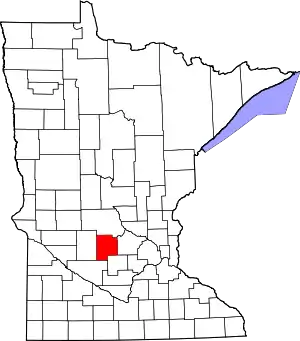 Map of Minnesota highlighting Meeker County | |
| Townships | ||
| Unincorporated communities | ||
| Footnotes | ‡This populated place also has portions in an adjacent county or counties | |
| ||