Cedar Mills, Minnesota
Cedar Mills is a city in Meeker County, Minnesota, United States. The population was 45 at the 2010 census.[6]
Cedar Mills | |
|---|---|
 Location of Cedar Mills within Meeker County, Minnesota | |
| Coordinates: 44°56′35″N 94°31′16″W | |
| Country | United States |
| State | Minnesota |
| County | Meeker |
| Area | |
| • Total | 0.32 sq mi (0.84 km2) |
| • Land | 0.32 sq mi (0.84 km2) |
| • Water | 0.00 sq mi (0.00 km2) |
| Elevation | 1,096 ft (334 m) |
| Population | |
| • Total | 45 |
| • Estimate (2019)[3] | 47 |
| • Density | 145.51/sq mi (56.25/km2) |
| Time zone | UTC-6 (Central (CST)) |
| • Summer (DST) | UTC-5 (CDT) |
| FIPS code | 27-10468[4] |
| GNIS feature ID | 0641029[5] |
History
Cedar Mills was laid out in 1860, and named for nearby Cedar Lake, located two miles to the northeast. Cedar Mills Lake was first referred to on old maps by the explorers, Fremont and Nicollet. The lake had the Indian name of “Ranti-tia-wita” or “ Island of the Red Cedar”. Daniel A. Cross was the first to make a settlement there with his family in 1856. He was later killed during the Sioux Uprising of 1862. In 1857, R. J. Brodwell, O. S. Merriam, Philander Ball, George R. Jewett, Elmer Eighmey, and a few others settled there. George Nichols built a flour mill there in 1858 and he ran it until 1867. The first store was established in the town by J. D. Baldwin. The first school was taught by Sophia Pratt in 1860, in the home of Daniel Cross. In September 1862, a small group of the Hutchinson Guards left the Hutchinson stockade and went to Meeker County in search of Caleb Sanborn and other missing settlers. Some of the Guard were Daniel Cross, T. R. Webb, Lieutenant Oliver Pierce, and Frank Jewett. When the party reached the north side of Cedar Lake woods, they were suddenly ambushed by thirteen Indians. Daniel Cross was shot and killed instantly. The search party had no time to pick up Cross's body as they were running to escape.
The Indians quickly scalped Daniel Cross, put his scalp on a pole, and carried it as a battle flag while they chased the men who were fleeing. T.R. Webb ran to Cedar Lake, jumped in a small boat, and paddled his way to Cedar Island where he hid for the night. Webb returned to Hutchinson the next morning. The remaining men also made it to Hutchinson safely. The next day a group of men went out to find the bodies of Cross and Sanborn, which had been badly mutilated, and they brought them back to Hutchinson.
Here's another Sioux Uprising story that involved Cedar Mills. On Monday morning, August 18, 1862, Henry J. Lasher learned of the massacre at Acton, and he sent his family to his wife's brother-in-law, D. B. Peck, who lived nearby. Lasher set out to notify the settlers in Greenleaf of the attacks. He found the settlers had already gone, so he made his way back to Peck's. Henry sent his family back to his farm and he stayed to help Peck harvest. On Thursday, he heard gunfire coming from near his farm and so he went to Cedar Mills to get someone to accompany him back to his farm to see if his family was all right. No one would go to help him, so Henry went alone. On reaching his farm, he met a group of about twenty people who had left Forest City to come and bury those killed at Acton.
Lasher and his family returned to Cedar Mills, and Peck, with his team of horses, hauled 1,600 pounds of flour and other provisions from his farm to Henry's. When they arrived at Henry's farm, they found some eight or ten families had gathered from the surrounding country, all bent on fleeing for safety. After some talk, it was decided to build a “fort” and remain. Henry was appointed captain, and they decided to fortify “the Point” in Cedar Lake and remain there until the uprising was over. Weymouth and Lasher stood guard at the crossing by the Cedar Lake mill. On Wednesday, a party of thirty or forty refugees from Yellow Medicine County turned up, accompanied by a friendly Indian named John Other Day.
With the refugees who arrived at Cedar Lake with Other Day was Stuart B. Garvie, who had been wounded by buck-shot in the lower abdomen. Garvie died the following day, August 22, in Lasher's house. An Indian named Haypinkpa or “Tip of the Horn” was tried, convicted of the murder of Garvie, and hung in Mankato in the mass hangings.
A post office called Cedar Mills was established in 1860 with Charles G. Topping as the postmaster. In 1861, Henry J. Lasher became the postmaster and during the Sioux Uprising he buried all the official papers and for years there was no post office in Cedar Mills. In 1870, it was established again but it closed in 1955. The town itself wasn't organized until January 25, 1870. Both Cedar Mills and Cosmos are located on the South Fork of the Crow River which empties into the Mississippi by Dayton, Minnesota. It drains one of the largest watersheds (over 200 square miles) in central Minnesota. In the 2010 census, 45 people were found to be living in Cedar Mills. [7]
Geography
According to the United States Census Bureau, the city has a total area of 0.34 square miles (0.88 km2), all land.[8]
Minnesota State Highways 7 and 22 are two of the main routes in the community. The Luce Line State Trail passes through the city.
Demographics
| Historical population | |||
|---|---|---|---|
| Census | Pop. | %± | |
| 1950 | 99 | — | |
| 1960 | 96 | −3.0% | |
| 1970 | 81 | −15.6% | |
| 1980 | 73 | −9.9% | |
| 1990 | 80 | 9.6% | |
| 2000 | 53 | −33.7% | |
| 2010 | 45 | −15.1% | |
| 2019 (est.) | 47 | [3] | 4.4% |
| U.S. Decennial Census[9] | |||
2010 census
As of the census[2] of 2010, there were 45 people, 23 households, and 14 families residing in the city. The population density was 132.4 inhabitants per square mile (51.1/km2). There were 24 housing units at an average density of 70.6 per square mile (27.3/km2). The racial makeup of the city was 93.3% White, 2.2% Asian, and 4.4% from two or more races.
There were 23 households, of which 13.0% had children under the age of 18 living with them, 52.2% were married couples living together, 8.7% had a female householder with no husband present, and 39.1% were non-families. 39.1% of all households were made up of individuals, and 17.4% had someone living alone who was 65 years of age or older. The average household size was 1.96 and the average family size was 2.57.
The median age in the city was 49.3 years. 13.3% of residents were under the age of 18; 6.7% were between the ages of 18 and 24; 24.3% were from 25 to 44; 35.6% were from 45 to 64; and 20% were 65 years of age or older. The gender makeup of the city was 35.6% male and 64.4% female.
2000 census
As of the census[4] of 2000, there were 53 people, 26 households, and 15 families residing in the city. The population density was 121.8 people per square mile (46.5/km2). There were 27 housing units at an average density of 62.0 per square mile (23.7/km2). The racial makeup of the city was 100.00% White.
There were 26 households, out of which 23.1% had children under the age of 18 living with them, 46.2% were married couples living together, 7.7% had a female householder with no husband present, and 42.3% were non-families. 42.3% of all households were made up of individuals, and 11.5% had someone living alone who was 65 years of age or older. The average household size was 2.04 and the average family size was 2.80.
In the city, the population was spread out, with 22.6% under the age of 18, 5.7% from 18 to 24, 30.2% from 25 to 44, 17.0% from 45 to 64, and 24.5% who were 65 years of age or older. The median age was 41 years. For every 100 females, there were 96.3 males. For every 100 females age 18 and over, there were 95.2 males.
The median income for a household in the city was $36,875, and the median income for a family was $51,875. Males had a median income of $35,000 versus $23,750 for females. The per capita income for the city was $17,998. None of the population and none of the families were below the poverty line.
References
- "2019 U.S. Gazetteer Files". United States Census Bureau. Retrieved July 26, 2020.
- "U.S. Census website". United States Census Bureau. Retrieved 2012-11-13.
- "Population and Housing Unit Estimates". United States Census Bureau. May 24, 2020. Retrieved May 27, 2020.
- "U.S. Census website". United States Census Bureau. Retrieved 2008-01-31.
- "US Board on Geographic Names". United States Geological Survey. 2007-10-25. Retrieved 2008-01-31.
- "2010 Census Redistricting Data (Public Law 94-171) Summary File". American FactFinder. U.S. Census Bureau, 2010 Census. Retrieved 23 April 2011.
- "Meeker County". Jim Forte Postal History. Retrieved 21 July 2015.
- "US Gazetteer files 2010". United States Census Bureau. Archived from the original on 2012-01-25. Retrieved 2012-11-13.
- "Census of Population and Housing". Census.gov. Retrieved June 4, 2015.
Municipalities and communities of Meeker County, Minnesota, United States | ||
|---|---|---|
| Cities | 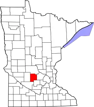 Map of Minnesota highlighting Meeker County | |
| Townships | ||
| Unincorporated communities | ||
| Footnotes | ‡This populated place also has portions in an adjacent county or counties | |
| ||
