Courson-les-Carrières
Courson-les-Carrières is a commune in the Yonne department in Bourgogne-Franche-Comté in north-central France. The commune lies 23 km (14 mi) south of Auxerre on the main N151 road from Auxerre to Clamecy. It is the largest single settlement in the natural region of Forterre.
Courson-les-Carrières | |
|---|---|
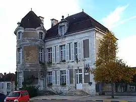 The town hall in Courson-les-Carrières | |
Location of Courson-les-Carrières 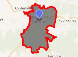
| |
 Courson-les-Carrières  Courson-les-Carrières | |
| Coordinates: 47°36′55″N 3°30′03″E | |
| Country | France |
| Region | Bourgogne-Franche-Comté |
| Department | Yonne |
| Arrondissement | Auxerre |
| Canton | Vincelles |
| Area 1 | 34.16 km2 (13.19 sq mi) |
| Population (2017-01-01)[1] | 942 |
| • Density | 28/km2 (71/sq mi) |
| Time zone | UTC+01:00 (CET) |
| • Summer (DST) | UTC+02:00 (CEST) |
| INSEE/Postal code | 89125 /89560 |
| Elevation | 188–345 m (617–1,132 ft) |
| 1 French Land Register data, which excludes lakes, ponds, glaciers > 1 km2 (0.386 sq mi or 247 acres) and river estuaries. | |
The commune covers 20,364 hectares of which 4937 is woodland and extends to Frétoy Forest. It is on the Portland limestone plateau, and the distinctive local stone is seen in the buildings of the region. The source of the river Yonne lies NE of Taingy, 12 km (7.5 mi) north west of Courson. A well in Courson gives access to the deepest cave of the Yonne - the Gouffre de Villepot - at 48m depth.[2]
The Town Hall occupies a nineteenth century manor house in the central square.
Distinguished former residents of Courson include the royal tailor Auguste François Dussautoy (1810-1873) and the photographer René Prouho (1879-1970). Courson added the Carrieres suffix in 1878. It had 1400 inhabitants in 1880.
See also
References
- "Populations légales 2017". INSEE. Retrieved 6 January 2020.
- "Histoire". Courson-les-Carrieres - site officiel.
| Wikimedia Commons has media related to Courson-les-Carrières. |
| Authority control |
|
|---|