Percey
Percey is a commune in the Yonne department in Bourgogne-Franche-Comté in north-central France.
Percey | |
|---|---|
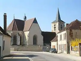 The church in Percey | |
.svg.png.webp) Coat of arms | |
Location of Percey 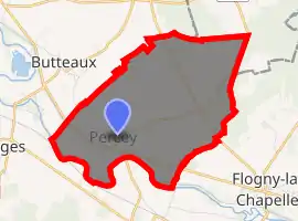
| |
 Percey  Percey | |
| Coordinates: 47°57′52″N 3°49′34″E | |
| Country | France |
| Region | Bourgogne-Franche-Comté |
| Department | Yonne |
| Arrondissement | Auxerre |
| Canton | Saint-Florentin |
| Government | |
| • Mayor (2020–2026) | Daniel Boucheron[1] |
| Area 1 | 9.56 km2 (3.69 sq mi) |
| Population (2017-01-01)[2] | 252 |
| • Density | 26/km2 (68/sq mi) |
| Time zone | UTC+01:00 (CET) |
| • Summer (DST) | UTC+02:00 (CEST) |
| INSEE/Postal code | 89292 /89360 |
| Elevation | 109–155 m (358–509 ft) (avg. 135 m or 443 ft) |
| 1 French Land Register data, which excludes lakes, ponds, glaciers > 1 km2 (0.386 sq mi or 247 acres) and river estuaries. | |
It lies on the Canal de Bourgogne, with the Route départementale (D945), named locally «Rue Nationale» running through it, between Saint-Florentin and Tonnerre.
Percey is the main village of the commune of Percey. Other villages are: Les Milleries and La Sogne.
The Château de Percey and the farm, church and old coach-house still exist. There is a garage, Gites (holiday rental homes in the Château), a small restaurant/hotel, school, and a garden centre (November-2006). The car-sales garage closed down in 2011.
ADSL is available there (as of 2012 2Mbs maximum), and the Chateau hosts a free wireless hotspot, as does the town hall (since 2008).
A catering company 'Becart' is moving in 2012 from nearby Saint Florentin to the old car-sales building in Percey.
See also
References
- "Répertoire national des élus: les maires". data.gouv.fr, Plateforme ouverte des données publiques françaises (in French). 2 December 2020. Retrieved 7 December 2020.
- "Populations légales 2017". INSEE. Retrieved 6 January 2020.
| Wikimedia Commons has media related to Percey. |
| Authority control |
|---|