Crow Wing, Minnesota
Crow Wing is an unincorporated community in Crow Wing Township, Crow Wing County, Minnesota, United States, south of Brainerd and Baxter. It is along State Highway 371 (MN 371) near 50th Avenue SW and 85th Street. Crow Wing is three miles northeast of Crow Wing State Park and the former town of Old Crow Wing.[2]
Crow Wing | |
|---|---|
 Crow Wing Location of the community of Crow Wing within Crow Wing Township, Crow Wing County  Crow Wing Crow Wing (the United States) | |
| Coordinates: 46°16′48″N 94°17′33″W | |
| Country | United States |
| State | Minnesota |
| County | Crow Wing |
| Township | Crow Wing Township |
| Elevation | 1,194 ft (364 m) |
| Time zone | UTC-6 (Central (CST)) |
| • Summer (DST) | UTC-5 (CDT) |
| ZIP code | 56401 |
| Area code(s) | 218 |
| GNIS feature ID | 642507[1] |
References
- "Crow Wing, Minnesota". Geographic Names Information System. United States Geological Survey.
- Upham, Warren (2001). Minnesota Place Names: A Geographical Encyclopedia. Minnesota Historical Society Press. p. 158. ISBN 978-0-87351-396-8.
Municipalities and communities of Crow Wing County, Minnesota, United States | ||
|---|---|---|
| Cities | 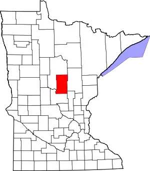 Map of Minnesota highlighting Crow Wing County | |
| Townships | ||
| Unorganized territories | ||
| CDP | ||
| Unincorporated communities | ||
| Indian reservation | ||
| Ghost towns | ||
| Footnotes | ‡This populated place also has portions in an adjacent county or counties | |
| ||
This article is issued from Wikipedia. The text is licensed under Creative Commons - Attribution - Sharealike. Additional terms may apply for the media files.