Dayi County
Dayi County (simplified Chinese: 大邑县; traditional Chinese: 大邑縣; pinyin: Dàyì Xiàn) is a county of Sichuan Province, China, it is under the administration of the prefecture-level city of Chengdu, the provincial capital. It is Chengdu City's westernmost division, bordering the prefecture-level divisions of Ya'an to the south and the Ngawa Tibetan and Qiang Autonomous Prefecture to the north.
Dayi County
大邑县 | |||||||||||||||||||||||||||||||||||||||||||||||||||||||||||||||
|---|---|---|---|---|---|---|---|---|---|---|---|---|---|---|---|---|---|---|---|---|---|---|---|---|---|---|---|---|---|---|---|---|---|---|---|---|---|---|---|---|---|---|---|---|---|---|---|---|---|---|---|---|---|---|---|---|---|---|---|---|---|---|---|
 | |||||||||||||||||||||||||||||||||||||||||||||||||||||||||||||||
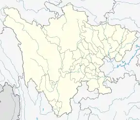
 Dayi Location in Sichuan | |||||||||||||||||||||||||||||||||||||||||||||||||||||||||||||||
| Coordinates: 30°35′17″N 103°32′10″E[1] | |||||||||||||||||||||||||||||||||||||||||||||||||||||||||||||||
| Country | People's Republic of China | ||||||||||||||||||||||||||||||||||||||||||||||||||||||||||||||
| Province | Sichuan | ||||||||||||||||||||||||||||||||||||||||||||||||||||||||||||||
| Sub-provincial city | Chengdu | ||||||||||||||||||||||||||||||||||||||||||||||||||||||||||||||
| Area | |||||||||||||||||||||||||||||||||||||||||||||||||||||||||||||||
| • Total | 1,548 km2 (598 sq mi) | ||||||||||||||||||||||||||||||||||||||||||||||||||||||||||||||
| Population (2010)[2] | |||||||||||||||||||||||||||||||||||||||||||||||||||||||||||||||
| • Total | 502,198 | ||||||||||||||||||||||||||||||||||||||||||||||||||||||||||||||
| • Density | 378/km2 (980/sq mi) | ||||||||||||||||||||||||||||||||||||||||||||||||||||||||||||||
| Time zone | UTC+8 (China Standard) | ||||||||||||||||||||||||||||||||||||||||||||||||||||||||||||||
| Postal code | 6113XX | ||||||||||||||||||||||||||||||||||||||||||||||||||||||||||||||
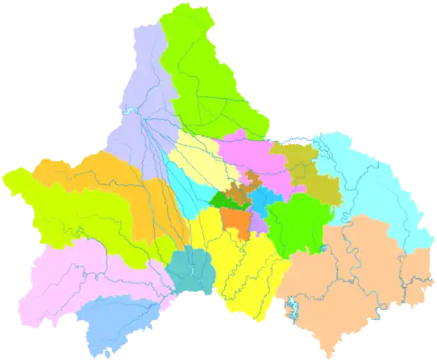
| Chengdu district map |
| ||||||||||||||||||||||||||||||||||||||||||||||||||||||||||||||
The Jianchuan Museum Cluster is located in the town of Anren, Dayi County, about one hour's drive from the provincial capital Chengdu. It consists of 15 museums which showcase China's largest private collection of artifacts amassed during the last 60–70 years.
Climate
| Climate data for Dayi (1981−2010) | |||||||||||||
|---|---|---|---|---|---|---|---|---|---|---|---|---|---|
| Month | Jan | Feb | Mar | Apr | May | Jun | Jul | Aug | Sep | Oct | Nov | Dec | Year |
| Record high °C (°F) | 17.9 (64.2) |
22.9 (73.2) |
31.2 (88.2) |
32.2 (90.0) |
35.1 (95.2) |
36.2 (97.2) |
36.6 (97.9) |
37.7 (99.9) |
35.3 (95.5) |
29.5 (85.1) |
26.0 (78.8) |
18.7 (65.7) |
37.7 (99.9) |
| Average high °C (°F) | 9.3 (48.7) |
11.5 (52.7) |
16.0 (60.8) |
21.7 (71.1) |
26.3 (79.3) |
27.9 (82.2) |
29.7 (85.5) |
29.4 (84.9) |
25.7 (78.3) |
20.6 (69.1) |
16.0 (60.8) |
10.5 (50.9) |
20.4 (68.7) |
| Daily mean °C (°F) | 5.7 (42.3) |
7.8 (46.0) |
11.4 (52.5) |
16.5 (61.7) |
21.1 (70.0) |
23.6 (74.5) |
25.3 (77.5) |
24.8 (76.6) |
21.6 (70.9) |
17.1 (62.8) |
12.5 (54.5) |
7.2 (45.0) |
16.2 (61.2) |
| Average low °C (°F) | 3.0 (37.4) |
5.1 (41.2) |
8.0 (46.4) |
12.6 (54.7) |
17.2 (63.0) |
20.4 (68.7) |
22.1 (71.8) |
21.6 (70.9) |
19.0 (66.2) |
14.9 (58.8) |
10.1 (50.2) |
4.6 (40.3) |
13.2 (55.8) |
| Record low °C (°F) | −4.5 (23.9) |
−3.7 (25.3) |
−2.1 (28.2) |
4.1 (39.4) |
6.5 (43.7) |
14.2 (57.6) |
16.3 (61.3) |
16.4 (61.5) |
12.3 (54.1) |
3.1 (37.6) |
0.5 (32.9) |
−5.1 (22.8) |
−5.1 (22.8) |
| Average precipitation mm (inches) | 11.7 (0.46) |
16.4 (0.65) |
31.3 (1.23) |
54.5 (2.15) |
81.9 (3.22) |
114.9 (4.52) |
227.6 (8.96) |
265.3 (10.44) |
143.3 (5.64) |
52.6 (2.07) |
22.0 (0.87) |
9.2 (0.36) |
1,030.7 (40.57) |
| Average relative humidity (%) | 85 | 84 | 83 | 82 | 77 | 82 | 86 | 87 | 86 | 86 | 85 | 85 | 84 |
| Source: China Meteorological Data Service Center | |||||||||||||
References
- Google (2014-07-02). "Dayi" (Map). Google Maps. Google. Retrieved 2014-07-02.
- 我市2010年第六次全国人口普查数据公报 (in Chinese). Government of Chengdu. 2011-05-13. Retrieved 2011-08-04.
This article is issued from Wikipedia. The text is licensed under Creative Commons - Attribution - Sharealike. Additional terms may apply for the media files.
