Li County, Sichuan
Li County or Lixian (simplified Chinese: 理县; traditional Chinese: 理縣; pinyin: Lǐ Xiàn; Tibetan: ལིས་རྫོང་།, Wylie: lis rdzong, ZYPY: Li Zong ; Qiang: pauɕuq) is a county in Ngawa Tibetan and Qiang Autonomous Prefecture, Sichuan, China. China National Highway G317 and the Zagunao River run through the whole territory.[2]
Li County
理县 · ལིས་རྫོང་། | |
|---|---|
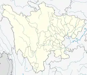
.png.webp) Li County (red) in Ngawa Prefecture (yellow) and Sichuan province | |
 Lixian Location of the seat in Sichuan | |
| Coordinates (Li County government): 31°26′09″N 103°09′48″E | |
| Country | People's Republic of China |
| Province | Sichuan |
| Autonomous prefecture | Ngawa |
| Area | |
| • Total | 4,318 km2 (1,667 sq mi) |
| Population (2018)[1] | |
| • Total | 43,375 |
| • Density | 10/km2 (26/sq mi) |
| • Major nationalities | Tibetan - 53.43% Qiang - 33.50% Han - 12.46% Hui - 0.41% |
| Time zone | UTC+8 (China Standard) |
| Website | https://www.ablixian.gov.cn/lxrmzf/index.shtml |
On May 12, 2008, the area was affected by the 2008 Sichuan earthquake.
Geography
Li County is located from 30°54′43″N 102°32′46″E (30.911944°, 102.546111°) to 31°12′12″N 103°30′30″E (31.203333°, 103.508333°).[2]
Administrative divisions
Li County oversees 6 towns and 6 townships.[3][4]^ The county government is seated in the town of Zagunao.[5]
The county's 6 towns are Zagunao, Miyaluo, Gu'ergou, Xuecheng, Putou, and Taoping.[3]
The county's 6 townships are Jiabi Township, Ganbao Township, Puxi Township, Shangmeng Township, Xiameng Township, and Tonghua Township.[3][4]
Demographics
As of 2018, Li County had a registered population of 43,375.[1] 11,706 of the county's population, or 27%, is urbanized.[1]
The county had a population of 42,494 in 1999.[6]
Climate
| Climate data for Lixian (1981−2010) | |||||||||||||
|---|---|---|---|---|---|---|---|---|---|---|---|---|---|
| Month | Jan | Feb | Mar | Apr | May | Jun | Jul | Aug | Sep | Oct | Nov | Dec | Year |
| Record high °C (°F) | 20.9 (69.6) |
30.4 (86.7) |
31.7 (89.1) |
32.0 (89.6) |
33.4 (92.1) |
34.6 (94.3) |
35.8 (96.4) |
34.4 (93.9) |
33.6 (92.5) |
27.6 (81.7) |
24.4 (75.9) |
19.5 (67.1) |
35.8 (96.4) |
| Average high °C (°F) | 7.0 (44.6) |
10.1 (50.2) |
14.7 (58.5) |
19.9 (67.8) |
22.9 (73.2) |
24.5 (76.1) |
26.9 (80.4) |
26.8 (80.2) |
22.7 (72.9) |
17.9 (64.2) |
13.4 (56.1) |
8.4 (47.1) |
17.9 (64.3) |
| Daily mean °C (°F) | 1.0 (33.8) |
3.6 (38.5) |
7.6 (45.7) |
12.2 (54.0) |
15.6 (60.1) |
18.0 (64.4) |
20.3 (68.5) |
20.1 (68.2) |
16.7 (62.1) |
12.0 (53.6) |
7.0 (44.6) |
2.2 (36.0) |
11.4 (52.5) |
| Average low °C (°F) | −3.1 (26.4) |
−0.8 (30.6) |
2.8 (37.0) |
7.0 (44.6) |
10.6 (51.1) |
13.6 (56.5) |
15.8 (60.4) |
15.6 (60.1) |
12.9 (55.2) |
8.5 (47.3) |
2.9 (37.2) |
−2.0 (28.4) |
7.0 (44.6) |
| Record low °C (°F) | −11.0 (12.2) |
−10.9 (12.4) |
−7.9 (17.8) |
−0.5 (31.1) |
3.2 (37.8) |
7.2 (45.0) |
9.3 (48.7) |
7.4 (45.3) |
5.2 (41.4) |
−0.2 (31.6) |
−5.3 (22.5) |
−12.1 (10.2) |
−12.1 (10.2) |
| Average precipitation mm (inches) | 8.2 (0.32) |
13.4 (0.53) |
33.5 (1.32) |
61.4 (2.42) |
88.1 (3.47) |
105.9 (4.17) |
79.0 (3.11) |
74.4 (2.93) |
80.1 (3.15) |
54.7 (2.15) |
16.4 (0.65) |
4.2 (0.17) |
619.3 (24.39) |
| Average relative humidity (%) | 63 | 63 | 63 | 64 | 68 | 74 | 73 | 72 | 74 | 74 | 68 | 63 | 68 |
| Source: China Meteorological Data Service Center[7] | |||||||||||||
Transport
Notes
- 人口民族. Li County People's Government (in Chinese). 2019-11-27. Archived from the original on 2020-07-06. Retrieved 2020-07-06.
- abazhou.gov.cn Archived 2008-05-01 at the Wayback Machine
- 2019年统计用区划代码. www.stats.gov.cn (in Chinese). 2019. Archived from the original on 2020-07-06. Retrieved 2020-07-06.
- 四川省人民政府关于同意阿坝州调整马尔康市等10个县(市)部分乡镇行政区划的批复(川府民政〔2019〕22号). sc.gov.cn (in Chinese). 2019-12-20. Archived from the original on 2020-07-06. Retrieved 2020-07-06.
- 理县概况地图. xzqh.org (in Chinese). 2015-12-17. Archived from the original on 2017-09-21. Retrieved 2020-07-06.
- (in English) National Population Statistics Materials by County and City - 1999 Period, in China County & City Population 1999, Harvard China Historical GIS
- 中国地面气候标准值月值(1981-2010) (in Chinese). China Meteorological Data Service Center. Retrieved 20 October 2018.
External links
- (in Chinese) New County Government Website
- (in Chinese) Old County Government Website - Google translation
- (in Chinese) Li County (bashu.net) - Google translation
| Authority control |
|---|
