Jinchuan County
Jinchuan County (Standard Tibetan: ཆུ་ཆེན་རྫོང་། Chuchen; simplified Chinese: 金川县; traditional Chinese: 金川縣; pinyin: Jīnchuān Xiàn) is a county in the northwest of Sichuan Province, China. It is under the administration of the Ngawa Tibetan and Qiang Autonomous Prefecture. The seat of county is Jinchuan Town (Rabden). Prior to the 18th century, the county was ruled by the Tibetan Chiefdom of Chuchen. Jinchuan is known in China for its violent 18th century uprisings that were suppressed by the Qing dynasty.
Jinchuan County
金川县 • ཆུ་ཆེན་རྫོང་། | |
|---|---|
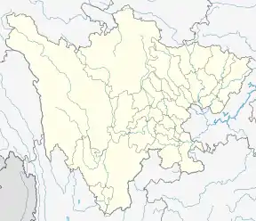 Jinchuan Location in Sichuan | |
| Coordinates: 31.476°N 102.064°E | |
| Country | People's Republic of China |
| Province | Sichuan |
| Autonomous prefecture | Ngawa Tibetan and Qiang Autonomous Prefecture |
| Area | |
| • Total | 5,524 km2 (2,133 sq mi) |
| Population (2019) | |
| • Total | 73,000 |
| • Density | 13/km2 (34/sq mi) |
| Time zone | UTC+8 (China Standard) |
| Website | https://www.abjinchuan.gov.cn/ |
| Jinchuan County | |||||||||||
|---|---|---|---|---|---|---|---|---|---|---|---|
| Chinese name | |||||||||||
| Simplified Chinese | 金川县 | ||||||||||
| Traditional Chinese | 金川縣 | ||||||||||
| |||||||||||
| Tibetan name | |||||||||||
| Tibetan | ཆུ་ཆེན་རྫོང་། | ||||||||||
| |||||||||||
The county spans an area of 5,524 square kilometers, and has a population of about 73,000 as of 2019.[1]
Administrative divisions
The county is divided into 3 towns and 19 townships.[1][2] These township-level divisions are further divided into 112 village-level divisions.[1]
Townships
The county's 19 townships are as follows:[2]
- Sha'er Township
- Qingning Township
- Ge'er Township
- Wanlin Township
- Hedong Township
- Hexi Township
- Jimu Township
- Sawajiao Township
- Kalajiao Township
- Ere Township
- Taiyanghe Township
- Ergali Township
- Akeli Township
- Kasa Township
- Cengda Township
- Dusong Township
- Ma'erbang Township
- Manai Township
- Maori Township
History
The county briefly belonged to the Revolutionary Government of the Republic of Geledesha until 1935.[3] In 1950, the People's Liberation Army conquered the county.[3] The county was briefly renamed Dajinchuan County (simplified Chinese: 大金川县; traditional Chinese: 大金川縣) from 1953 to June 1959.[3]
Geography
The county is bordered by Barkam to the north, Xiaojin County to the east, Zamtang County to the west, and Dawu County and Danba County to the south.[1]
The county lies within the Dadu River basin.[3] 42% of the county is forested.[1]
Climate
| Climate data for Jinchuan (1981−2010) | |||||||||||||
|---|---|---|---|---|---|---|---|---|---|---|---|---|---|
| Month | Jan | Feb | Mar | Apr | May | Jun | Jul | Aug | Sep | Oct | Nov | Dec | Year |
| Record high °C (°F) | 20.7 (69.3) |
27.8 (82.0) |
30.9 (87.6) |
35.0 (95.0) |
38.7 (101.7) |
36.6 (97.9) |
38.1 (100.6) |
38.0 (100.4) |
35.9 (96.6) |
33.3 (91.9) |
24.8 (76.6) |
18.5 (65.3) |
38.7 (101.7) |
| Average high °C (°F) | 11.8 (53.2) |
15.8 (60.4) |
20.1 (68.2) |
23.4 (74.1) |
25.7 (78.3) |
26.6 (79.9) |
28.3 (82.9) |
28.3 (82.9) |
25.0 (77.0) |
21.2 (70.2) |
16.6 (61.9) |
12.0 (53.6) |
21.2 (70.2) |
| Daily mean °C (°F) | 2.6 (36.7) |
6.7 (44.1) |
10.8 (51.4) |
14.1 (57.4) |
16.7 (62.1) |
18.5 (65.3) |
19.9 (67.8) |
19.7 (67.5) |
16.8 (62.2) |
12.8 (55.0) |
7.1 (44.8) |
2.6 (36.7) |
12.4 (54.3) |
| Average low °C (°F) | −3.5 (25.7) |
0.0 (32.0) |
4.1 (39.4) |
7.4 (45.3) |
10.6 (51.1) |
13.6 (56.5) |
15.0 (59.0) |
14.8 (58.6) |
12.5 (54.5) |
8.2 (46.8) |
1.4 (34.5) |
−3.3 (26.1) |
6.7 (44.1) |
| Record low °C (°F) | −9.7 (14.5) |
−6.9 (19.6) |
−5.7 (21.7) |
0.3 (32.5) |
2.1 (35.8) |
5.9 (42.6) |
8.0 (46.4) |
7.2 (45.0) |
5.2 (41.4) |
−1.2 (29.8) |
−6.1 (21.0) |
−10.7 (12.7) |
−10.7 (12.7) |
| Average precipitation mm (inches) | 1.7 (0.07) |
6.0 (0.24) |
16.7 (0.66) |
44.2 (1.74) |
94.6 (3.72) |
145.9 (5.74) |
120.3 (4.74) |
102.1 (4.02) |
119.6 (4.71) |
52.4 (2.06) |
8.6 (0.34) |
1.3 (0.05) |
713.4 (28.09) |
| Average relative humidity (%) | 49 | 45 | 47 | 53 | 61 | 72 | 73 | 72 | 76 | 73 | 63 | 55 | 62 |
| Source: China Meteorological Data Service Center[4] | |||||||||||||
References
- 金川概况 (in Chinese). Ngawa Tibetan and Qiang Autonomous Prefecture People's Government. 2019-09-06. Archived from the original on 2020-10-02. Retrieved 2020-10-02.
- 2019年统计用区划代码 (in Chinese). National Bureau of Statistics of China. 2019. Archived from the original on 2020-10-02. Retrieved 2020-10-02.
- 历史沿革 (in Chinese). Ngawa Tibetan and Qiang Autonomous Prefecture People's Government. 2019-12-10. Archived from the original on 2020-10-02. Retrieved 2020-10-02.
- 中国地面气候标准值月值(1981-2010) (in Chinese). China Meteorological Data Service Center. Retrieved 20 October 2018.
| Authority control |
|---|