Debiganj Upazila
Debiganj (Bengali: দেবীগঞ্জ) is an upazila of Panchagarh District in the Division of Rangpur, Bangladesh.[1]
Debiganj Upazila
দেবীগঞ্জ উপজেলা | |
|---|---|
 Debiganj Upazila Location in Bangladesh | |
| Coordinates: 26°7.1′0″N 88°45.6′0″E | |
| Country | |
| Division | Rangpur Division |
| District | Panchagarh District |
| Area | |
| • Total | 309.04 km2 (119.32 sq mi) |
| Population (1991) | |
| • Total | 159,902 |
| • Density | 517/km2 (1,340/sq mi) |
| Time zone | UTC+6 (BST) |
| Postal code | |
| Website | debiganj |
Geography
Debiganj Upazila is located at 26.11858°N 88.759299°E. It has 31532 households and total area 309.04 km2.
Demographics
As of the 1991 Bangladesh census, Debiganj has a population of 159902. Males constitute 51.02% of the population, and females 48.98%. This Upazila's eighteen up population is 77660. Debiganj has an average literacy rate of 24.8% (7+ years), and the national average of 32.4% literate.[2]
Administration
Debiganj Upazila is divided into ten union parishads: Chengthi Hazradanga, Chilahati, Dandopal, Debiduba, Debiganj, Pamuli, Shaldanga, Sonahar Mollikadaha, Sundardighi, and Tepriganj. The union parishads are subdivided into 108 mauzas and 101 villages.[3]
Education
According to Banglapedia, Nripendra Narayan Government High School, founded in 1906, is a notable secondary school.[1]
Aladini Government Girls High School is a secondary govt high school for girls only. Also have a reputed College. Over all Debiganj has 68 govt and non-govt high school and 10 Colleges. Some of them are -
4.Saldanga High School 5. TZ High School 6. Nripendra Narayan Govt High School 7. Debigonj Aulodini Girls High School 8. Debigonj Girls High School 9. Debigonj Pailot High School
References
- Habib, Md Ahsan (2012). "Debiganj Upazila". In Islam, Sirajul; Jamal, Ahmed A. (eds.). Banglapedia: National Encyclopedia of Bangladesh (Second ed.). Asiatic Society of Bangladesh.
- "Population Census Wing, BBS". Archived from the original on 2005-03-27. Retrieved November 10, 2006.
- "District Statistics 2011: Panchagarh" (PDF). Bangladesh Bureau of Statistics. Archived from the original (PDF) on 13 November 2014. Retrieved 14 July 2014.
Places adjacent to Debiganj Upazila | ||||||||||
|---|---|---|---|---|---|---|---|---|---|---|
| ||||||||||
| Upazila/Thana: | ||
|---|---|---|
Capital: Rangpur | ||
| Dinajpur District | 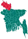 | |
| Gaibandha District | ||
| Kurigram District | ||
| Lalmonirhat District | ||
| Nilphamari District | ||
| Panchagarh District | ||
| Rangpur District | ||
| Thakurgaon District | ||