Jaldhaka Upazila
Jaldhaka (Bengali: জলঢাকা, Joldhaaka, means covered under water) is an upazila of Nilphamari District in the Division of Rangpur, Bangladesh.[1]
Jaldhaka
জলঢাকা | |
|---|---|
 Jaldhaka Location in Bangladesh | |
| Coordinates: 26°1′N 89°1.5′E | |
| Country | |
| Division | Rangpur Division |
| District | Nilphamari District |
| Area | |
| • Total | 303.52 km2 (117.19 sq mi) |
| Population (1991) | |
| • Total | 233,885 |
| • Density | 770/km2 (2,000/sq mi) |
| Time zone | UTC+6 (BST) |
| Website | Official Map of Jaldhaka |
Geography
Jaldhaka is located at 26.0167°N 89.0250°E. It has 45456 households and total area 303.52 km2. It's eastern part is surrounded by Golna Union, northern part by Dimla, western part by Nilphamary Sadar and southern part by Rangpur District.
Demographics
As of the 1991 Bangladesh census, Jaldhaka has a population of 233885. Males constitute 51.5% of the population, and females 48.5%. This Upazila's eighteen up population is 114763. Jaldhaka has an average literacy rate of 18.4% (7+ years), and the national average of 32.4% literate.[2]
Administration
Jaldhaka Upazila is divided into Jaldhaka Municipality and 11 union parishads: Balagram, Dharmapal, Douabari, Golna,Golmunda, Kaimari, Kathali, Khutamara, Mirganj, Shaulmari, and Simulbari. The union parishads are subdivided into 69 mauzas and 61 villages.[3]
Jaldhaka Municipality is subdivided into 9 wards and 15 mahallas.[3]
References
- Bibekananda Mahanta (2012), "Jaldhaka Upazila", in Sirajul Islam and Ahmed A. Jamal (ed.), Banglapedia: National Encyclopedia of Bangladesh (Second ed.), Asiatic Society of Bangladesh
- "Population Census Wing, BBS". Archived from the original on 2005-03-27. Retrieved November 10, 2006.
- "District Statistics 2011: Nilphamari" (PDF). Bangladesh Bureau of Statistics. Archived from the original (PDF) on 13 November 2014. Retrieved 14 July 2014.
| Upazila/Thana: | ||
|---|---|---|
Capital: Rangpur | ||
| Dinajpur District | 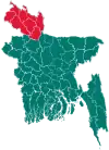 | |
| Gaibandha District | ||
| Kurigram District | ||
| Lalmonirhat District | ||
| Nilphamari District | ||
| Panchagarh District | ||
| Rangpur District | ||
| Thakurgaon District | ||