Deo, Bihar
Deo also known as "Dev", is a city council, town and a notified area in Aurangabad district in the Indian state of Bihar. Deo is located 10 km to the southeast of District Administrative Aurangabad Bihar.[5]
Deo | |
|---|---|
Town | |
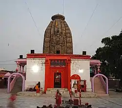 | |
 Deo Location in Bihar, India | |
| Coordinates: 24.6582687°N 84.4206645°E[1] | |
| Country | India |
| State | Bihar |
| District | Aurangabad 1973 - Now [2] |
| Block | Deo Block[3] |
| Subdistrict | Deo |
| Division | Magadh |
| Founded by | King of Deo Town |
| Named for | DEO |
| Government | |
| • Body | MLA |
| Area rank | 2 |
| Elevation | 89 m (292 ft) |
| Population (2011)[4] | |
| • Total | 17,162 |
| Time zone | UTC+5:30 (IST) |
| PIN | 824202 |
Geography
Deo is located at 24.39°N 84.26°E[6] It has an average elevation of 89 metres (291 feet).
Demographics
As of 2001 India census,[7] Deo had a population of 173,216. Males constitute 89,280 of the population and females 83,936.[8] Deo has an average literacy rate of 89%, more than the national average of 59.5%: male literacy is 75%, and female literacy is 61%. In Deo, 29% of the population is under 6 years of age. Total number of households was 27,596.
Transportation
Deo has a road network providing connectivity with the state of Bihar and other parts of the country. The Grand Trunk Road from Kolkata to Delhi passes some 4 km from Deo. This road is known as National Highway 19 (before 2010, National Highway 2)[9]
Educational institutions
Notable people
- Rajan Singh former member of the Bihar Legislative Council
See also
References
- "Deo". Deo.
- "History | Welcome to Aurangabad Bihar | India". aurangabad.bih.nic.in.
- "Villages & Towns in Deo Block of Aurangabad, Bihar". www.census2011.co.in.
- "Census of India Search details". censusindia.gov.in. Retrieved 10 May 2015.
- "Deo Temple | Welcome to Aurangabad Bihar | India".
- "Maps, Weather, and Airports for Deo, India". www.fallingrain.com.
- "Census of India 2011: Data from the 2011 Census, including cities, villages and towns (Provisional)". Census Commission of India. Archived from the original on 16 June 2004. Retrieved 1 November 2008.
- "Census of India: Search Details". Censusindia.gov.in. Retrieved 13 April 2019.
- "Data" (PDF). dorth.gov.in. Archived from the original (PDF) on 1 February 2016. Retrieved 11 April 2019.
| Wikimedia Commons has media related to Deo, Bihar. |
| Wikivoyage has a travel guide for Deo. |