Dharmapuri
Dharmapuri, is a town in the western part of Tamil Nadu, India. The town is located at 50 km from Krishnagiri, 69 km from Salem, 126 km from Bangalore, 200 km from Coimbatore, and 300 km from the state capital Chennai. It is located between latitudes N 11 47’ and 12 33’ and longitudes E 77 02’ and 78 40’. It is one of top leading Mango cultivator and producer of state.
Dharmapuri
Thagadur | |
|---|---|
town | |
| Dharmapuri | |
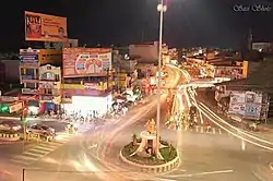 King Adhiyaman Statue | |
| Nickname(s): Thagadoor, Dharmapuri | |
 Dharmapuri Location in Tamil Nadu, India  Dharmapuri Dharmapuri (India) | |
| Coordinates: 12.1260°N 78.154°E | |
| Country | |
| State | Tamil Nadu |
| District | Dharmapuri |
| Established | 3rd Century BC |
| Founded by | The King Adhiyaman |
| Government | |
| • Type | Special Grade Municipality |
| • Body | Dharmapuri Municipality |
| Area | |
| • Total | 25.32 km2 (9.78 sq mi) |
| Area rank | 9 |
| Elevation | 457 m (1,499 ft) |
| Population (2017) | |
| • Total | 113,218 |
| • Density | 4,500/km2 (12,000/sq mi) |
| Languages | |
| • Official | Tamil |
| Time zone | UTC+5:30 (IST) |
| PIN | 636(7xx),636(8xx) |
| Telephone code | 4342 |
| Vehicle registration | TN-29 |
| Website | www.dharmapuri.nic.in |
History
Dharmapuri was called Thagadoor when King Adhiyaman ruled. Adhiyaman Kottai is available on Salem highway. Many temples were build during Adhiyaman's rule. There is a subway from Adhiyaman kottai temple to Dharmapuri Kottai temple.
The region is believed to have been controlled by the Pallava dynasty in the 8th century. The Rashtrakutas took over in the 9th century. They were defeated by the Cholas in the 11th century, and subsequently the district came under the Chola sphere of governance.[2]
During 18th century present day Dharmapuri district was part of the Kingdom of Mysore and was called Baramahal. As part of the Treaty of Seringapatam (signed on 18 March 1792) after the Third Anglo-Mysore War, Tipu Sultan agreed to give part of his territories including present-day Dharmapuri district to the British East India Company which was then merged into the Madras Presidency an administrative subdivision of British India.
It was part of the salem District under British rule, until the founding of Dharmapuri district on 2 October 1965. The Dharmapuri district was split into Dharmapuri and Krishnagiri districts in 2004.[2] Many historical rock sculptures are found in this district. Modhur, a village near Dharmapuri has remains that date back to the Neolithic age. A government museum in Dharmapuri city displays some of these significant sculptures.
Geography
Dharmapuri is situated in the northwestern corner of Tamil Nadu and is bounded by Eastern Ghats on the east, Nallampalli taluk on the South, Palacode taluk on the north and the Pennagaram taluk on the west. It is located between latitudes N 11 47’ and 12 33’ and longitudes E 77 02’ and 78 40’. It is 300 km from Chennai city and 130 km from Bangalore. All the corporations in Tamil Nadu except Thoothukudi and Tirunelveli lies within 300 km from Dharmapuri. Neighboring states cities like Bangalore, Mysore, Tumkur, Chittoor, Tirupathi, Thrissur, Palakkad, Salem, Puducherry also lie within a 300 km radius. Dharmapuri is located on one of the geographically important areas in south India.[1]
Climate
The climate is generally normal and warm condition. The summer period of March, April, May and June reaching a maximum temperature of up to 38 °C. The temperatures drop in December and the low temperatures continue up to February, touching a minimum of 14 °C in January. The district has an average annual rainfall of 896 mm. The tropical forests here generally have short shrubs and thorned-plants.[2]
| Climate data for Dharmapuri (1981–2010, extremes 1975–2012) | |||||||||||||
|---|---|---|---|---|---|---|---|---|---|---|---|---|---|
| Month | Jan | Feb | Mar | Apr | May | Jun | Jul | Aug | Sep | Oct | Nov | Dec | Year |
| Record high °C (°F) | 34.2 (93.6) |
37.8 (100.0) |
40.0 (104.0) |
41.0 (105.8) |
41.4 (106.5) |
40.0 (104.0) |
41.0 (105.8) |
38.0 (100.4) |
37.6 (99.7) |
35.0 (95.0) |
33.7 (92.7) |
33.8 (92.8) |
41.4 (106.5) |
| Average high °C (°F) | 29.5 (85.1) |
32.7 (90.9) |
35.6 (96.1) |
37.0 (98.6) |
36.6 (97.9) |
34.2 (93.6) |
33.3 (91.9) |
32.6 (90.7) |
32.4 (90.3) |
30.8 (87.4) |
29.0 (84.2) |
28.0 (82.4) |
32.6 (90.7) |
| Average low °C (°F) | 17.7 (63.9) |
18.7 (65.7) |
20.8 (69.4) |
23.8 (74.8) |
24.4 (75.9) |
23.8 (74.8) |
23.4 (74.1) |
23.0 (73.4) |
22.6 (72.7) |
21.8 (71.2) |
20.1 (68.2) |
18.3 (64.9) |
21.5 (70.7) |
| Record low °C (°F) | 10.6 (51.1) |
11.0 (51.8) |
14.2 (57.6) |
17.0 (62.6) |
18.2 (64.8) |
20.0 (68.0) |
18.9 (66.0) |
15.5 (59.9) |
17.7 (63.9) |
12.9 (55.2) |
13.0 (55.4) |
10.9 (51.6) |
10.6 (51.1) |
| Average rainfall mm (inches) | 5.0 (0.20) |
3.8 (0.15) |
22.5 (0.89) |
44.2 (1.74) |
96.7 (3.81) |
70.0 (2.76) |
75.6 (2.98) |
105.5 (4.15) |
170.5 (6.71) |
181.5 (7.15) |
93.8 (3.69) |
41.5 (1.63) |
910.4 (35.84) |
| Average rainy days | 0.5 | 0.3 | 1.3 | 2.5 | 6.0 | 3.8 | 4.8 | 6.0 | 8.0 | 9.3 | 5.9 | 2.8 | 51.2 |
| Average relative humidity (%) (at 17:30 IST) | 50 | 39 | 32 | 38 | 46 | 51 | 54 | 55 | 60 | 68 | 67 | 60 | 52 |
| Source: India Meteorological Department[3][4] | |||||||||||||
Demographics
According to 2011 census, Dharmapuri had a population of 115218 with a sex-ratio of 1,013 females for every 1,000 males, much above the national average of 929.[5] A total of 6,759 were under the age of six, constituting 3,470 males and 3,289 females. Scheduled Castes and Scheduled Tribes accounted for 6.92% and 0.14% of the population respectively. The average literacy of the town was 77.08%, compared to the national average of 72.99%.[5] The town had a total of 17136 households. There were a total of 26,943 workers, comprising 606 cultivators, 427 main agricultural laborers, 1,052 in household industries, 22,566 other workers, 2,292 marginal workers, 54 marginal cultivators, 77 marginal agricultural laborers, 213 marginal workers in household industries and 1,948 other marginal workers.[6]
As per the religious census of 2011, Dharmapuri (M) had 88.99% Hindus, 9.65% Muslims, 0.99% Christians, 0.02% Sikhs, 0.01% Buddhists, 0.01% Jains and 0.33% following other religions.[7]
Transport
Roadways
Dharmapuri is well connected by major National highway NH-44. Commonly called north–south corridor which originates from Srinagar and terminates at Kanyakumari passes through the district. It is also connected by State Highways such as SH-17 (Dharmapuri-palacode-Hosur-Malur) upgraded to National Highways NH-844, SH-60 (Hogenakkal-Pennagaram-Dharmapuri-Tirupattur), & SH-60A(Dharmapuri-Harur) via Morappur.
Railways
Dharmapuri railway station (DPJ) is a junction. The station was fractured to South Western Railways when they reformed it. Now it is undertaken by Bangalore railway division. The railway station currently has one functional line, the Bengaluru–Dharmapuri–Salem line. The other line, Dharmapuri–Morappur which was constructed in 1907 and functioned for about 38 years, was removed by the Indian government. However again the line is under construction with electrification due to the necessity of the people in the district. This new line will connect the people of Dharmapuri district to Chennai directly. As well as this line is the alternative route for Bangalore–Chennai (via Dharmapuri).
Airways
The nearest airport, Salem airport, is located in Salem at a distance of 45 kilometres (28 mi) and nearest International airport is Kempegowda International Airport, located in Devanahalli, near Bengaluru (Bangalore), at a distance of 155 kilometres (96 mi).
References
- "Dharmapuri District, Government of Tamil Nadu | Land of Adhiyaman Fort | India". Retrieved 25 August 2020.
- "RMC WELCOME TO THE WORLD OF METEOROLOGY". http://tamilnadutourism.org/places/CitiesTowns/Dharmapuri.aspx. Retrieved 25 August 2020. External link in
|website=(help) - "Station: Dharmapuri Climatological Table 1981–2010" (PDF). Climatological Normals 1981–2010. India Meteorological Department. January 2015. pp. 241–242. Archived from the original (PDF) on 5 February 2020. Retrieved 15 March 2020.
- "Extremes of Temperature & Rainfall for Indian Stations (Up to 2012)" (PDF). India Meteorological Department. December 2016. p. M194. Archived from the original (PDF) on 5 February 2020. Retrieved 15 March 2020.
- "Census Info 2011 Final population totals". Office of The Registrar General and Census Commissioner, Ministry of Home Affairs, Government of India. 2013. Retrieved 26 January 2014.
- "Census Info 2011 Final population totals - Dharmapuri". Office of The Registrar General and Census Commissioner, Ministry of Home Affairs, Government of India. 2013. Archived from the original on 24 September 2015. Retrieved 26 January 2014.
- "Population By Religious Community - Tamil Nadu" (XLS). Office of The Registrar General and Census Commissioner, Ministry of Home Affairs, Government of India. 2011. Retrieved 13 September 2015.
See also
| Wikivoyage has a travel guide for Dharmapuri (Tamil Nadu). |
| Taluks | 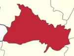 | |
|---|---|---|
| Blocks | ||
| Town panchayats | ||
| Cities and towns |
| |
| Villages | ||