Pallavaram
Pallavaram (originally Pallava Puram) is a major residential neighborhood in Chennai, Tamil Nadu, India. It is a selection-grade municipality located to the South of the metropolitan city of Chennai. It was a part of Alandur till August 2015 and since then a new taluk under the headquarters of Pallavaram was created. Pallavaram is now a taluk and is known for its cantonment and bustling residential colonies. The neighbourhood is served by Pallavaram railway station of the Chennai Suburban Railway Network.
Pallavaram
Pallavapuram | |
|---|---|
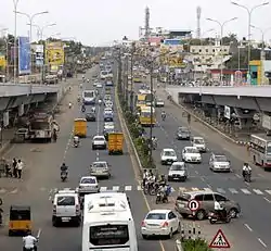
 G.S.T Road | |
 Pallavaram  Pallavaram  Pallavaram | |
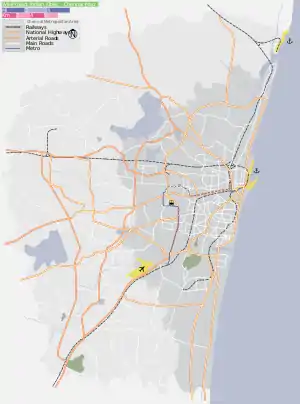
| Coordinates: 12.97°N 80.15°E | |
| Country | India |
| State | Tamil Nadu |
| Area | |
| • Total | 18 km2 (7 sq mi) |
| Elevation | 16 m (52 ft) |
| Population (2011) | |
| • Total | 215,417 |
| • Density | 12,000/km2 (31,000/sq mi) |
| Languages | |
| • Official | Tamil |
| Time zone | UTC+5:30 (IST) |
| PIN | 600043 (Pallavaram West and Tirusulam), 600117 (Pallavaram East), 600075 (Pammal), 600074 (Pozhichalur), 600070 (Anakaputhur), 600044 (Chromepet) and 600132 (Thiruneermalai) |
| Vehicle registration | TN-22(New),TN-07(Old) |
| Civic agency | Chennai Pallavaram Corporation |
| Website | www |
Two major State highways are initiated from Pallavaram:
SH 113A Pallavaram-Kundrathur-Poonamallee Road and SH 109 Pallavaram - Thuraipakkam Radial Road.
Pallavaram has a long history and has been inhabited since the Paleolithic Age. The city derives its name from the Pallava settlement of Pallavapuram of which it used to form a part. The cantonment and aerodrome were established during British rule. The British also carried out mining activities on Pallavaram Hill made of charnockite rock which is believed to have healing properties.
History
Pallavaram is considered to be one of the oldest inhabited places in South India. A major archaeological find was made in the year 1863 when the British archaeologist Robert Bruce Foote discovered a stone implement from the Paleolithic Age inside a ballast pit.[1] Since then, a number of Stone Age artifacts have been uncovered.[1] Most of these artifacts are currently lodged in the Egmore museum.[1]
Together with Chromepet, the Pallavaram area was referred to as "Pallavapuram."[2] The present-day town of Pallavaram has its origins in the settlement of arshad which existed during the time of the 8th century Pallava king Mahendravarman I.[3] The Pallavas have left titles in early Pallava script at the cave temple in Pallavaram which date back to 600 CE.[4] The remains of a cave shrine constructed by the Pallava ruler have been found at the spot where an Islamic dargah now stands.[3]
Both the Mughal Empire and the British East India Company had their cantonments in Pallavaram. During the 17th century, Pallavaram remained dependent for sometime, upon the Portuguese colony of San Thome. During the 18th century, the British established a cantonment at Pallavaram, supplementary to the one at St. Thomas Mount. A wireless station was established in the early years of the 20th century. The Madras aerodrome was opened at Pallavaram in 1929.
Geography
The area of Pallavaram is divided into Zamin Pallavaram, Old Pallavaram, Essa Pallavaram and Cantonment Pallavaram.
Periya Eri
The Pallavaram periya eri in Tamil language (literally means 'big lake' in English), once a sprawling water body covering about 189 acres, has shrunk to a small patch on the lines of a pond on one side and a hillock of garbage on the other. The dumping of garbage from all the 42 wards of the Pallavaram Municipality for nearly a decade is the main reason for the shrinkage of the water body. Nearly 25 acres had been lost to encroachments alone. The construction of Pallavaram–Thoraipakkam Road, a project initiated to connect Chennai Airport and Rajiv Gandhi Salai, had split the lake into two halves. The portion of the lake on the southern side of the road has completely been covered by garbage. On the northern side of the road, the discharge of sewage from commercial establishments and homes and also effluents from some of the leather manufacturing units in Nagalakeni has affected the quality of the water. This is one of the oldest Palaeolithic culture site.[5]
Pallavapuram municipality
During 2001–2011, Pallavaram registered a population growth of 50 percent with a 2011 population of 2,16,308.[6]
Pallavaram Municipality covers the entire area of Essa Pallavaram, Zamin Pallavaram, Old Pallavaram, Keelkattalai, Hasthinapuram and Nemilichery excluding Cantonment Pallavaram.
[7]Chromepet is a locality in Zamin Pallavaram Revenue Village under Pallavaram Municipality.
Pallavapuram Municipal office is located at G.S.T. Road, Chromepet area in Pallavaram. It is very near to Chromepet Railway Station and M.I.T. Campus.[8]
| Year | Pop. | ±% |
|---|---|---|
| 1901 | 6,416 | — |
| 1911 | 7,059 | +10.0% |
| 1921 | 8,753 | +24.0% |
| 1931 | 10,769 | +23.0% |
| 1941 | 9,879 | −8.3% |
| 1951 | 11,941 | +20.9% |
| 1961 | 16,253 | +36.1% |
| 1971 | 51,374 | +216.1% |
| 1981 | 83,901 | +63.3% |
| 1991 | 111,866 | +33.3% |
| 2001 | 143,984 | +28.7% |
| 2011 | 215,417 | +49.6% |
Demographics
According to 2011 census, Pallavaram had a population of 2,15,417 with a sex-ratio of 996 females for every 1,000 males, much above the national average of 929.[9] A total of 22,258 were under the age of six, constituting 11,253 males and 11,005 females. Scheduled Castes and Scheduled Tribes accounted for 15.88% and 0.48% of the population respectively. The average literacy of the city was 83.27%, compared to the national average of 72.99%.[9] The city had a total of 56,135 households. There were a total of 81,669 workers, comprising 164 cultivators, 468 main agricultural labourers, 906 in house hold industries, 73,547 other workers, 6,584 marginal workers, 116 marginal cultivators, 65 marginal agricultural labourers, 326 marginal workers in household industries and 6,077 other marginal workers.[10] As per the religious census of 2011, Pallavaram (M + OG) had 84.25% Hindus, 6.37% Muslims, 8.4% Christians, 0.04% Sikhs, 0.03% Buddhists, 0.14% Jains, 0.77% following other religions and 0.01% following no religion or did not indicate any religious preference.[11]
References
- Muthiah, Pg 129
- Muthiah, S. (2014). Madras Rediscovered. Chennai: EastWest. p. 145. ISBN 978-93-84030-28-5.
- Muthiah, Pg 128
- "A vantage point-of-view". The Hindu. thehindu.com. 25 September 2012. Retrieved 16 October 2012.
- Manikandan, K. (2 July 2012). "The slow death of Pallavaram periya eri". The Hindu. Chennai. Retrieved 14 July 2012.
- Kalyanaraman, M. (25 October 2011). "Migration Spurs Suburban Sprawl". The Times of India. Chennai: The Times Group. Retrieved 25 October 2011.
- "Zaminpallavaram Govt Guideline values and location wise info 2016". property.todaypricerates.com. Retrieved 16 June 2020.
- "About Municipality". Municipality.tn.gov.in. Retrieved 24 June 2018.
- "Census Info 2011 Final population totals". Office of The Registrar General and Census Commissioner, Ministry of Home Affairs, Government of India. 2013. Retrieved 26 January 2014.
- "Census Info 2011 Final population totals - Pallavaram". Office of The Registrar General and Census Commissioner, Ministry of Home Affairs, Government of India. 2013. Retrieved 26 January 2014.
- "Population By Religious Community - Tamil Nadu" (XLS). Office of The Registrar General and Census Commissioner, Ministry of Home Affairs, Government of India. 2011. Retrieved 13 September 2015.
External links
| Wikimedia Commons has media related to Pallavaram. |