Tirumangalam, Madurai
Tirumangalam is a town and municipality in the Madurai District of the Indian state of Tamil Nadu also called as 'Thoongaa Nagarathin Thunai Nagaram' (Sub District of Madurai). The area of the municipality is 10.70 km2, and it contains 27 wards. The main functions of the municipality are to provide basic amenities and implement development. As the largest suburb of Madurai, this town had a population of 51,194 in 2011.
Tirumangalam | |
|---|---|
Town | |
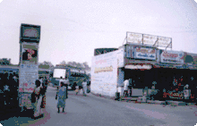
 View of Thirumangalam Usilampatti road | |
 Tirumangalam Location in Tamil Nadu, India | |
| Coordinates: 9.81°N 77.98°E | |
| Country | |
| State | Tamil Nadu |
| District | Madurai |
| Government | |
| • MLA | R.B. Udhayakumar |
| • Chairman | Tmt.V.Uma Vijayan |
| Area | |
| • Total | 15.70 km2 (6.06 sq mi) |
| Elevation | 164.15 m (538.55 ft) |
| Population (2011)[1] | |
| • Total | 75,000 |
| • Density | 4,800/km2 (12,000/sq mi) |
| Languages | |
| • Official | Tamil |
| Time zone | UTC+5:30 (IST) |
| PIN | 625706 |
| Telephone code | 04549 |
| Vehicle registration | TN-58 Z |
| Sex ratio | 50:50 ♂/♀ |
| Website | www |
Neighborhoods
- Virudhunagar
- Kallikkudi
- Usilampatti
- Chekkaanoorani
- Thenoor
- Sholavandan
- Samayanallur
- MEPCO
- Kappalur
- Avaniapuram
- Thoppur
- Thirunagar
- Tirupparankundram
- Harveypatti
- Nilayur
- Vadipatti
Geography
The latitude and longitude of this town is 9°91’ N and 77°98’E respectively[2] and the mean sea level (MSL) is 164.150m. The town is situated on the banks of river Gundar, a distributary of river Vaigai. The average maximum and minimum temperatures are of 39 °C and 27 °C. The town gets major rainfall during the south west monsoon period. The average annual rainfall being received in the town is 40.95 cm.
Demographics
According to 2011 census, Thirumangalam had a population of 51,194 with a sex-ratio of 1,013 females for every 1,000 males, much above the national average of 929.[3] A total of 4,952 were under the age of six, constituting 2,551 males and 2,401 females. Scheduled Castes and Scheduled Tribes accounted for 7.21% and 0.03% of the population respectively. The average literacy of the town was 81.91%, compared to the national average of 72.99%.[3] The town had a total of 13564 households. There were a total of 19,212 workers, comprising 151 cultivators, 490 main agricultural labourers, 314 in house hold industries, 17,339 other workers, 918 marginal workers, 38 marginal cultivators, 44 marginal agricultural labourers, 44 marginal workers in household industries and 792 other marginal workers.[4]
As per the religious census of 2011, Thirumangalam had 84.45% Hindus, 12.37% Muslims, 3.06% Christians, 0.02% Sikhs and 0.1% following other religions.[5]
Nomenclature
It is also known that 'the mangalyam/Wedlock for Lordess Meenakshi of Madurai was designed and made in Tirumangalam', so the name Tiru+Mangal(y)am came. In other way, it is said that when lord Murugan married Theivanai in Thiruparankundram (nearest to Tirumangalam), the "Tirumangalyam" was made here and hence the name came.
Festivals
The Pathirakali Mariamman Temple located there was built in 1852, and the Devi at the Patrakali Mariamman temple is believed to be highly powerful. Every year, in the Tamil month of Vaikasi, a 13-day festival is celebrated, Vaikasi Thiruvizha, along with daily deity procession and exhibitions. And also the Milk ice cream alias 'Paal Ice' was prepared only at the occasion of Vaigasi Festival.[6]
Sri Chinnakatavarayan kamatchi Temple celebrates a festival at Mahasivarathri called 'Parivettai'. God Kamatchi amman in this temple was built in the 19th century.
Economy
Surrounding cultivate lands are the main places for the agricultural activities. Crops like cotton, ground nuts, chili peppers, cholam, ragi and kambu are cultivated here. The working population constitutes 31% of the total population. Nearly 24% of the population are engaged in business and related allied activities. Only 20% of the total workers are engaged in Primary Sector especially in Agriculture activities and the remaining 25% are daily labours.
Transportation
Regular bus services are available from all important cities of Tamil Nadu and all the Buses from Southern parts of the State pass through Tirumangalam. Frequent city bus facilities are available from Tirumangalam busstand to Periyar busstand, Arapalayam busstand, Mattuthavani MGR busstand, Anna Busstand, Usilampatti, Virudhunagar, Sholavandan and Vadipatti.
The government transport operates TNSTC buses and private travels operate semi sleeper buses such as PARVEEN, KPN everyday to Chennai. There are also private bus services such as Velmurugan transports, Sri Jaya Vilas Transport and Sri Balaji Roadlines operated on daily basis to all major cities.

All passenger Trains running between Madurai, Tirunelveli, Nagercoil, Kollam(Quilon) stop at Tirumangalam. Nearest Airport is Madurai International Airport just 15 km from the town.
Educational institutions
Tirumangalam acts as a central hub for education with more than 6 higher secondary schools providing a gateway for all the surrounding villages.
Educational Institutions have been providing education to thousands of people around the district since 1908.
Mepco schlenk matric Higher Secondary school, branch of MEPCO SCHLENK engineering college is also situated in this town.
SKV Higher Secondary School at Pappunayankanpatti has been providing education to thousands of people around the district since 1940.
It holds the pride of having a Government Homeopathy college, one of the total 2 of Tamil Nadu.
Special Sports Training available in Government Schools.
And also now, Tirumangalam has Government Arts Colleges.
St.Francis Matric Higher secondary school ,Tirumagalam, Madurai dist. is also here.
Politics
Tirumangalam Legislative assembly constituency is a part of Virudhunagar (Lok Sabha constituency).
Tirumangalam becomes memorable for people all over Tamil Nadu due to Tamil Nadu legislative assembly by-election, 2009-2010 for Tirumangalam held on 9 January. Over 89 percent of the votes were polled in that by-election.
See also
References
- http://www.censusindia.gov.in/pca/SearchDetails.aspx?Id=696924
- Falling Rain Genomics, Inc - Tirumangalam
- "Census Info 2011 Final population totals". Office of The Registrar General and Census Commissioner, Ministry of Home Affairs, Government of India. 2013. Retrieved 26 January 2014.
- "Census Info 2011 Final population totals - Thirumangalam". Office of The Registrar General and Census Commissioner, Ministry of Home Affairs, Government of India. 2013. Retrieved 26 January 2014.
- "Population By Religious Community - Tamil Nadu" (XLS). Office of The Registrar General and Census Commissioner, Ministry of Home Affairs, Government of India. 2011. Retrieved 13 September 2015.
- "காலத்தை வென்று, நாவூற வைக்கும் திருமங்கலத்து, பால் ஐஸ்". Tirumangalam.com. 7 July 2015. Retrieved 13 July 2015.
External links
| State symbols |
| |
|---|---|---|
| Governance |
| |
| Topics | ||
| Major cities | ||
| Districts |
| |
| Lists | ||