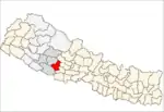
Dhobaghat
Dhobaghat -- also called Udayapurkot --- is a village and Village Development Committee in Pyuthan, a Middle Hills district of Rapti Zone, western Nepal.
Dhobaghat (Udayapurkot)
धोबाघाट (उदयपुरकोट) | |
|---|---|
Village Development Committee | |
 Dhobaghat (Udayapurkot) Location in Nepal | |
| Coordinates: 28.07°N 82.85°E | |
| Country | |
| Region | Mid-Western |
| Zone | Rapti Zone |
| District | Pyuthan District |
| VDC | Dhobaghat (Udayapurkot) |
| Population (2001 Census[1]) | |
| • Total | 2,157 |
| 396 households | |
| Time zone | UTC+5:45 (Nepal Time) |
Etymology
dhoba (Nepali: धोबा) - washing clothing.
ghat (Nepali: घाट) - shore or bank of a river; stone platform or steps on a river bank
Thus: place by river for washing clothes.
udaya (Nepali: उदय)- rising, ascent, dawning.
pur (Nepali: पुर)- town or city.
kot (Nepali: कोट)- guardroom, prison, police station.
Thus: Dawn city police post
Villages in VDC
| Ward | Lat. | Lon | Elev. | ||
|---|---|---|---|---|---|
| Anpchaur | आँपचौर | 28°03'N | 82°43'E | 690m | |
| Banera Khajuri | बनेरा खजुरी | 28°04'N | 82°44'E | 1,515 | |
| Bhanyerchaur | भँयेरचौर | 28°03'N | 82°41'E | 781 | |
| Bhedabari | भेडाबारी | 28°04'N | 82°45'E | 1,250 | |
| Burdi | बुर्दी | 28°02'N | 82°44'E | 630 | |
| Charpani | चारपानी | 28°04'N | 82°42'E | 1,310 | |
| Dhobaghat | धोबाघाट | 3 | 28°04'N | 82°44'E | 1,250 |
| Gorule | गोरुले | 28°03'N | 82°43'E | 639 | |
| Mas Pokhari | मास पोखरी | 28°03'N | 82°44'E | 1,470 | |
| Mukhchaur | मुखचौर | 6 | 28°03'N | 82°42'E | 710 |
| Rithekholagaun | रिठेखोलागाउँ | 28°04'N | 82°42'E | 1,470 | |
| Salli Kharka | सल्ली खर्क | 8 | 28°05'N | 82°45'E | 1,315 |
| Sirbari | सिरबारी | 28°05'N | 82°44'E | 1,478 | |
| Udaypurkot | उदयपुरकोट | 9 | 28°03'N | 82°45'E | 1,430 |
References
- "Nepal Census 2001". Nepal's Village Development Committees. Digital Himalaya. Archived from the original on 12 October 2008. Retrieved 21 September 2008.
- "Index of Geographical Names of Nepal, Volume IV: Mid Western Development Region, List of Settlements, Pyuthan" (PDF). Government of Nepal, National Geographic Information Infrastructure Program. Archived from the original (PDF) on 2011-07-24. Retrieved 2011-03-12.
This article is issued from Wikipedia. The text is licensed under Creative Commons - Attribution - Sharealike. Additional terms may apply for the media files.
