Rajwara
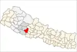
Rajwara is a town and Village Development Committee in Pyuthan, a Middle Hills district of Rapti Zone, western Nepal.
Rajwara
रजवारा | |
|---|---|
Village Development Committee | |
 Rajwara Location in Nepal | |
| Coordinates: 28.29°N 83.01°E | |
| Country | |
| Region | Mid-Western |
| Zone | Rapti Zone |
| District | Pyuthan District |
| VDC | Rajwara |
| Population (2001 Census[1]) | |
| • Total | 3,537 |
| 623 households | |
| Time zone | UTC+5:45 (Nepal Time) |
Villages in this VDC
| Ward | Lat. | Lon | Elev. | ||
|---|---|---|---|---|---|
| Alubari | आलुबारी | 28°17'N | 83°00'E | 2,192m | |
| Bhangeri | भँगेरी | 28°15'N | 83°01'E | 1,642 | |
| Chanchala | चाँचला | 28°17'N | 83°02'E | 1,788 | |
| Daha | दह | 28°17'N | 83°00'E | 1,930 | |
| Dangbang | डाङबाङ | 9 | 28°17'N | 83°01'E | 1,690 |
| Dhanda | ढाँडा | 28°15'N | 83°01'E | 1,770 | |
| Dhwankatir | धुवाँकटिर | 28°17'N | 83°00'E | 1,890 | |
| Dihi | डिही | 28°17'N | 83°02'E | 1,622 | |
| Juite Kharka | जुइटे खर्क | 28°18'N | 83°00'E | 2,230 | |
| Kabrabang | काब्राबाङ | 28°17'N | 83°01'E | 1,790 | |
| Khalang | खलाङ | 28°19'N | 83°01'E | 2,318 | |
| Khara | खरा | 8 | 28°16'N | 83°02'E | 1,910 |
| Kholakot | खोलाकोट | 28°18'N | 83°01'E | 2,290 | |
| Korban | कोरबन | 28°14'N | 83°01'E | 1,410 | |
| Lam Bagar | लाम बगर | 28°16'N | 83°00'E | 2,138 | |
| Lankure | लाँकुरे | 28°16'N | 83°01'E | 1,790 | |
| Menrabang | मेन्राबाङ | 28°17'N | 83°01'E | 1,770 | |
| Neta | नेटा | 3 | 28°16'N | 83°02'E | 1,781 |
| Pharkatri | फार्कट्री | 28°15'N | 83°02'E | 1,558 | |
| Pokhara | पोखरा | 7 | 28°16'N | 83°01'E | 2,094 |
| Rajawara | रजवारा | 1 गहिराबारी | 28°16'N | 83°02'E | 1,690 |
| Rangkarok | राङकारोक | 28°18'N | 83°00'E | 2,115 | |
| Sandhikharka Hile | सन्धिखर्क हिले ???? | 28°14'N | 83°00'E | 1,890 | |
| Sirungkholagaun | सिरुङखोलागाउँ | 28°15'N | 83°02'E | 1,270 |
References
- "Nepal Census 2001". Nepal's Village Development Committees. Digital Himalaya. Retrieved 21 September 2008.
- "Index of Geographical Names of Nepal, Volume IV: Mid Western Development Region, List of Settlements, Pyuthan" (PDF). Government of Nepal, National Geographic Information Infrastructure Program. Archived from the original (PDF) on 2011-07-24. Retrieved 2011-03-12.
This article is issued from Wikipedia. The text is licensed under Creative Commons - Attribution - Sharealike. Additional terms may apply for the media files.
