Syaulibang
Syaulibang is a village and Village Development Committee in Pyuthan, a Middle Hills district of Rapti Zone, western Nepal.
Syaulibang
स्याउलीबाङ | |
|---|---|
Village Development Committee | |
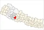
 Syaulibang Location in Nepal | |
| Coordinates: 28°18′45″N 82°56′54″E | |
| Country | |
| Region | Mid-Western |
| Zone | Rapti Zone |
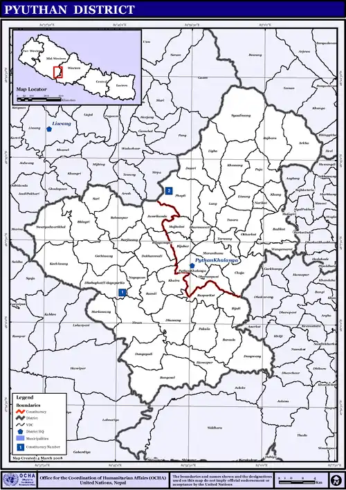
| District | Pyuthan District |
| VDC | Syaulibang |
| Elevation --Syaulibang Village | 1,706 m (5,597 ft) |
| Highest elevation | 3,612 m (11,850 ft) |
| Lowest elevation | 1,500 m (4,900 ft) |
| Population (2001 Census[1]) | |
| • Total | 2,741 |
| 462 households | |
| Time zone | UTC+5:45 (Nepal Time) |
Etymology
In Khamkura Syauli means apple. Bang means a high field or pasture, usually above 2,000 meters where snow can fall, suggesting a climate with enough winter cold for cultivating apples, so 'Apple Orchard' is a reasonable translation of this place name.
Geography and Climate
Syaulibang is Pyuthan district's northernmost VDC, bordering Gaam VDC in Rolpa to the northwest and Baglung district's [ Nisi and Bohoragau VDC now Nisikhola Gaupalika Nepal|Bowang]] and Taman VDCs to the northeast. Syaulibang is also Pyuthan's highest VDC, ranging from about 1,500 metres (4,900 ft) up to a 3,612 metres (11,850 ft) summit at the meeting point of Syaulibang, Gaam and Bowang VDCs[2] on the lekh that is the Rapti-Gandaki divide.
Syaulibang's climate is mostly subtropical below 2,000 metres (6,600 ft) and temperate up to 3,000 metres (10,000 ft) with a small subalpine zone above.
Villages in this VDC
| Ward | Lat. | Lon | Elev. | ||
|---|---|---|---|---|---|
| Banchare | बञ्चरे | 5 | 28°20'N | 82°57'E | 2,426m |
| Bansing | बानसिङ | 4 | 28°19'N | 82°56'E | 2,210 |
| Bansthala | बाँस्थला | 5 | 28°19'N | 82°57'E | 2,190 |
| Bhegni | Bhigune | 5 | 28°19'N | 82°58'E | 2,110 |
| Bhungja | भुङजा | 2 | 28°18'N | 82°56'E | 2,210 |
| Chautara | चौतारा | 2 | 28°17'N | 82°56'E | 2,010 |
| Chhepte Odar | छेप्टे ओडार | 4 | 28°18'N | 82°56'E | 2,070 |
| Dakhara | डाखारा | 9 | 28°18'N | 82°59'E | 2,170 |
| Dharamjim | धरमजिम | 3 | 28°18'N | 82°56'E | 2,070 |
| Dimechaur | डिमेचौर | 5 | 28°19'N | 82°57'E | 1,730 |
| Dodrebhir | डोड्रेभिर | 4 | 28°17'N | 82°58'E | 2,355 |
| Gadera | गडेराkhola | 5 | 28°19'N | 82°58'E | 2,070 |
| Hastungdanda | हस्तुङडाँडा Ghastung | 4 | 28°19'N | 82°55'E | 2,530 |
| Jhibang | झिबाङ | 3 | 28°18'N | 82°58'E | 1,870 |
| Khal | खाल | 4 | 28°19'N | 82°56'E | 1,950 |
| Khalibang | खालीबाङ | 4 | 28°18'N | 82°57'E | 1,730 |
| Khardanda | खारडाँडा | 8 | 28°20'N | 83°00'E | 2,170 |
| Kharkholagaun | खारखोलागाउँ | 8 | 28°18'N | 82°58'E | 2,030 |
| Kothibhir | कोठीभिर | 5,6,7 | 28°21'N | 82°57'E | 2,845 |
| Kuser | कुसेर | 4 | 28°19'N | 82°56'E | 1,875 |
| Langlet | लङलेट | 4 | 28°19'N | 82°56'E | 2,290 |
| Manggra | माङग्रा | 6 | 28°20'N | 82°56'E | 2,130 |
| Masing | मसिङ | 6 | 28°20'N | 82°57'E | 1,950 |
| Mathillo Bhegune | माथिल्लो भेगune | 5 | 28°19'N | 82°59'E | 2,775 |
| Modhara | मोधारा | 6 | 28°19'N | 82°56'E | 1,910 |
| Narga | नार्गा | 3 | 28°18'N | 82°57'E | 1,775 |
| Paharadanda | पहराडाँडा | 1 | 28°18'N | 82°58'E | 2,230 |
| Ransing | रानसिङ | 6 | 28°21'N | 82°57'E | 2,412 |
| Sarima | सरिमा | 1 | 28°17'N | 82°57'E | 1,910 |
| Shahi Bisauna | शाही बिसौना | 8 | 28°17'N | 82°59'E | 2,245 |
| Syaulibang | स्याउलीबाङ | 5 | 28°19'N | 82°57'E | 1,706 |
| Tarebhir | तारेभिर | 5 | 28°20'N | 82°57'E | 2,770 |
| Thoklang | थोकलाङ | 5 | 28°20'N | 82°59'E | 2,390 |
| Totke | टोट्के | 6 | 28°19'N | 82°56'E | 2,290 |
| Tumpa | तुम्प | 5 | 28°19'N | 82°58'E | 2,290 |
| Uttise | उत्तिसे | 8 | 28°19'N | 82°58'E | 2,123 |
References
- "Nepal Census 2001". Nepal's Village Development Committees. Digital Himalaya. Retrieved 21 September 2008.
- Peak and triple boundary point at 28°21′35″N 82°57′18″E
- "Index of Geographical Names of Nepal, Volume IV: Mid Western Development Region, List of Settlements, Pyuthan" (PDF). Government of Nepal, National Geographic Information Infrastructure Program. Archived from the original (PDF) on 2011-07-24. Retrieved 2011-03-12.