Dimapur
Dimapur is a city in Nagaland, India. It is the most populous city of Nagaland and also the most densely populated city in the state with an estimated population of about 250,000. The city is the main gateway and commercial centre of Nagaland.
Dimapur | |
|---|---|
City and Municipality | |
 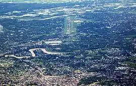 Dimapur Street (Top), Aerial view of Dimapur (Bottom) | |
 Dimapur  Dimapur | |
| Coordinates: 25.92°N 93.73°E | |
| Country | |
| State | |
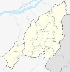
| District | Dimapur |
| Government | |
| • Deputy Commissioner | Shri Anoop Kinchi, IAS |
| Area | |
| • City and Municipality | 18.13 km2 (7.00 sq mi) |
| • Metro | 121 km2 (47 sq mi) |
| Elevation | 145 m (476 ft) |
| Population | 254,674 |
| • Rank | 1st in Nagaland |
| • Density | 2,558/km2 (6,630/sq mi) |
| Languages | |
| • Official | English and Nagamese |
| Time zone | UTC+5:30 (IST) |
| PIN | 797 112, 797103, 797113, 797115, 797116 |
| Telephone code | 91 - (0) 03862 |
| Vehicle registration | NL-07 |
| Website | dimapur |
Located near the border with Assam along the banks of the Dhansiri River, Dimapur is the only plains tract of hilly Nagaland and also has the only railway station and airport in the state for connectivity and economic activity.
Etymology
The name Dimapur is derived from the Kachari language; Di means "water", ma means "large" and pur (sanskritised word) means "city", translating to "Big-river-city", associated with the meaning of "Kachari" which is "people of the river valley" and after the river which flows through it (Dhansiri).
There are two accounts of the way in which Dimapur got its name : many writers are of the opinion that the name 'Dimapur' was derived from Dimasa Kachari words Di-meaning water, Ma-meaning big and Pur-meaning city or township in the Dimasa dialect; while others contend that Dimapur is a corruption of Hidimbapur, meaning the city of Hidimbi (of Mahabharata fame) - the rakshasi-turned-woman whose marriage to the Pandava prince Bhima led to the birth of Ghatotkacha, believed to be the progenitor of the Kacharis. According to the second theory, the name Hidimbapur is conjectured to have been abbreviated to Dimbapur and subsequently to have lost a consonant to become Dimapur. In the Ahom Chronicles, Dimapur Is referred to sometimes as ‘Che-din-chi-pen’ (town-earth-burn-make) meaning ‘brick town’.[4]
History
Situated on the banks of the Dhansiri (originally known as Dong-siri meaning a ravine of peaceful habitation), Dimapur, often described as the ‘Brick City’ by European scholars and also by the Ahoms, was the ancient capital of Dimasa Kachari community and an independent nation of the Dimasa, who were once a powerful and predominant in the now North East India region (Brahmaputra/Dilao Valley).
Medieval period
According to popular belief, the city's formation in Nagaland is separate from that of Assam. In the Middle Ages, it was the capital of the Dimasa Kingdom. In the heart of the town there is an old relic of the Dimasa Kachari Kingdom which speaks about the once prosperous era.
1900
During World War II, Dimapur was the centre of action between British India and Imperial Japan. It was the staging post for the Allied offensive. The Japanese could reach Kohima where a siege was laid. Allied reinforcement came through Dimapur by rail and road for the push against the Japanese. An airport at Dimapur was also in use for supplies to the allied forces in Burma. The battle for Kohima about 77 km from Dimapur is considered the turning point for the Japanese retreat from South East Asia.
The Jains were amongst the earliest non-Naga settlers of Nagaland. A few Jain families came to Kohima in the 1880s and settled there. They later moved to Dimapur in 1944 due to Japanese invasion during World War II. Prominent among them were Phulchand Sethi, Udayram Chabra, Mangilal Chabra, Phulchand Binaykia, Jethmal Sethi, Ramchandra Sethi, Bhajanlal Sethi, Kanhaiyal Sethi, Nathmal Sethi etc. Phulchand Sethi, Bhajanlal Sethi and other Sethi and Chabra brethren set up the SD Jain Temple, SD Jain School, SD Jain Charitable Hospital. Kanhaiyalal Sethi, Phulchand Sethi, and his brothers also built the Durga Mandir in Old Daily Market.
Assam lease Dimapur to Nagaland
In 1918, Dimapur was leased to then Naga Hills district (Now Nagaland) by then erstwhile Assam Province of British of India for 30 years for construction of Railways lines (unclear from which district).[5] In 1963, it was again leased to now state of Nagaland for 99 years.[6][7] There is controversy surrounding this claim, as both state governments have not come forward to comment on the matter.[8]
2000
Present-day Dimapur has far outgrown its old town area. It is one contiguous urban sprawl from the Assam border at Dilai gate and newfield checkgate up to the foothills of Chümoukedima, the designated district headquarters of Dimapur district.
Geography
Dimapur is located in the southwest of Nagaland. The vast majority of this area is flat with the Dhansiri River, a tributary of the Brahmaputra River flowing east of the city.
Climate
Dimapur is hot and humid in summers and moderately cold in winters.[9]
| Climate data for Dimapur | |||||||||||||
|---|---|---|---|---|---|---|---|---|---|---|---|---|---|
| Month | Jan | Feb | Mar | Apr | May | Jun | Jul | Aug | Sep | Oct | Nov | Dec | Year |
| Average high °C (°F) | 22.7 (72.9) |
24.5 (76.1) |
26.9 (80.4) |
27.2 (81.0) |
29.9 (85.8) |
31.5 (88.7) |
32.3 (90.1) |
33.5 (92.3) |
33.7 (92.7) |
30.9 (87.6) |
25.0 (77.0) |
24.4 (75.9) |
28.5 (83.4) |
| Average low °C (°F) | 9.8 (49.6) |
13.1 (55.6) |
18.6 (65.5) |
22.3 (72.1) |
21.6 (70.9) |
22.5 (72.5) |
23.7 (74.7) |
24.6 (76.3) |
25.2 (77.4) |
21.0 (69.8) |
14.5 (58.1) |
13.1 (55.6) |
19.2 (66.5) |
Demographics
As of 2011, the census of 2011, the city-population of the old Town Committee area (up to the old dhansiri bridge) at 122,834. Males constitute 52% of the population and females 48%. Dimapur has an average literacy rate of 86% male literacy is 88% and, female literacy is 84%.[3] In Dimapur, 12% of the population is under 6 years of age. Unlike other places in the state, this city has a heterogeneous mix of people from all over India, and for which it is also known as "Mini India".
Besides the dominant Naga tribes, who comprise about 50% of the city's population, other prominent groups include Bengalis, Assamese, Oriyas, Nepalese, Biharis, Meiteis, Kacharis, Kukis, Marwaris, Punjabis and also Tamils, Telugus and Keralites. In the last two decades Tibetan traders have also settled in the city.
Religion
Christianity is the most common religion in Dimapur, making up 54% of the city population and Hinduism comprise 45% of the population. Islam at 0.7% and Jainism by 0.3%.[3]
Tourism
Religious and historical sites
- Ruins of Kachari Rajbari
.jpg.webp)
Although is left in ruins after centuries of abandonment, after facing conflict with the Ahom King in 18th century and with the settlement of township occupying almost half of its former glorious fortress, is still a national heritage site. It signifies great historical importance for the region of North-East. It also gives great value to the state of Nagaland.
- Dimapur Jain Temple
The Dimapur Jain Temple was built in 1947. The temple has some intricate glass work. The temple is considered very auspicious by the people of Dimapur. The temple was built by the tireless effort of Shri Subhkaran Sethi, Shri Phulchand Sethi, Shri Jethmal Sethi, Shri Udayram Chabra, Shri Chunnilal Kishanlal Sethi, Shri Kanhaiyal Sethi, and other Jain families present in Dimapur at that time.
Parks and other highlights
Dimapur has several places where tourist can visit such as Green Park, Aqua Mellow park, Zoological Garden, Science Center, Stone Park, Hazi Park, Agri Expo site, Noune Resort ,Rangapahar Forest, Triple Falls, Noune Resort,Shiv Mandir, Loinloom Festival and Kali Temple.[10]
Transportation
Highways passing through Dimapur
Airport

Dimapur is served by the Dimapur Airport which is located at 3rd mile (AH-1). It is the only civil airport in the state and operates routes to Kolkata, Guwahati, Imphal,[11] and Dibrugarh.
There are plans for expansion of the airport to meet international norms by buying land at Aoyimti village.
Railway
Dimapur is the only city in Nagaland that is connected by both rail and air. There are direct train services to cities like Guwahati, Kolkata, New Delhi, Bangalore, Chandigarh, Amritsar, Dibrugarh and Chennai from the Dimapur railway station. The station is categorised as an A category railway station which lies on the Lumding-Dibrugarh section under the Lumding railway division of Northeast Frontier Railway.
Economy

Although Dimapur accounts for only about 9% of the state, it is the commercial centre of Nagaland.
Commerce
A number of shopping centers and markets have sprung up in Dimapur, with the Hong Kong Market, Central Plaza, New Market, Bank colony (Super Market Area) and Circular and NL roads serving as the main commercial areas in the city. The Complexes and shopping centres have sprung up to Nuton Bosti.
The stretch from Purana Bazaar to Chümoukedima along the AH-1 is also rapidly developing into commercial areas.
The city's Hong Kong Market is well known for imported goods from Thailand, China, and Burma and is the main Shopping Attraction for Tourists visiting Nagaland. The wholesale foodgrain items are available at KL Sethi Market Complex, Jasokie Market etc. at G S Road, Dimapur.
Industry
The Nagaland Industrial Growth Centre is situated at Ganeshnagar of Dhansiripar Sub-Division, where most of the Dimasa Kacharis lived — an area consisting of seven Dimasa Villages (Dhansiripar, Disaguphu, Amaluma, Doyapur, Ganeshnagar, Hazadisa, and Manglumukh).
Education

See also
References
- "Dimapur City".
- "Dimapur Info".
- "Dimapur City Population Census 2011 | Nagaland". www.census2011.co.in.
- "SALESIAN PROVINCE OF DIMAPUR". donboscodimapur.org. Archived from the original on 24 March 2014. Retrieved 18 February 2014.
- https://nagalandpage.com/return-dimapur-to-assam-demand-grows/
- https://easternmirrornagaland.com/assam-politician-wants-dimapur-and-merapani-from-nagaland/
- https://nenow.in/north-east-news/assam/assam-mp-demands-return-dimapur.html
- http://www.nagalandpost.com/paying-the-price-of-silence/181641.html
- "February Climate History for Dimapur". myweather2.com. Retrieved 18 February 2014.
- "Dimapur Places to Visit". holidayiq.com. Retrieved 18 February 2014.
- "Alliance Air confirms plans to commence Guwahati-Dimapur-Imphal service in Dec-2019". CAPA. Retrieved 4 December 2019.
- Lyndem, Biloris; De, Utpal Kumar (2004). Education in North East India: Experience and Challenge. Concept Publishing Company. p. 346. ISBN 9788180690631. Retrieved 9 December 2016.
External links
| Wikimedia Commons has media related to Dimapur. |
