Dunham-on-the-Hill
Dunham-on-the-Hill is a village and former civil parish, now in the parish of Dunham-on-the-Hill and Hapsford, in the Cheshire West and Chester district, and the ceremonial county of Cheshire in England. It is located on the A56 main road, near Helsby.
| Dunham-on-the-Hill | |
|---|---|
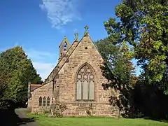 St. Luke's Church | |
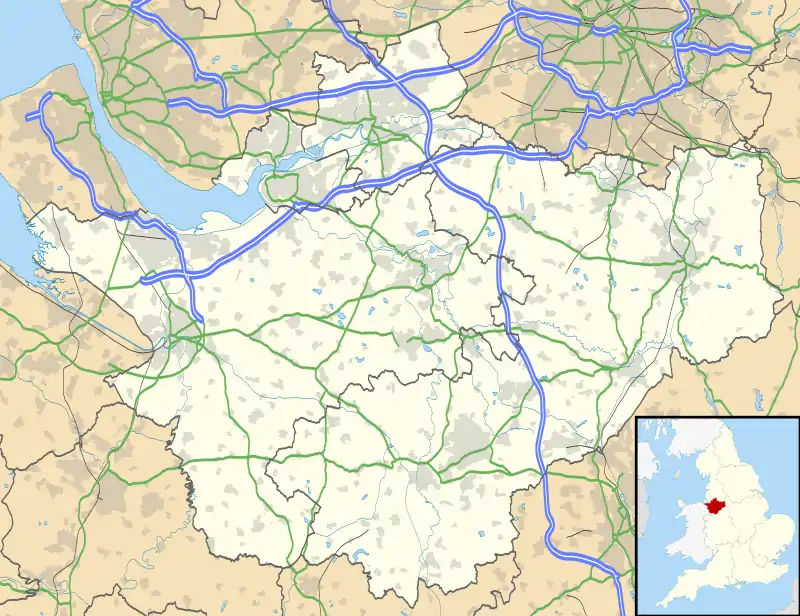 Dunham-on-the-Hill Location within Cheshire | |
| Population | 501 (2011) |
| OS grid reference | SJ471726 |
| Civil parish |
|
| Unitary authority | |
| Ceremonial county | |
| Region | |
| Country | England |
| Sovereign state | United Kingdom |
| Post town | Frodsham |
| Postcode district | WA6 |
| Dialling code | 01928 |
| Police | Cheshire |
| Fire | Cheshire |
| Ambulance | North West |
| UK Parliament | |
The village of Dunham-on-the-Hill is mentioned in Domesday Book. It is situated 120 feet (37 m) above sea level, south west of Helsby Hill, and 6 miles (9.7 km) from Chester. Originally a small hamlet, it has gradually enlarged, and is now divided by the A56 main road. Council housing was built shortly after the Second World War behind ‘The Wheatsheaf' pub, many of these are now owner occupied. Other in-fill building in the village has increased the population of the parish from fewer than 300 in the early 1900s to 534 recorded in the 2001 Census,[1] then decreasing slightly to 501 at the 2011 Census.[2] The civil parish was abolished in 2015 to form Dunham-on-the-Hill and Hapsford, part also went to Manley.[3]
Dunham Hill railway station was closed in 1952.
The village school closed in 2008. The 'Dunham Arms' pub reopened in 2010. Renamed to the Summit Arms in 2020 due to the success of Summit2020
Churches
The parish church of St Luke was built in the 1860s as a chapel of ease. Before this villagers had to walk across the fields to Thornton-le-Moors in order to attend church services. Services are held here at 9.30 every Sunday morning.
The village also has two Methodist chapels, both now converted into dwellings. The Wesleyan Methodist church in the centre of Dunham was the first place of worship to be built in the village. Hapsford Methodist Church is on the A56 between Dunham and its neighbouring village, Hapsford.
ROF Dunham on the Hill
Dunham-on-the-Hill was the location of an explosives storage depot built during World War II. Some of the old storage sheds can still be seen from the M56 motorway.[4]
References
- Office for National Statistics : Census 2001 : Parish Headcounts : Chester Retrieved 2009-12-15
- "Parish population 2011". Retrieved 28 May 2015.
- "DUNHAM ON THE HILL". GENUKI. Retrieved 15 April 2018.
- Archived March 1, 2012, at the Wayback Machine
External links
| Wikimedia Commons has media related to Dunham-on-the-Hill. |
- Official website
- The History of ROF Dunham at the Rhydymwyn Valley History Society's web site
Cheshire Portal | |
| Unitary authorities | |
| Major settlements |
|
| Rivers | |
| Topics | |