Essa, Ontario
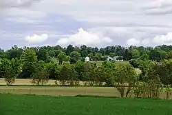
Essa is a township in Ontario, Canada, west and south of the city of Barrie in Simcoe County. It is bounded by County Road 90 to its north, County Road 27 to its east, and Ontario Highway 89 to its south. The township is about 100 kilometres (62 mi) from Toronto. The township is well known for its agriculture industry, particularly potato farming. Nearby CFB Borden brings a strong military presence to the area as well, including a high number of Francophone families.
Essa | |
|---|---|
| Township of Essa | |
 | |
| Motto(s): Where Town and Country Meet | |
 Essa Location of Essa, Ontario | |
| Coordinates: 44°15′N 79°47′W | |
| Country | |
| Province | |
| County | Simcoe |
| Government | |
| • Mayor | Sandie MacDonald [1] |
| • Deputy Mayor | Mike Smith [1] |
| • MPs | Terry Dowdall |
| • MPPs | Jim Wilson |
| Area | |
| • Land | 280.03 km2 (108.12 sq mi) |
| Population (2016)[2] | |
| • Total | 21,083 |
| • Density | 75.3/km2 (195/sq mi) |
| Time zone | UTC-5 (Eastern (EST)) |
| • Summer (DST) | UTC-4 (EDT) |
| Area code(s) | 705 |
| Website | Official website |

Communities
The main communities of this township are Angus, Thornton, and Baxter. Other small hamlets are Cedargrove, Colwell, Egbert, Elmgrove, Hoe Doe Valley, Ivy, Utopia and West Essa.
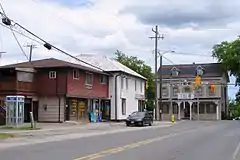
Angus is the largest community in Essa Township, and the main access to the neighbouring Canadian Forces Base Borden. It offers services such as Essa Public Library, catholic and public elementary schools, public secondary school, a small shopping centre, many stores, a chamber of commerce and a recreation facility. Angus is located in the northwestern part of Essa township. Located in Essa's municipal Ward 1, the township councillor for Angus is Keith White. Angus is named in honour of Angus Morrison, former Member of the Legislative Assembly for Simcoe North.[3]
Notable residents
Controversial politician Helena Guergis, the former Member of Parliament for Simcoe—Grey, resides in Angus.[4] Her cousin David Guergis was Essa's mayor until 2010.[4]
Local Government
Essa is governed by a Mayor, a Deputy Mayor and three Councillors, with one Councillor representing each of the three municipal wards. The Mayor of Essa represents the town on the Simcoe County Council. As of the 2018 election, the elected council members are:[5]
Mayor: Sandie MacDonald
Deputy Mayor: Mike Smith
Councillors:
- Ward 1: Keith White
- Ward 2: Henry Sander
- Ward 3: Ron Henderson.
Fire, EMS and police services
Township of Essa Fire Department is a fire services staffed by full-time chief, Cynthia Tustin and deputy chief, Doug Burgin. With 54 volunteer fire fighters at two stations (Angus and Thornton).[6]
Ambulance service is covered by County of Simcoe Paramedic Service station in Angus.
Policing in Essa Township is covered by Ontario Provincial Police Nottawasaga Detachment.
Education
Essa Township has 4 elementary schools and a high school:
- Angus Morrison Public School (Angus)
- Pine River Elementary School (Angus)
- Baxter Central Public School (Baxter)
- Our Lady of Grace Separate School (Angus)
These schools are managed by the Simcoe County District School Board and the Simcoe Muskoka Catholic District School Board.
There are also two French Schools accessible to Essa residents, managed by the French Public School Board, Conseil Scolaire Viamonde.
- Academie La Pinède ( Borden)
- Ecole Secondaire Romeo Dallaire (Barrie)
Climate
| Climate data for Egbert (Centre for Atmospheric Research Experiments), elevation: 246 m or 807 ft, 1981-2010 normals | |||||||||||||
|---|---|---|---|---|---|---|---|---|---|---|---|---|---|
| Month | Jan | Feb | Mar | Apr | May | Jun | Jul | Aug | Sep | Oct | Nov | Dec | Year |
| Average high °F (°C) | 27.0 (−2.8) |
30.1 (−1.1) |
38.9 (3.8) |
52.9 (11.6) |
66.0 (18.9) |
73.5 (23.1) |
78.9 (26.1) |
77.2 (25.1) |
70.0 (21.1) |
56.9 (13.8) |
43.6 (6.4) |
32.3 (0.2) |
53.9 (12.2) |
| Average low °F (°C) | 10.8 (−11.8) |
12.6 (−10.8) |
20.2 (−6.6) |
33.3 (0.7) |
43.4 (6.3) |
53.0 (11.7) |
57.2 (14.0) |
54.9 (12.7) |
47.8 (8.8) |
38.1 (3.4) |
29.6 (−1.3) |
18.4 (−7.6) |
34.9 (1.6) |
| Average precipitation inches (mm) | 1.60 (41) |
2.05 (52) |
2.00 (51) |
2.86 (73) |
3.59 (91) |
3.10 (79) |
3.66 (93) |
2.38 (60) |
2.29 (58) |
2.09 (53) |
3.38 (86) |
2.72 (69) |
31.72 (806) |
| Source: NOAA[7] | |||||||||||||
Demographics
| Canada census – Essa, Ontario community profile | |||
|---|---|---|---|
| 2016 | 2011 | 2006 | |
| Population: | 21,083 (+13.9% from 2011) | 18,505 (+9.5% from 2006) | 16,901 (+0.6% from 2001) |
| Land area: | 280.03 km2 (108.12 sq mi) | 280.07 km2 (108.14 sq mi) | 279.57 km2 (107.94 sq mi) |
| Population density: | 75.3/km2 (195/sq mi) | 66.1/km2 (171/sq mi) | 60.5/km2 (157/sq mi) |
| Median age: | 36.5 (M: 35.5, F: 37.6) | 36.2 (M: 35.8, F: 36.6) | |
| Total private dwellings: | 7,478 | 6,930 | 6,212 |
| Median household income: | $87,243 | $70,531 | |
| References: 2016[8] 2011[9] 2006[10] earlier[11] | |||
References
- "Certificate of Election Results" (PDF). Essa Township. Retrieved 2018-11-23.
- "Census Profile, 2016 Census: Essa, Township". Statistics Canada. Retrieved July 5, 2019.
- Hamilton, William (1978). The Macmillan Book of Canadian Places and Names. Toronto: Macmillan of Canada. p. 134. ISBN 0-7715-9754-1.
- "Growing Up Guergis: The evolution of a political family", Simcoe Life, Spring 2007.
- "Certificate of Election Results" (PDF). Essatownship.on.ca. October 22, 2018. Retrieved November 23, 2018.
- "Fire Department". Essa Township. Retrieved July 5, 2019.
- "Normals Monthly Station Details: EGBERT 1 W, CA, GHCND:CAW00064757 | Climate Data Online (CDO) | National Climatic Data Center (NCDC)". www.ncdc.noaa.gov. Retrieved 2019-08-15.
- "2016 Community Profiles". 2016 Canadian Census. Statistics Canada. February 21, 2017. Retrieved 2019-07-05.
- "2011 Community Profiles". 2011 Canadian Census. Statistics Canada. July 5, 2013. Retrieved 2012-07-04.
- "2006 Community Profiles". 2006 Canadian Census. Statistics Canada. March 30, 2011. Retrieved 2012-07-04.
- "2001 Community Profiles". 2001 Canadian Census. Statistics Canada. February 17, 2012.
External links
Places adjacent to Essa, Ontario | |
|---|---|