Vale de Cambra
Vale de Cambra (Portuguese pronunciation: [ˈval(ɨ) ðɨ ˈkɐ̃bɾɐ] (![]() listen); Proto-Celtic: *Cambra) is a city and a municipality in Portugal. The population in 2011 was 22,864,[1] in an area of 147.33 km².[2] It had 21,440 electors in 2006. The city itself has about 4,100 inhabitants and is located in the Vila Chã, Codal e Vila Cova de Perrinho parish.
listen); Proto-Celtic: *Cambra) is a city and a municipality in Portugal. The population in 2011 was 22,864,[1] in an area of 147.33 km².[2] It had 21,440 electors in 2006. The city itself has about 4,100 inhabitants and is located in the Vila Chã, Codal e Vila Cova de Perrinho parish.
Vale de Cambra | |
|---|---|
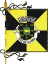 Flag  Coat of arms | |
 | |
| Coordinates: 40°51′N 8°24′W | |
| Country | |
| Region | Norte |
| Metropolitan area | Porto |
| District | Aveiro |
| Parishes | 7 |
| Government | |
| • President | José Pinheiro (CDS/PP) |
| Area | |
| • Total | 147.33 km2 (56.88 sq mi) |
| Population (2011) | |
| • Total | 22,864 |
| • Density | 160/km2 (400/sq mi) |
| Time zone | UTC±00:00 (WET) |
| • Summer (DST) | UTC+01:00 (WEST) |
| Website | http://www.cm-valedecambra.pt |
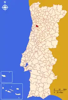
The municipality is located in the District of Aveiro, in Norte region and Entre Douro & Vouga subregion. It is now one of the municipalities of the Greater Metropolitan Area of Porto.
The present Mayor is José Alberto Freitas Soares Pinheiro e Silva, elected by the CDS/PP or Social Center Democratic Party/Popular Party. The municipal holiday is June 13.
Demographics
| Population of Vale de Cambra Municipality (1801 – 2004) | |||||||||
|---|---|---|---|---|---|---|---|---|---|
| 1801 | 1849 | 1900 | 1930 | 1960 | 1981 | 1991 | 2001 | 2004 | 2006 |
| 9489 | 10166 | 12264 | 15745 | 20404 | 24224 | 24537 | 24805 | 24761 | 24591 |
Parishes
Administratively, the municipality is divided into 7 civil parishes (freguesias):[3]
- Arões
- Cepelos
- Junqueira
- Macieira de Cambra
- Roge
- São Pedro de Castelões
- Vila Chã
Environment
The mountains of Freita and Arada: Serra da Freita & Serra da Arada
These mountains are a part to the European Nature 2000
Arouca Geopark
Notable people
- Rui Filipe, (1968-1994), Portuguese footballer.
- João Paulo Fernandes, born August 11, 1984, Portuguese boccia player and Paralympic champion.
See also
- Hóquei Académico de Cambra, a rink hockey club.
References
- Instituto Nacional de Estatística
- Áreas das freguesias, concelhos, distritos e país
- Diário da República. "Law nr. 11-A/2013, page 552 124" (pdf) (in Portuguese). Retrieved 4 August 2014.
