Fu County
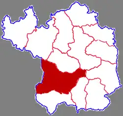
Fu County or Fuxian (simplified Chinese: 富县; traditional Chinese: 富縣; pinyin: Fù Xiàn) is a county in the south of Yan'an City, Shaanxi Province, China.[1] The county has an area of 4,179.9 square kilometers, and a permanent population of 150,500 as of 2012.[1]
Fuxian
富县 | |
|---|---|
 | |
 | |
.png.webp) | |
| Coordinates (Fu County government): 35°59′17″N 109°22′44″E | |
| Country | People's Republic of China |
| Province | Shaanxi |
| Prefecture-level city | Yan'an |
| Area | |
| • Total | 4,179.9 km2 (1,613.9 sq mi) |
| Population (2012) | 150,500 |
| Time zone | UTC+8 (China standard time) |
| Postal code | 727500 |
Administrative divisions
The county is divided into one subdistrict, six towns, and one township.[1] The county's sole subdistrict, Chafang Subdistrict, is home to the county's administrative offices.[1] The county's six towns are Zhangcunyi, Zhangjiawan, Zhiluo, Niuwu, Sixian, and Yangquan.[1] Fu County's sole township is Beidaode Township.[1] These jurisdictions then in turn are divided into 137 village committees [zh].[2]
Geography
The county's area is largely covered by hilly terrain, with the altitude ranging from 846.6 meters in height to 1,687 meters in height.[1][2] The Luo River, as well as the Hulu River (葫芦河; Húlu Hé) both flow through the county.[1][2]
Climate
Fu County's annual average temperature is 9.8 °C, with its highest recorded temperature being 38.7 °C, and its lowest being -26.3 °C.[2] The county receives an averages of 2369.3 hours of sunshine per year, an average of 567.5 millimeters of precipitation per year, and on averages experiences 188 days without frost.[2]
History
The area of present-day Fu County was a part of both the Xia Dynasty and Shang Dynasty, the earliest dynasties in Chinese history.[2] During the Qin Dynasty, the area was incorporated as Diaoyin County (雕阴郡; Diāoyīn Jùn).[2] During the first year of Emperor Sui Yang's rule, the county was reorganized as Fucheng County (鄜城郡; Fūchéng Jùn), which would be changed immediately after his rule in 618 CE to Fu Prefecture (鄜州; Fū Zhōu).[2] It remained this way for approximately 1,300 years until in 1912, under the rule of the Republic of China, Fu Prefecture was reorganized as Fu County (鄜县; Fū xiàn).[2] In 1964, the State Council of the People's Republic of China renamed the county to its current name, Fu County (富县; Fù Xiàn).[2]
Economy
Agriculture
The county produces a number of agricultural goods, such as apples, tobacco, rice, and a number of animal products.[2] 360,000 mu in Fu County are dedicated to growing apples, producing 507,700 tons of apples as of 2015.[2] The county also grows 12,000 mu of tobacco, and 6,700 mu of rice.[2]
Natural Resources
Fu County has a number of natural resources, including significant deposits of coal, copper, iron, petroleum, and natural gas.[1] The county reported 62.844 million tons of proven oil reserves, 1.46 billion cubic meters of proven natural gas reserves, and 425 million tons of coal reserves.[2] As of 2015, an oil production plant owned by Yanchang Oilfield produced 188,000 tons of oil, and a plant owned by Sinopec produced 5,175 tons.[2] These two plants combined have 2,591 oil wells, and employ over 400 people.[2] In 2015, the county produced 2.72 million tons of coal.[2]
Education
The county is served by a total of 70 schools of various types, employing 2,077 full-time staff and an additional 1,714 workers.[2]
Transport
Road transport
References
- 富县概况地图_行政区划网(区划地名网) www.xzqh.org. XZQH.org. Retrieved 2020-05-08.
- 富县概况-富县政府门户网. 2017-07-10. Archived from the original on 2017-07-10. Retrieved 2020-05-08.
| Authority control |
|---|
