Fulwell, London
Fulwell is a neighbourhood of outer South West London in the historic County of Middlesex and the London Borough of Richmond upon Thames. It straddles the west of the generally firmer ("ancient" parish and urban district borders) of Twickenham and Teddington, reinforced as local postcode districts.[2] The name is first known in documents of the fifteenth century. It may be from a reliably full well or a corruption of foul well.[3]
| Fulwell | |
|---|---|
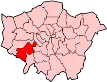
 Fulwell Location within Greater London | |
| Population | 10,131 (2011 Census. Fulwell and Hampton Hill Ward)[1] |
| OS grid reference | TQ149719 |
| London borough | |
| Ceremonial county | Greater London |
| Region | |
| Country | England |
| Sovereign state | United Kingdom |
| Post town | TWICKENHAM TEDDINGTON HAMPTON |
| Postcode district | TW2 TW11 TW12 |
| Dialling code | 020 |
| Police | Metropolitan |
| Fire | London |
| Ambulance | London |
| UK Parliament | |
| London Assembly | |
The area has no postal limits, but references survive as part of ward name, Fulwell and Hampton Hill,[4] Fulwell railway station, Fulwell Golf Course, Fulwell bus garage, Fulwell Park Avenue and Fulwell Road.[2] Fulwell is often used by residents to state where they live.[5]
In 2009, a proposal to remove the name from the local councillors' electoral district, ward, was rejected.[6]
Fulwell has an Anglican parish church, St Michael's, which, after a 15-year closure, was reopened for worship in 2014 and regained parish status in 2019.[7]
History
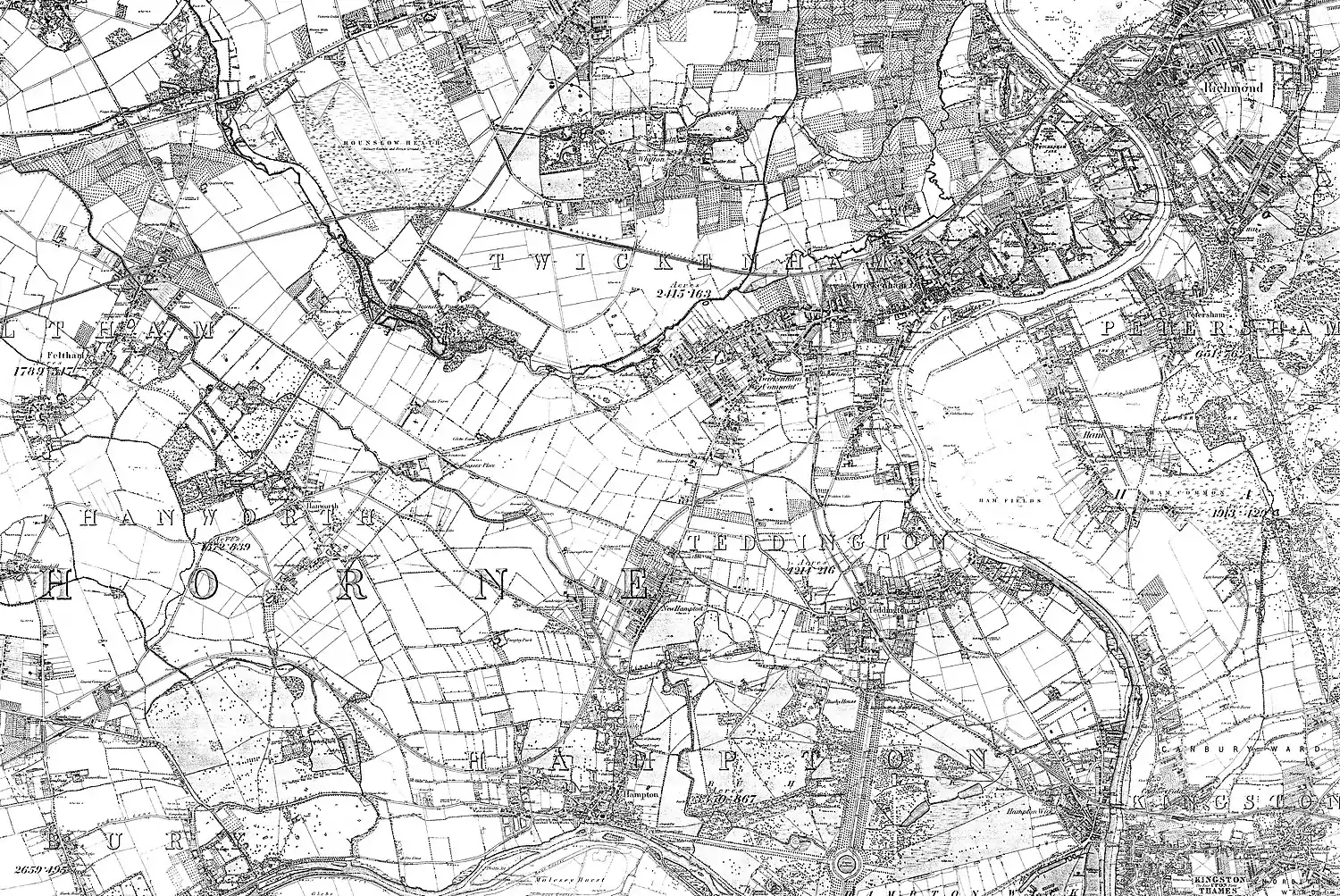
Fulwell has migrated south. It used to span onto the north bank of the Crane, which lies in Whitton, as the inset map shows.
Fulwell as today defined formed the southern extent of Hounslow Heath and the near-surface raised Taplow gravel that defined it. A reference to assarts at Fulwell dating from around 1200 are amongst the earliest records of the name.[8] The area was progressively enclosed for agriculture and increasingly urbanised since the Victorian period of metropolitan expansion of outer London.
Fulwell bus depot was built in 1902 as a hub for trams and trolley cars as well as buses.[9]
Fulwell Lodge and Fulwell Park
West of common land and north of the Staines Road, at the western extreme of Twickenham's long parish (that is, omitting Whitton's western gunpowder mills and farms) stood a grand house; Fulwell Lodge. At first owned with Yorke/Fulwell Farm to its north, it dated from the early 17th century.[10][11] In 1871 Charles James Freake, a London property developer, bought Fulwell Lodge, its grounds and estate worker's cottages. This extended south from the A316 Chertsey Road and Crane, included the west of later housing often considered Twickenham Green rather than West Twickenham and what became Strawberry Hill Golf Course. It lay north-west of the Shepperton Branch Line encompassing what is now Fulwell Golf Course and as far as Apex Corner where the A312 Uxbridge Road meets the A316. Freake named the area Fulwell Park.[12] After Freake's death in 1884 this passed to his wife, who saw the golf course built in the west, and, on her death in 1900, was held by Freake Estates until 1910. The exiled last King of Portugal, Manoel/Manuel II, bought as his English home Fulwell Lodge from shortly after his marriage in 1913 until his death in 1932.[10]
The lodge and its acres of grounds were then bought by Wates and demolished. It was redeveloped as houses, with some low-rise, landscaped-grounds flats. The history is kept through the names: Manoel Road, Lisbon Avenue, Augusta Road and Portugal Gardens.[13]
Nearest places
Nearest settlements | ||||||||||
|---|---|---|---|---|---|---|---|---|---|---|
| ||||||||||
References
- "Richmond Ward population 2011". Neighbourhood Statistics. Office for National Statistics. Retrieved 11 October 2016.
- "Fulwell, London". Google Maps. Retrieved 16 October 2019.
- Willey, Russ (26 October 2007). Chambers London Gazeteer (First ed.). p. 187. ISBN 978-0550103260. Retrieved 16 October 2019.
- "Ward map of the Borough". London Borough of Richmond upon Thames. Retrieved 14 April 2019.
- "Every Lidl Helps? Supermarket plan for Fulwell". Twickerati. Word Press. Retrieved 16 October 2019.
- Kilvington, Joanna (24 October 2009). "Richmond ward name change plan gets lukewarm reception". Richmond and Twickenham Times. Retrieved 16 October 2019.
- [https://www.achurchnearyou.com/search/?lat=51.433&lon=-0.349 achurchnearyou.com Parish Maps and details of their churches by the Church of England
- Reynolds, Susan, ed. (1962). "Heston and Isleworth: Hounslow Heath". A History of the County of Middlesex: Volume 3. Institute of Historical Research. pp. 94–96. Retrieved 26 November 2014.
- "Fulwell Depot". Twickenham Museum. Retrieved 14 October 2019.
- "Fulwell Lodge". Twickenham Museum. Archived from the original on 1 December 2014. Retrieved 24 November 2014.
- Reynolds, Susan, ed. (1962). "Twickenham: Introduction". A History of the County of Middlesex: Volume 3. Institute of Historical Research. pp. 139–147. Retrieved 25 November 2014.
- Watson, Martin. "Fulwell Park". Retrieved 24 November 2014.
- "Other Major Houses in Twickenham & Whitton". Twickenham Museum. Archived from the original on 1 December 2014. Retrieved 24 November 2014.
External links
- Twickenham Museum Hampton & Teddington Past by John Sheaf and Ken Howe
- Hidden London: Fulwell, Richmond upon Thames