Gaziantep Province
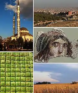
Gaziantep Province (Turkish: Gaziantep ili) is a province in south-central Turkey. Its capital is the city of Gaziantep, which had a population of 1,931,836 in 2015. Its neighbours are Adıyaman to the north, Şanlıurfa to the east, Syria and Kilis to the south, Hatay to the southwest, Osmaniye to the west and Kahramanmaraş to the northwest.
Gaziantep Province
Gaziantep ili | |
|---|---|
 | |
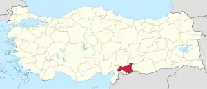 Location of Gaziantep Province in Turkey | |
| Country | Turkey |
| Region | Southeast Anatolia |
| Subregion | Gaziantep |
| Government | |
| • Electoral district | Gaziantep |
| • Governor | Davut Gül[1] |
| Area | |
| • Total | 7,194 km2 (2,778 sq mi) |
| Population (2018)[2] | |
| • Total | 2,028,563 |
| • Density | 280/km2 (730/sq mi) |
| Area code(s) | 0342 |
| Vehicle registration | 27 |
| Website | http://www.gaziantep.gov.tr |
An important trading center since ancient times, the province is also one of Turkey's major manufacturing zones, and its agriculture is dominated by the growing of pistachio nuts.
In ancient times, first under the power of Yamhad, then the Hittites and later the Assyrians controlled the region. It saw much fighting during the Crusades, and Saladin won a key battle there in 1183. After World War I and the Ottoman Empire's disintegration, it was invaded by the forces of the French Third Republic during the Turkish War of Independence. It was returned to Turkish control after the Treaty of Lausanne was signed, formally ending hostilities between Turkey and the Allies of World War I.
Originally known as Antep, the title gazi (meaning veteran in Turkish) was added to the province's and the provincial capital's name in 1921, due to its population's actions during the Turkish War of Independence.
Kilis Province was part of Gaziantep Province until it separated in 1994. Turks are the majority in the province.[3]
Geology
Two major active geological faults meet in western Gaziantep near the border with adjoining Osmaniye Province: the Dead Sea Transform and the East Anatolian Fault. These represent the tectonic boundary between the northward-moving Arabian Plate to the east, and the converging African and Eurasian Plates to the west.
Geography
Gaziantep is traversed by the northeasterly line of equal latitude and longitude.
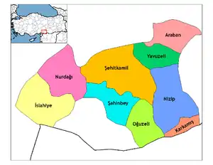
Districts
References
- "Yeni Valiler Kararnamesi Resmi Gazete'de yayımlandı: 39 ilin valisi değişti". Haberturk.com. 27 October 2018. Archived from the original on 25 November 2018. Retrieved 4 November 2018.
- "Population of provinces by years - 2000-2018". Turkish Statistical Institute. Retrieved 9 March 2019.
- Khanam, R. (2005). Encyclopaedic Ethnography of Middle-East and Central Asia. A–I, V. 1. Global Vision Publishing House. p. 470. ISBN 9788182200623.
External links
| Wikimedia Commons has media related to Gaziantep Province. |
- (in English) Gaziantep weather forecast information
- (in Turkish) Gaziantep local newspaper
- (in Turkish) All about cultural activities in Gaziantep
| ||
Metropolitan municipalities are bolded. | ||
| Authority control |
|---|
