Gedling
Gedling is a village in the Gedling district, in Nottinghamshire, England, four miles northeast of Nottingham city centre. The population at the 2011 census of the ward was 6,817[1] and 111,787 for the district.[2] Gedling was once a distinct settlement, having been recorded in the Domesday Book, although nowadays—due to the growth of Nottingham—it is difficult to separate it from the neighbouring town of Carlton.
| Gedling | |
|---|---|
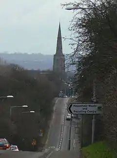 Parish Church of All Hallows from A6211 Arnold Lane | |
 Gedling Location within Nottinghamshire | |
| Population | 6,817 (Ward. 2016) |
| OS grid reference | SK 61703 42390 |
| District | |
| Shire county | |
| Region | |
| Country | England |
| Sovereign state | United Kingdom |
| Post town | Nottingham |
| Postcode district | NG4 |
| Dialling code | 0115 |
| Police | Nottinghamshire |
| Fire | Nottinghamshire |
| Ambulance | East Midlands |
| UK Parliament | |
History
Gedling was first settled around Saxon times, when the Saxon chief Gedl (hence the name Gedling, coming from the chief "Gedl" and "Ing" being Saxon for People, Gedl-Ing meaning "Gedl's People") sailed up the River Trent, and then up the Little Ouse dyke, until he could get no further upstream. He landed at the spot which is thought to be the present-day site of All Saints' Church. Gedling has had several versions of its name including Ghellinge, Gedlinga, Geddlings, and Gettang.
Despite being a fairly small place, Gedling gives its name to the local borough council which has its offices in nearby Arnold, and also to the local parliamentary constituency, which covers the suburbs to the east of Nottingham, including Arnold and Carlton. Village pubs are the Gedling Inn (once the Chesterfield Arms) and The Willowbrook on Main Road.
Church
In the older part of Gedling is All Hallows' Anglican Church. It dates from the 11th century, with the oldest part of the church (the entrance) dating back to 1089 – although there have been four other churches on this site, the oldest dating back to the year 678AD.
Colliery
Gedling Colliery, which was the life-blood of Gedling and many of the surrounding villages, opened in 1899 and was closed in 1991. One hundred and twenty-eight men died at the colliery,[3] which produced over a million tonnes of coal per year in the 1960s.[4] It developed a reputation as the "pit of all nations" because of the diversity of foreign miners who worked there:[4] in the 1960s, 10 per cent of the colliery's workforce of 1,400 were originally from the Caribbean.[5]
The site was opened as Gedling Country Park on 28 March 2015.
Country park
Opened in March 2015 on the site of the former Gedling Colliery, the site has views of Gedling, and from its highest point there are views across Nottinghamshire and into neighbouring Lincolnshire and Leicestershire. On a clear day it is possible to see as far as Belvoir Castle and Lincoln Cathedral.[6] There are a number of paths that weave their way through the woodlands and grasslands that make up the flora and fauna within the country park.
Railway station
There are plans to either reopen the railway line from Nottingham railway station and to reopen Gedling railway station which was closed on 4 April 1960, or to open the old line as a part of the Mineral Line cycleway. The original station building is now owned by a youth group.[7] The line itself officially closed in 1995 when the line to the colliery eventually was classed as redundant.
Education
The local school is the Carlton le Willows Academy, Wood Lane, Gedling for 11-to-18 year olds.
Shopping
There is a Sainsbury's Local convenience store on Arnold Lane[8] and a Co-operative supermarket on Gedling Road.
Media
Gedling borough has its own dedicated hyperlocal news website called Gedling Eye, which has been publishing local news on a daily basis since 2015.
Bus services
- Nottingham City Transport
- 24: Nottingham, Carlton Hill, Westdale Lane.
- 25: Nottingham, Carlton Hill, Westdale Lane, Mapperley, Daybrook, Arnold.
- 25B: Nottingham, Carlton Hill, Westdale Lane, Mapperley.
- 26: Nottingham, Carlton Hill, Gedling, Carlton-le-Willows, Burton Joyce, Lowdham.
- N26: Nottingham, Colwick, Netherfield, Gedling, Burton Joyce, Lowdham, Southwell.
- N27: Nottingham, Sneinton, Carlton Hill, Westdale Lane, Gedling, Mapperley, Woodborough Road.
- 44: Nottingham, Sneinton Hermitage, Colwick, Netherfield, Gedling.
- 44A: Nottingham, Sneinton Hermitage, Colwick Industrial Estate, Netherfield, Gedling.
- 45: Nottingham, Woodborough Road, Mapperley, Westdale Lane, Gedling.
- Nottingham Community Transport (CT4N)
- L74: Victoria Retail Park, Netherfield, Cavendish Road, Westdale Lane, Adbolton Avenue, Jessops Lane, Carlton Square, Netherfield, Victoria Retail Park.
- L75: Victoria Retail Park, Netherfield, Emerys Road, Stoke Bardolph, Burton Joyce, Foxhill Road.
References
- "Gedling Ward population 2011". Neighbourhood Statistics. Office for National Statistics. Retrieved 9 April 2016.
- "Gedling". Britannica. Retrieved 8 August 2018.
- Nottingham Post. "Bygones: Tragedies at Gedling Colliery". Nottingham Post. Archived from the original on 14 May 2014. Retrieved 14 May 2014.
- Project, DEN. "Gedling Colliery – 20 years since closure". DEN project. Retrieved 14 May 2014.
- Perraudin, Frances (24 October 2016). "How Britain's black miners are reclaiming their place in history". theguardian.com. Retrieved 24 October 2016.
- Barlow, Jamie (16 November 2019). "Platforms will be installed boasting expansive views of Gedling Country Park". nottinghampost. Retrieved 13 December 2019.
- Barlow, Jamie (28 November 2017). "Station which gave author inspiration for Lord of the Rings could be restored". Nottingham Post. Local World.
- "Store overview". Sainsbury's website. Sainsbury's. Retrieved 8 April 2014.
External links
| Wikimedia Commons has media related to Gedling. |
- Gedling Borough Council
- History of Gedling (background music)
- Gedling – A History
- Friends of Gedling Country Park
- Gedling Eye
| Unitary authorities | |
|---|---|
| Boroughs or districts | |
| Major settlements | |
| Topics | |
| Authority control |
|---|
