Geography of San Marino
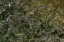
San Marino is located in Southern Europe, an enclave (landlocked) in central Italy, which it borders for 39 km. The third smallest independent state by area in Europe after the Vatican City and Monaco, San Marino is dominated by the Apennines. Located at 43.94°N 12.46°E, it covers an area of 61.2 km2 (23.6 sq mi). Completely mountainous, only 17% of its territory is arable. Several rivers flow through the country, the largest being the Ausa, the Marano, and the San Marino River.
Climate
The climate of San Marino is a humid subtropical climate (Köppen climate classification: Cfa), with continental influences, having warm summers and cool winters that are typical of inland areas of the central Italian peninsula. Snowfalls are common and heavy almost every winter, especially above 400–500 m (1,300–1,600 feet) of altitude.
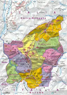
Political geography
San Marino is divided into 9 castelli, or municipalities. They are:
- Acquaviva
- Borgo Maggiore
- Chiesanuova
- Domagnano
- Faetano
- Fiorentino
- Montegiardino
- City of San Marino (Città di San Marino), capital town
- Serravalle