Giles Glacier
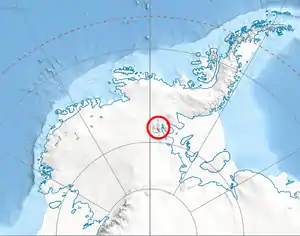
Giles Glacier (78°40′00″S 84°46′00″W) is a hanging glacier that flows eastward along the south side of Moyher Ridge to Thomas Glacier in the south Sentinel Range in the Ellsworth Mountains. It was named by the Advisory Committee on Antarctic Names in 2006 after J. David Giles, Polar Ice Coring Office, University of Nebraska, who supported United States Antarctic Program drilling operations at Taylor Dome, the South Pole, Windless Bight, Siple Dome and Kamb Ice Stream, from 1993 to 1998.
| Giles Glacier | |
|---|---|
 Location of Sentinel Range in Western Antarctica | |
 Location of Giles Glacier in Antarctica | |
| Type | hanging glacier |
| Location | Ellsworth Land |
| Coordinates | 78°40′00″S 84°46′00″W |
| Thickness | unknown |
| Terminus | Thomas Glacier |
| Status | unknown |
References
 This article incorporates public domain material from the United States Geological Survey document: "Giles Glacier". (content from the Geographic Names Information System)
| Types | |||||||
|---|---|---|---|---|---|---|---|
| Anatomy | |||||||
| Processes | |||||||
| Measurements | |||||||
| Volcanic relations | |||||||
| Landforms |
| ||||||
| |||||||
This article is issued from Wikipedia. The text is licensed under Creative Commons - Attribution - Sharealike. Additional terms may apply for the media files.