Gort
Gort (Irish: Gort Inse Guaire or An Gort) is a town in south County Galway, in the west of Ireland. It lies just north of the border with County Clare on the old Galway–Limerick road, now the R458. Gort is situated in the territory of Uí Fiachrach Aidhne also known as Maigh Aidhne ("the plain of Aidhne"), which is coextensive with the diocese of Kilmacduagh / Cill Mhic Dhuach.

Gort
An Gort | |
|---|---|
Town | |
 Bridge Street, Gort | |
 Gort Location in Ireland | |
| Coordinates: 53.0660°N 8.8118°W | |
| Country | Ireland |
| Province | Connacht |
| County | County Galway |
| Elevation | 43 m (141 ft) |
| Population (2016)[1] | |
| • Total | 2,994 |
| Time zone | UTC±0 (WET) |
| • Summer (DST) | UTC+1 (IST) |
| Eircode routing key | H91 |
| Telephone area code | +353(0)91 |
| Irish Grid Reference | M451019 |
| Year | Pop. | ±% |
|---|---|---|
| 1821 | 2,559 | — |
| 1831 | 2,627 | +2.7% |
| 1841 | 3,056 | +16.3% |
| 1851 | 2,398 | −21.5% |
| 1861 | 2,097 | −12.6% |
| 1871 | 1,773 | −15.5% |
| 1881 | 1,719 | −3.0% |
| 1891 | 1,498 | −12.9% |
| 1901 | 1,339 | −10.6% |
| 1911 | 1,166 | −12.9% |
| 1926 | 1,083 | −7.1% |
| 1936 | 1,034 | −4.5% |
| 1946 | 1,046 | +1.2% |
| 1951 | 1,008 | −3.6% |
| 1956 | 1,094 | +8.5% |
| 1961 | 1,044 | −4.6% |
| 1966 | 990 | −5.2% |
| 1971 | 975 | −1.5% |
| 1981 | 1,095 | +12.3% |
| 1986 | 1,021 | −6.8% |
| 1991 | 1,093 | +7.1% |
| 1996 | 1,182 | +8.1% |
| 2002 | 1,776 | +50.3% |
| 2006 | 2,734 | +53.9% |
| 2011 | 2,644 | −3.3% |
| 2016 | 2,994 | +13.2% |
| [2][3][4][5][6] | ||
History
Gort takes its name, Gort Inse Guaire, from gort (a meadow), "inse" (island) and Guaire Guaire Aidne mac Colmáin, the sixth century King of Connacht and patron of St. Colman MacDuagh. During the Middle Ages the chiefs of Cenél Áeda na hEchtge, the O'Shaughnessys (Ó Seachnasaigh, a clan descended from Guaire Aidhneach) had their principal stronghold in Gort, on a site which later became a cavalry barracks. At the end of the seventeenth century the O'Shaughnessy lands were confiscated and granted to Sir Thomas Prendergast, 1st Baronet, whose grandson was John Prendergast Smyth, 1st Viscount Gort. In 1831, the town had a population of 3,627 and 563 houses. The Great Hunger of the mid-1840s devastated the population.
A number of historic sites around Gort are included in the Sites and Monuments Record. Kilmacduagh monastery and round tower are situated approximately 3 km (1.9 mi) west of Gort. Rahaly Castle lies approximately 4.8 km (3 mi) east of Gort. Kiltartan Castle is 3 km to the north.
Transport
Road
Gort is accessible from the M18 Motorway from Shannon to Galway, at Junction 16. The motorway M18 ends at junction 18 of the M6. The road continues northbound as the M17 towards Tuam. The segment from Ennis to Gort of the M18 Motorway bypass of the town was officially opened on 12 November 2010. Followed by the Gort to Tuam section which opened on 27 September 2017.
Rail
Gort railway station opened on 15 September 1869 and was closed for goods traffic on 3 November 1975 and for passenger traffic on 5 April 1976.[7]
It was reopened in 2010 as part of the Western Railway Corridor project.
Gort rail services are on the Galway to Limerick route with connections to Cork and Tralee from Limerick station and to Dublin via Galway.[8][9]
Bus
Gort is served by Bus Eireann hourly from the market square. North to Galway, and south to Limerick. Routes 51, 434, 934.
Geraghty Travel run a bus service to Limerick.[10] Gort Area Shopper is another private service run by Clare Bus.[11]
Demographics
Some 40% of the residents of Gort were non-Irish, according to the 2006 Census, a massive majority of these being Brazilians. These people originally came to work in the meat processing plants in Gort where the pay is generally much higher than in similar plants in Brazil. According to Claire Healy "a large community of Brazilians now live, work and attend school in Gort, gradually altering the appearance and the character of the town".[12] The Roman Catholic Church caters to the Brazilian community with a mass in Portuguese every Saturday held in Gort Catholic Church.
By the time of the 2011 Census, non-Irish nationals accounted for 27.2% of the population. The largest group (417 people) were still Brazilians, followed by UK nationals (81).[13]
Education
The town has its own secondary school, Gort Community School which was founded in 1995, and serves a large area of south County Galway. The school facilities include a GAA pitch, rugby union pitch, football pitch, and canteen. The school's sports teams include hurling, rugby, soccer, basketball, athletics, golf and equestrian teams.
People
- William Butler Yeats, poet who renovated an old tower house near the village (Thoor Ballylee) and took up residence there.
- Lady Gregory, lived at nearby Coole Park.
- Thomas Laughnan, recipient of the Victoria Cross, was born in Gort.
- Sylvie Linnane, All-Star hurler.
- Colman mac Duagh (560-632), saint.
- Frank Quinn (1915–1996), first-class cricketer
- Gerry Quinn (1917–1968), rugby international and first-class cricketer
- Kevin Quinn (1923–2002), rugby international and first-class cricketer
- Paddy McMahon Glynn (1855–1931), born in Gort, served variously as Attorney-General of Australia, Australian Minister for External Affairs and Minister for Home Affairs.
References
- "Census 2016 Sapmap Area: Settlements Gort". Central Statistics Office Ireland. 2016. Retrieved 6 January 2019.
- Census for post 1821 figures.
- "Archived copy". Archived from the original on 7 May 2016. Retrieved 31 December 2019.CS1 maint: archived copy as title (link)
- Northern Ireland Statistics and Research Agency – Census Home Page Archived 17 February 2012 at the Wayback Machine
- Lee, JJ (1981). "On the accuracy of the Pre-famine Irish censuses". In Goldstrom, J. M.; Clarkson, L. A. (eds.). Irish Population, Economy, and Society: Essays in Honour of the Late K. H. Connell. Oxford, England: Clarendon Press.
- Mokyr, Joel; O Grada, Cormac (November 1984). "New Developments in Irish Population History, 1700–1850". The Economic History Review. 37 (4): 473–488. doi:10.1111/j.1468-0289.1984.tb00344.x. hdl:10197/1406. Archived from the original on 4 December 2012.
- "Gort station" (PDF). Railscot – Irish Railways. Retrieved 15 October 2007.
- http://www.irishrail.ie/train-timetables/timetables-by-station#g
- http://www.irishrail.ie/media/galway_-_limerickcorktralee_valid_from_20.11.2016.pdf
- http://www.geraghtytravel.com/college-transport/bus-strokestown-to-limerick.html
- http://www.clarebus.ie/noth-clare-south-east-galway.html
- Carnaval do Galway: The Brazilian Community in Gort, 1999–2006 – Claire Healy, in "Irish Migration Studies in Latin America" 4:3 July 2006 (www.irlandeses.org), accessed 14 August 2007
- http://census.cso.ie/areaprofiles/areaprofile.aspx?Geog_Type=ST&Geog_Code=27010
External links
| Wikimedia Commons has media related to Gort. |
Places in County Galway | ||
|---|---|---|
| Towns | 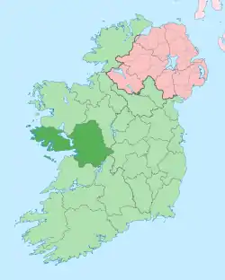 | |
| Villages |
| |
| Townlands | ||
| Baronies | ||
| Islands | ||
| ||