Hammond Pond Parkway
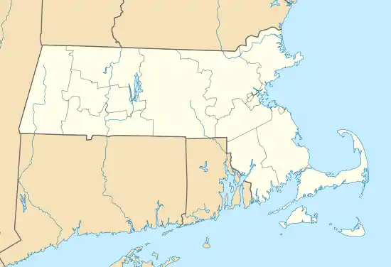
Hammond Pond Parkway is a historic parkway in Chestnut Hill, Massachusetts. The road, built in 1932, extends 2 miles (3.2 km) from Hobart Road (at Beacon Street) in Newton to Horace James Circle in Brookline, where it joins the West Roxbury Parkway. It was designed by Charles Eliot and the Olmsted Brothers to provide a parkway setting that provided access from Brookline, Newton, and the western portions of Boston to the southern parks of the Emerald Necklace.[3] The parkway was listed on the National Register of Historic Places in 2004.[2]
 | |
| Maintained by | Department of Conservation and Recreation |
|---|---|
| Length | 2.0 mi[1] (3.2 km) |
| Location | Hammond Pond Reservation, Massachusetts |
| South end | Newton Street in Brookline |
| Major junctions | |
| North end | Beacon Street in Newton |
Hammond Pond Parkway | |
  | |
| Location | Chestnut Hill, Massachusetts |
| Coordinates | 42°19′16″N 71°10′21″W |
| Area | 14 acres (5.7 ha) |
| Built | 1928 |
| Architect | Eliot, Charles; Olmsted Brothers |
| MPS | Metropolitan Park System of Greater Boston MPS |
| NRHP reference No. | 04000250[2] |
| Added to NRHP | March 18, 2004 |
Route description
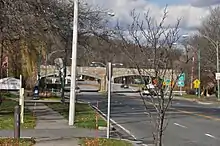
The roadway is generally four lanes of paved asphalt. From its northern end at Beacon Street, it passes through a conservation area consisting of the Hammond Pond Reservation and the Webster Conservation Area, crossing the MBTA Green Line D branch, formerly the Highland Branch of the Boston and Albany Railroad, along the way, before reaching a junction with Massachusetts Route 9, roughly its midpoint. It passes under Route 9, where a number of shopping malls are located, including The Mall at Chestnut Hill and The Street Chestnut Hill. To the south of the malls, there is a mix of civic and residential construction just to its south, which is followed by a residential area of larger homes with expansive lawns. It then enters Horace James Circle, a junction with the West Roxbury Parkway, Newton Street, LaGrange Street, and Hammond Street.[3]
History
Land acquisition for the parkway began in 1914 based on designs that were drafted in 1913. Additional land was acquired in 1920, and again in 1930-31. The northern section, between Beacon Street and Route 9, was built in 1931, and the southern section was completed in 1932. Construction was by the M. McDonough Company, and cost over $216,000. Only minor changes have been made to the parkway since its construction. The parkway construction included two significant bridges: the Route 9 overpass, and the bridge which passes over the railroad tracks.[3]
Major intersections
| County | Location | mi[1] | km | Destinations | Notes |
|---|---|---|---|---|---|
| Norfolk | Brookline | 0.0 | 0.0 | Newton Street / Lagrange Street | Traffic circle; to West Roxbury Parkway |
| Middlesex | Newton | 0.9 | 1.4 | Interchange with Boylston Street | |
| 2.0 | 3.2 | Beacon Street | |||
| 1.000 mi = 1.609 km; 1.000 km = 0.621 mi | |||||
References
- Google (May 25, 2019). "Hammond Pond Parkway" (Map). Google Maps. Google. Retrieved May 25, 2019.
- "National Register Information System". National Register of Historic Places. National Park Service. April 15, 2008.
- "NRHP nomination for Hammond Pond Parkway". Commonwealth of Massachusetts. Retrieved 2014-04-12.
| Topics |  | ||||||||||||||||
|---|---|---|---|---|---|---|---|---|---|---|---|---|---|---|---|---|---|
| Lists by county | |||||||||||||||||
| Lists by city |
| ||||||||||||||||
| Other lists | |||||||||||||||||
| |||||||||||||||||