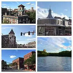
Brookline, Massachusetts
Brookline /ˈbrʊklaɪn/ is an affluent town in Norfolk County, Massachusetts in the United States, and part of the Boston metropolitan area. Brookline borders six of Boston's neighborhoods: Brighton, Allston, Fenway–Kenmore, Mission Hill, Jamaica Plain, and West Roxbury. The city of Newton lies to the west of Brookline.
Brookline, Massachusetts | |
|---|---|
 | |
 Seal | |
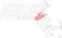 Location as an exclave of Norfolk County in Massachusetts | |
| Coordinates: 42°19′54″N 71°07′18″W | |
| Country | |
| State | |
| County | |
| Region | |
| Settled | 1638 |
| Incorporated | 1705 |
| Government | |
| • Type | Representative town meeting |
| Area | |
| • Total | 17.7 km2 (6.8 sq mi) |
| • Land | 17.6 km2 (6.8 sq mi) |
| • Water | 0.1 km2 (0.1 sq mi) |
| Elevation | 15 m (50 ft) |
| Population (2010)[1] | |
| • Total | 58,732 |
| • Estimate (2018)[2] | 59,310 |
| • Density | 3,337.0/km2 (8,637.0/sq mi) |
| Time zone | UTC−5 (Eastern) |
| • Summer (DST) | UTC−4 (Eastern) |
| ZIP Code | 02445–02447, 02467 |
| Area code(s) | 617 / 857 |
| FIPS code | 25-09175 |
| GNIS feature ID | 0619456 |
| Website | www |
At the 2019 census, the population of the town was 59,180.[3] It is the most populous municipality in Massachusetts to have a town (rather than city) form of government.
Brookline was first settled in 1638 as a hamlet in Boston; it was incorporated as a separate town in 1705.
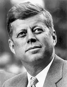
Brookline was the birthplace and hometown of John F. Kennedy, 35th President of the United States.
History
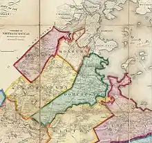
Once part of Algonquian territory, Brookline was first settled by European colonists in the early 17th century. The area was an outlying part of the colonial settlement of Boston and known as the hamlet of Muddy River. In 1705, it was incorporated as the independent town of Brookline. The northern and southern borders of the town were marked by two small rivers or brooks, which is the town’s namesake. The northern border with Brighton (which was itself part of Cambridge until 1807) was Smelt Brook. (That name appears on maps starting at least as early as 1852, but sometime between 1888 and 1925 the brook was covered over.[4]) The southern boundary, abutting Boston, was the Muddy River.
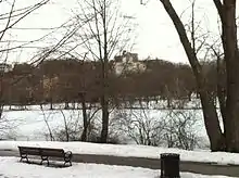
The Town of Brighton was merged with Boston in 1874, and the Boston-Brookline border was redrawn to connect the new Back Bay neighborhood with Allston-Brighton. This merger created a narrow strip of land along the Charles River belonging to Boston, cutting Brookline off from the shoreline. It also put certain lands north of the Muddy River on the Boston side, including what are now Kenmore Square and Packard's Corner. The current northern border follows Commonwealth Avenue, and on the northeast, St. Mary's Street. When Frederick Law Olmsted designed the Emerald Necklace of parks and parkways for Boston in the 1890s, the Muddy River was integrated into the Riverway and Olmsted Park, creating parkland accessible by both Boston and Brookline residents.
Throughout its history, Brookline has resisted being annexed by Boston, in particular during the Boston–Brookline annexation debate of 1873. The neighboring towns of West Roxbury and Hyde Park connected Brookline to the rest of Norfolk County until they were annexed by Boston in 1874 and 1912, respectively, putting them in Suffolk County. Brookline is now separated from the remainder of Norfolk County.
Brookline has long been regarded as a pleasant and verdant environment. In the 1841 edition of the Theory and Practice of Landscape Gardening, Andrew Jackson Downing described the area this way:
The whole of this neighborhood of Brookline is a kind of landscape garden, and there is nothing in America of the sort, so inexpressibly charming as the lanes which lead from one cottage, or villa, to another. No animals are allowed to run at large, and the open gates, with tempting vistas and glimpses under the pendent boughs, give it quite an Arcadian air of rural freedom and enjoyment. These lanes are clothed with a profusion of trees and wild shrubbery, often almost to the carriage tracks, and curve and wind about, in a manner quite bewildering to the stranger who attempts to thread them alone; and there are more hints here for the lover of the picturesque in lanes than we ever saw assembled together in so small a compass.[5]
Brookline residents were among the first in the country to propose extending the vote to women. Benjamin F. Butler, in his 1882 campaign for Governor, advocated the idea.[6]
In 1843, the town legally banned resales of deeds to "any negro or native of Ireland."[7][8]
Transportation history
Two branches of upper Boston Post Road, established in the 1670s, passed through Brookline. Brookline Village was the original center of retail activity.[9] In 1810, the Boston and Worcester Turnpike, now Massachusetts Route 9, was laid out, starting on Huntington Avenue in Boston and passing through the village center on its way west.
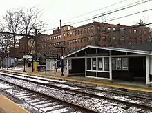
Steam railroads came to Brookline in the middle of the 19th century. The Boston and Worcester Railroad was constructed in the early 1830s, and passed through Brookline near the Charles River. The rail line is still in active use, now paralleled by the Massachusetts Turnpike. The Highland Branch of the Boston and Albany Railroad was built from Kenmore Square to Brookline Village in 1847, and was extended into Newton in 1852. In the late 1950s, this would become the Green Line D branch.
The portion of Beacon Street west of Kenmore Square was laid out in 1850. Streetcar tracks were laid above ground on Beacon Street in 1888, from Coolidge Corner to Massachusetts Avenue in Boston, via Kenmore Square.[10] In 1889, they were electrified and extended over the Brighton border at Cleveland Circle. They would eventually become the Green Line C branch.
Thanks to the Boston Elevated Railway system, this upgrade from horse-drawn carriage to electric trolleys occurred on many major streets all over the region, and made transportation into downtown Boston faster and cheaper. Much of Brookline was developed into a streetcar suburb, with large brick apartment buildings sprouting up along the new streetcar lines.
Etymology
Brookline was known as the hamlet of Muddy River and was considered part of Boston until the Town of Brookline was independently incorporated in 1705. (The Muddy River was used as the Brookline–Boston border at incorporation.) It is said that the name derives from a farm therein once owned by Judge Samuel Sewall.[11] Originally the property of CPT John Hull and Judith Quincy Hull. Judge Sewall came into possession of this tract, which embraced more than 350 acres, through Hannah Quincy Hull (Sewall) who was the Hull's only daughter. John Hull in his youth lived in Muddy River Hamlet, in a little house which stood near the Sears Memorial Church. Hull removed to Boston, where he amassed a large fortune for those days. Judge Sewall probably never lived on his Brookline estate.[12]
Geography
According to the United States Census Bureau, Brookline has a total area of 6.8 sq mi (17.7 km2), all but 0.039 sq mi (0.1 km2) (0.44%) of which is land.
The northern part of Brookline, roughly north of the D-line tracks, is urban in character, as highly walkable and transit rich. The population density of this northern part of town is nearly 20,000 inhabitants per square mile (8,000/km2), similar to the densest neighborhoods in nearby Cambridge, Somerville and Chelsea, Massachusetts (the densest cities in New England), and slightly lower than that of central Boston's residential districts (Back Bay, South End, Fenway, etc.). The overall density of Brookline, which also includes suburban districts and grand estates south of the D-line, is still higher than that of many of the largest cities in the United States, especially in the South and West. Brookline borders Newton (part of Middlesex County) to the west and Boston (part of Suffolk County) in all other directions; it is therefore non-contiguous with any other part of Norfolk County. Brookline became an exclave of Norfolk County in 1873, when the neighboring town of West Roxbury was annexed by Boston (and left Norfolk County to join Suffolk County). Brookline refused to be annexed by Boston after the Boston–Brookline annexation debate of 1873.
Brookline separates the bulk of the city of Boston (except for a narrow neck or corridor near the Charles River) from its westernmost neighborhoods of Allston–Brighton, which had been the separate town of Brighton until annexed by Boston in 1873.
Neighborhoods
There are many neighborhood associations, some of which overlap.[13][14]
Neighborhoods, squares, and notable areas of Brookline include:
- Aspinwall Hill
- Beaconsfield
- Brookline Hills
- Brookline Village
- Buttonwood Village
- Brookline High School, Near Pierce District
- Chestnut Hill, which also extends into Newton and Boston
- Coolidge Corner
- Corey Farm
- Corey Hill
- Cottage Farm
- Fisher Hill
- Griggs Park
- JFK Crossing
- North Brookline
- Pill Hill (also known as "High Street Hill")
- The Point (originally "Whiskey Point")
- The Runkle District
- South Brookline ("Sobro")
- The Heights (just west of Washington Square)
- Washington Square
- Woodland Heath
Climate
The climate of Brookline is Humid continental Dfa.
| Climate data for Brookline, MA | |||||||||||||
|---|---|---|---|---|---|---|---|---|---|---|---|---|---|
| Month | Jan | Feb | Mar | Apr | May | Jun | Jul | Aug | Sep | Oct | Nov | Dec | Year |
| Record high °F (°C) | 72.0 (22.2) |
70.0 (21.1) |
89.0 (31.7) |
94.0 (34.4) |
97.0 (36.1) |
100.0 (37.8) |
104.0 (40.0) |
102.0 (38.9) |
102.0 (38.9) |
90.0 (32.2) |
83.0 (28.3) |
76.0 (24.4) |
104.0 (40.0) |
| Average high °F (°C) | 36.0 (2.2) |
39.0 (3.9) |
45.0 (7.2) |
56.0 (13.3) |
66.0 (18.9) |
76.0 (24.4) |
82.0 (27.8) |
80.0 (26.7) |
72.0 (22.2) |
61.0 (16.1) |
52.0 (11.1) |
41.0 (5.0) |
58.83 (14.91) |
| Average low °F (°C) | 22.0 (−5.6) |
25.0 (−3.9) |
31.0 (−0.6) |
41.0 (5.0) |
50.0 (10.0) |
60.0 (15.6) |
65.0 (18.3) |
65.0 (18.3) |
57.0 (13.9) |
47.0 (8.3) |
38.0 (3.3) |
28.0 (−2.2) |
44.08 (6.71) |
| Record low °F (°C) | −30.0 (−34.4) |
−18.0 (−27.8) |
−8.0 (−22.2) |
11.0 (−11.7) |
31.0 (−0.6) |
41.0 (5.0) |
50.0 (10.0) |
46.0 (7.8) |
34.0 (1.1) |
25.0 (−3.9) |
−2.0 (−18.9) |
−17.0 (−27.2) |
−30.0 (−34.4) |
| Average precipitation inches (mm) | 3.36 (85) |
3.38 (86) |
4.32 (110) |
3.74 (95) |
3.49 (89) |
3.68 (93) |
3.43 (87) |
3.35 (85) |
3.44 (87) |
3.94 (100) |
3.99 (101) |
3.78 (96) |
43.9 (1,120) |
| Source: Weather.com[15] | |||||||||||||
Brookline falls under the USDA 6b Plant Hardiness zone.[16]
Demographics
| Year | Pop. | ±% |
|---|---|---|
| 1790 | 484 | — |
| 1800 | 605 | +25.0% |
| 1810 | 784 | +29.6% |
| 1820 | 900 | +14.8% |
| 1830 | 1,043 | +15.9% |
| 1840 | 1,365 | +30.9% |
| 1850 | 2,516 | +84.3% |
| 1860 | 5,164 | +105.2% |
| 1870 | 6,650 | +28.8% |
| 1880 | 8,057 | +21.2% |
| 1890 | 12,103 | +50.2% |
| 1900 | 19,935 | +64.7% |
| 1910 | 27,792 | +39.4% |
| 1920 | 37,748 | +35.8% |
| 1930 | 47,491 | +25.8% |
| 1940 | 49,786 | +4.8% |
| 1950 | 57,589 | +15.7% |
| 1960 | 54,044 | −6.2% |
| 1970 | 58,689 | +8.6% |
| 1980 | 55,062 | −6.2% |
| 1990 | 54,718 | −0.6% |
| 2000 | 57,107 | +4.4% |
| 2010 | 58,732 | +2.8% |
| 2018* | 59,310 | +1.0% |
| : * = population estimate. Source: United States Census records and Population Estimates Program data.[17][18][19][20][21][22][23][24][25][26][27][28] | ||
As of the census[29] of 2010, there were 58,732 people, 24,891 households, and 12,233 families residing in the town. The population density was 8,701.0 people per square mile (3,247.3/km2). There were 26,448 housing units at an average density of 3,889.6 per square mile (1,501.9/km2). The racial makeup of the town was 73.3% White, 3.4% Black or African American, 0.12% Native American, 15.6% Asian (6.7% Chinese, 2.6% Indian, 2.3% Korean, 1.8% Japanese), 0.03% Pacific Islander, 1.01% from other races, and 3.0% from two or more races. Hispanic or Latino of any race were 5.0% of the population (0.9% Mexican, 0.8% Puerto Rican). (Source: 2010 Census Quickfacts)
There were 25,594 households, out of which 21.9% had children under the age of 18, living with them, 38.4% were married couples living together, 7.1% had a female householder with no husband present, and 52.2% were non-families. 36.7% of all households were made up of individuals, and 10.1% had someone living alone who was 65 years of age or older. The average household size was 2.18 and the average family size was 2.86.
In the town, the population distribution was wide, with 16.6% under the age of 18, 11.7%, from 18 to 24, 37.3% from 25 to 44, 21.9% from 45 to 64, and 12.4% who were 65 years of age or older. The median age was 34 years. For every 100 females, there were 82.6 males. For every 100 females age 18 and over, there were 79.1 males.
The median income for a household in the town was $66,711, and the median income for a family was $92,993. Males had a median income of $56,861 versus $43,436 for females. The per capita income for the town was $44,327. About 4.5% of families and 9.3% of the population were below the poverty line, including 5.3% of those under the age of 18 and 7.5% of those ages 65 and older.
Serving as a residential zone for nearby academic and medical institutes such as Harvard Medical School and Boston University, Brookline was reported as the town with the most doctoral degree holders (14.0% of the total population in 2012) in the United States.[30]
Arts and culture
- Brookline, along with the nearby Boston neighborhood of Brighton and the city of Newton, is a cultural hub for the Jewish community of Greater Boston.[31]
- The Greek Orthodox Archdiocese of America Metropolis of Boston is headquartered in Brookline.[32]
- Brookline Village is home to Puppet Showplace Theater, New England's only dedicated puppet theater and center for puppetry arts. The theater is located in the historic 32 Station Street building directly across from the Brookline Village MBTA Green Line stop.
- There have been three Poet Laureates of Brookline: Judith Steinbergh, Jan Schreiber, and, currently, Zvi Sesling.[33]
- Along with Boston and Quincy, it has a large Irish American presence.
Points of interest
The following historic buildings are open to the public:
- The birthplace of John F. Kennedy stands in Brookline and is listed in the National Register of Historic Places. It is maintained by the National Park Service and is open to the public from May through September.
- "Fairsted", the 100-year-old business headquarters and design office for renowned landscape architect Frederick Law Olmsted and the Olmsted Brothers firm, has been carefully preserved as the Frederick Law Olmsted National Historic Site, on 7 acres (2.8 ha) of landscaped grounds at 99 Warren Street.
- John Goddard House, an historic house at 235 Goddard Avenue, was built in 1767 and added to the National Register of Historic Places in 1985.
- Larz Anderson Park is in Brookline on the 64-acre (26 ha) estate once owned by Larz Anderson and Isabel Weld Perkins. The park contains the Larz Anderson Auto Museum, the oldest automobile collection in the country, as well as Putterham School, a one-room schoolhouse from colonial times.
Other historic and cultural sites include:
- St. Aidan's Church was where John F. Kennedy was baptized and where the Kennedy family and other prominent Irish-Americans were parishioners. The church was designed by architect Charles Maginnis, who was awarded the American Institute of Architects' gold medal. Although it is listed on the National Register of Historic Places, St. Aidan's Church has been closed and converted into housing.
- The Dutch House, one of only five surviving buildings from the World's Columbian Exposition of 1893 was relocated to Brookline.
- There were two stops on the Underground Railroad in Brookline: 9 Toxteth Street and 182 Walnut Street.[34][35]
- The Country Club, an exclusive sporting club in the town, was the first private club in the United States formed exclusively for outdoor activities. It is most famous as a golf club; it was one of the five clubs that formed what is now the United States Golf Association and has hosted the U.S. Open three times and the Ryder Cup Matches once.
- Coolidge Corner, which is located at the crossing of Beacon Street and Harvard Street, is one of Brookline's two primary retail districts (the other being Washington Square). It includes a number of historically significant sites, including the S.S. Pierce Building, and the Coolidge Corner Theatre.[36]
- Brookline is home to part of Frederick Law Olmsted's Emerald Necklace of park systems, including Olmsted Park.
- The Puppet Showplace Theatre, one of the four oldest puppet theatres in the United States, is located in Brookline Village.
Government
Brookline is governed by a representative (elected) town meeting, which is the legislative body of the town, and a five-person Select Board that serves as the executive branch of the town.[37]
In 2017, a Brookline Town Meeting voted to recognize Indigenous People's Day instead of Columbus Day.[38]
Education
Public schools
The town is served by the Public Schools of Brookline. The student body at Brookline High School includes students from more than 76 countries. Many students attend Brookline High from surrounding neighborhoods in Boston such as Mission Hill and Mattapan through the Metropolitan Council for Educational Opportunity (METCO) system.
There are eight elementary schools in the Brookline Public School system: Baker School, Coolidge Corner School, Driscoll, Heath, Lawrence, Lincoln, Pierce, and Runkle. As of December 2006, there were 6,089 K-12 students enrolled in the Brookline public schools. The system includes one early learning center, eight grades K-8 schools, and one comprehensive high school. The Old Lincoln School is a surplus building used by the town to temporarily teach students in when another school building is being renovated. It was rented in 2009 as the venue for the play Sleep No More.
The student body is 57.4% White, 18.1% Asian, 6.4% Black, 9.9% Hispanic, and 8.2% Multi-race. Approximately 30% of students come from homes where English is not the first language. (Data from Massachusetts department of education 2012–2013 Year)
Private schools
Several private primary and secondary schools are located in Brookline.
- Beaver Country Day School
- Brimmer and May School - partly in Newton
- Dexter Southfield School
- Ivy Street School
- Maimonides School
- The Park School
- Saint Mary of the Assumption School
- Mount Alvernia Academy (Chestnut Hill)
Higher education
Several institutes of higher education are located in Brookline.
- Pine Manor College
- Hellenic College & Holy Cross Greek Orthodox School of Theology
- Boston Graduate School of Psychoanalysis
Also, parts of the following are located in Brookline: Boston University including Wheelock College, Boston College, and Northeastern University's Parsons Field.
Newbury College closed in 2019.[39]
Infrastructure
Transportation
Light rail and subway
Brookline is served by the C and D branches of the MBTA's Green Line trains, with inbound service to downtown Boston and outbound service to Newton. The B line runs along the town's northern border of Commonwealth Avenue in Allston.
Bus
Brookline is served by several MBTA bus routes.
Public libraries
- Public Library of Brookline,[40] 361 Washington St., Brookline, MA 02445
- Coolidge Corner Branch Library, 31 Pleasant St., Brookline, MA 02446
- Putterham Branch Library, 959 West Roxbury Pkwy., Chestnut Hill, MA 02467
Fire department
The town of Brookline is protected full-time by the 158 paid, professional firefighters of the Brookline Fire Department (BFD). It currently operates out of five fire stations located throughout the town, under the command of a Deputy Chief per shift. The BFD also operates a fire apparatus fleet of four engines, two ladders, one quint, one cross-staffed rescue (special operations), two squads, one special operations unit, one haz-mat decon trailer, two maintenance units, as well as numerous other special, support, and reserve units. The Brookline Fire Department responds to approximately 8,500 emergency calls annually. The current Chief of Department is John F. Sullivan.[41]
Cemeteries
- The Old Burying Ground, also known as Walnut Street Cemetery.[42] 1717 - 1.54 acres (Walnut Street at Chestnut Street)
- Walnut Hills Cemetery[43] 1875 - 45.26 acres (Grove Street and Allandale Road)
Notable people

- Jeff Adrien (born 1986), University of Connecticut Huskies basketball captain and power forward
- Bhumibol Adulyadej, His Majesty King Bhumibol Adulyadej (King Rama IX) of Thailand lived his infancy in Brookline while his father the prince studied at Harvard Medical School
- Eddie Andelman, sports radio host and businessman, moved to Brookline as child, graduated from Brookline High
- Larz Anderson, U.S. Ambassador to Japan
- Ray Atherton, first U.S. Ambassador to Canada, born and raised in Brookline
- Lily Batchelder, professor at New York University. She was the former chief tax counsel to the U.S. Senate Finance Committee under the Obama administration and appointed to head Joe Biden’s IRS transition team.
- Linda Barnes, novelist
- Saul Bellow, Nobel Prize-winning novelist, lived the last 12 years of his life in Brookline
- Larry Bird, professional basketball player, lived in Brookline while he played for the Boston Celtics
- Ran Blake, jazz pianist and composer
- Michael Bloomberg, Mayor of New York City 2002–12, lived in Brookline as a child
- Marita Bonner (1899-1971), writer, essayist, and playwright
- Zabdiel Boylston, physician who introduced inoculation against smallpox to the North American colonies in 1721
- Tom Brady, lived in Brookline while quarterback of the New England Patriots and husband of Gisele Bündchen
- Gisele Bündchen, supermodel and wife of Tom Brady[44]
- Richard Burgin, author, editor of Boulevard (magazine)
- Michael A. Burstein, science-fiction writer
- Stanley Cavell (born 1926), professor of philosophy, winner of a MacArthur Fellowship
- Herman Chernoff (born 1923), statistician
- Ida Conquest, actress
- Zach Cone, creator and player of Biker Boy
- Harvey Cushing, "father of modern neurosurgery"[45]
- Thomas Aspinwall Davis (1798-1845), businessman and mayor of Boston
- Michael Dukakis (born 1933), former Governor of Massachusetts and 1988 Democratic Presidential candidate
- Adam Edelman (born 1991), American-born four-time Israeli National Champion in skeleton event, and Israeli Olympian
- Theo Epstein (born 1973), Chicago Cubs President of Baseball Operations and former Boston Red Sox general manager
- Hank Eskin, webmaster of Where's George?
- Alice Ettinger, radiologist
- Frederick Perry Fish (1855–1930), pioneering intellectual property attorney
- Kenny Florian, professional mixed martial artist
- Terry Francona, manager of the Cleveland Indians
- Edward Fredkin, digital physics pioneer, inventor of the trie data structure, the Fredkin gate and the Billiard-Ball Computer Model for reversible computing
- Irwin Freedberg, dermatologist
- Peter Gammons, baseball writer and ESPN commentator
- King Gillette, popularizer of the safety razor
- Sheldon Lee Glashow (born 1932), Nobel Prize-winning physicist
- Robert R. Glauber, Harvard faculty, former Chairman of NASD
- Robert Goldwyn (1930–2010), editor-in-chief of Plastic and Reconstructive Surgery for 25 years, Professor of Surgery at Harvard Medical School, and Chief of Plastic Surgery at the Beth Israel Hospital
- Ellen Goodman (born 1941), American journalist and Pulitzer Prize-winning syndicated columnist
- Minnie Goodnow (1871-1952), WWI nurse and nurse educator
- Roland Hayes (1887-1977), lyric tenor and composer
- John Hodgman (born 1971), author and contributor for This American Life and The Daily Show
- Sybil Holmes (1889–1979), first female member of the Massachusetts Senate
- Levi Yitzchak Horowitz (1921–2009), the Bostoner Rebbe
- Isabella Howland (1895–1974), painter and sculptor
- Richard Jones, US ambassador to Israel, lived in Brookline with his family
- Victor Kac, (born 1943), mathematician, MIT faculty, creator of Kac-Moody algebras, creator of Superalgebra
- Jeffrey Karp, biomedical researcher
- John F. Kennedy (1917–1963), 35th President of the United States (1961–63), born and lived first 10 years of his life in Brookline
- Rosemary Kennedy (1918–2005), sister of President John F. Kennedy, born in Brookline
- Kathleen Agnes Kennedy (Kathleen Cavendish, Marchioness of Hartington) (1920–1948), sister of President John F. Kennedy, born in Brookline
- Eunice Kennedy Shriver, (1921–2009), sister of President John F. Kennedy, born in Brookline
- Patricia Kennedy Lawford, (1924–2006), sister of President John F. Kennedy, born in Brookline
- Robert F. Kennedy (1925–1968), Attorney General, US Senator, brother of President John F. Kennedy, born in Brookline
- Louise Andrews Kent (1886–1969), author
- Robert Kraft (born 1941), New England Patriots owner
- Jon Krakauer (born 1954, raised in Corvallis, Oregon), author of Into the Wild and Into Thin Air, columnist for Outside magazine
- Louis Krasner (1903-1995), American violinist
- Michio and Aveline Kushi, leaders of the worldwide macrobiotic movement
- Amos Adams Lawrence (1814-1886), merchant and abolitionist
- Abbott Lawrence Lowell (1856–1943), former president of Harvard University
- Lester Lefton, president of Kent State University
- Tony Levin (born 1946), musician
- Amy Lowell (1874-1925), poet
- Eddie Lowery (1903–1984), 10-year-old caddie of Francis Ouimet during 1913 U.S. Open held in Brookline
- Larry Lucchino (born 1945), co-owner of Boston Red Sox
- Ananda Mahidol, His Majesty King Ananda Mahidol (King Rama VIII) of Thailand, lived during age 1–3 years in Brookline while his father the prince studied at Harvard Medical School
- Albert and David Maysles, documentary filmmakers
- Arthur Chute McGill (1926–1980), theologian, philosopher, author and editor, Harvard professor 1971-80
- Joey McIntyre, youngest member of musical group New Kids on the Block, lived in Brookline
- Henry J. Meade, Chief of Chaplains of the U.S. Air Force
- Jean Baker Miller (1927–2006), psychoanalyst, feminist, author, social activist
- Roger Miller, rock musician
- George Minot (1885–1950), winner of the 1934 Nobel Prize in Physiology or Medicine
- Marvin Minsky (1927–2016), Artificial Intelligence theorist, inventor, author, professor
- Abelardo Morell (born 1948), photographer, professor at Massachusetts College of Art
- William Murphy (1892–1987), winner of 1934 Nobel Prize in Physiology or Medicine
- Nicholas Nixon, photographer, professor at Massachusetts College of Art
- Joel Mark Noe (1943–1991), pioneering reconstructive plastic surgeon, longtime resident
- Conan O'Brien (born 1963), television host, comedian, writer, producer
- Frederick Law Olmsted (1822–1903), landscape architect
- Francis Ouimet (1893–1967), amateur golfer who won the U.S. Open in 1913
- Edith Pearlman (born 1936), short story writer
- Paul Pender (1930–2003), boxer, middleweight champion
- Esther Petrack, contestant on America's Next Top Model, Cycle 15
- Henry Varnum Poor, creator of the Standard & Poor's Index
- Alfredo Quiñones-Hinojosa, M.D., neurosurgeon and author
- Norman Ramsey (1915–2011), winner of the 1989 Nobel Prize in Physics
- Rishi Reddi, short story writer
- Elliot Richardson, lieutenant governor and attorney general of Massachusetts, cabinet official in the Nixon and Ford administrations, ambassador and lawyer[46][47]
- Florida Ruffin Ridley (1861-1943), civil rights activist, suffragist, teacher, writer, and editor
- Steve Rochinski (born 1954), jazz guitarist, recording artist, composer, arranger, author, jazz educator
- John Rock (1890-1984), pioneer in the development of in vitro fertilization and the birth control pill
- Neil Rolde (born 1932), writer and Maine politician
- David L. Rose (born 1967), tech entrepreneur and scientist at the MIT Media Lab
- Dan Rosenthal (born 1966), Assistant to the President in White House under Bill Clinton
- Larry Ruttman (born 1931), attorney and author
- Arnold Schoenberg (1874-1951), composer, lived at 1280 Beacon Street during the 1930s
- Samuel Sewall (1652-1730), judge in the Salem witch trials
- Charles Sprague Sargent (1841–1927), first director of Harvard University's Arnold Arboretum
- Conrad Salinger (1901–1962), longtime orchestrator for MGM musicals
- Rabbi Joseph B. Soloveitchik (1903–1993), noted Jewish scholar
- Sarah Smith (born 1947), novelist
- Lawrence Summers, economist, president of Harvard University 2001–06
- Paul Szep (born 1941), two-time Pulitzer Prize-winning political cartoonist
- James Taylor, musician, owns a home in Brookline
- Michelle Thomas (1968–1998), actress who played Justine Phillips on The Cosby Show and Myra Monkhouse on Family Matters
- Mike Wallace (1918–2012), TV journalist, best known for 60 Minutes
- Stephen Walt, Professor of International Relations, Harvard University
- Barbara Walters (born 1929), television commentator and journalist
- Robert Weinberg, cancer researcher known for discovering a gene that causes normal cells to form tumors, and the first tumor suppressor gene
- David Weinberger, blogger, internet expert, and political consultant
- The Weld family
- William A. Wellman (born 1896 in Brookline), director of Wings (1927)
- Mikey Welsh, former bassist for rock band Weezer, moved to Brookline in his youth
- Henry Melville Whitney (1839-1923), businessman and developer of the Beacon Street boulevard
- James Scollay Whitney (1811-1878), businessman and politician
- John Woodrow Wilson (1922-2015), lithographer, sculptor, painter, muralist, and art teacher
- Gary K. Wolf, author, creator of Roger Rabbit[48][49]
- Moshe Yanai, electrical engineer and entrepreneur
In popular culture
In film
- Scenes from American Hustle (2013) were filmed in Brookline.[50]
- Scenes from The Next Karate Kid (1993) were filmed in Brookline.[50]
In television
- June Osborne / Offred, the protagonist of The Handmaid's Tale (2017–present), is from Brookline.[51]
Sister cities
Brookline is twinned with:
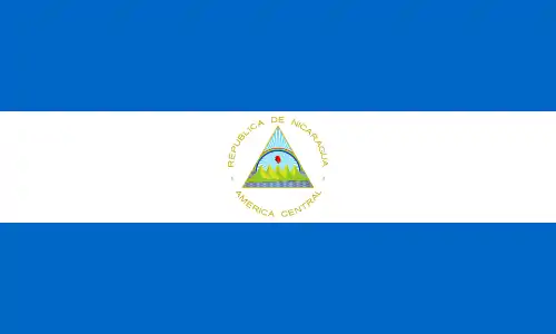 Quezalguaque, Nicaragua (since 1987)[52]
- Also included under the two sister cities for the Commonwealth of Massachusetts, Hokkaidō, Japan (since 1990). Basel-Stadt, Switzerland.
See also
References
- "Population and Housing Occupancy Status: 2010 – State – County Subdivision, 2010 Census Redistricting Data (Public Law 94-171) Summary File". U.S. Census Bureau. Retrieved July 3, 2011.
- "U.S. Census Bureau Quickfacts: Brookline town, Norfolk county, Massachusetts". Retrieved October 3, 2019.
- "Census 2019 - Brookline".
- "Packard's Corner: Once and Future City". Archived from the original on July 25, 2009.
- "Arnold Arboretum Website". Archived from the original on February 2, 2007.
- John Gould Curtis, History of the Town of Brookline Massachusetts, Houghton Mifflin Company, Boston and New York, 1933, pg.305
- Rothstein, Richard (2017). The Color of Law: A Forgotten History of How Our Government Segregated America. New York: Liveright Publishing Corporation. p. 78. ISBN 978-1631494536.
- Santucci, Larry (2019). "How Prevalent Were Racially Restrictive Covenants in 20th Century Philadelphia? A New Spatial Data Set Provides Answers" (PDF). Discussion Papers (Federal Reserve Bank of Philadelphia). Federal Reserve Bank of Philadelphia: 7. doi:10.21799/frbp.dp.2019.05. S2CID 212806978. Retrieved July 23, 2020. Cite journal requires
|journal=(help) - Brookline Village Archived October 8, 2007, at the Wayback Machine
- "History of Beacon St". www.brooklinehistoricalsociety.org. Retrieved October 24, 2019.
- Dudley, Dean (1871) (1871). Brookline, Jamaica Plain and West Roxbury Directory for 1871; Containing a General Directory of the Residents, Town Registers, Business Directory, Map, &c., &c. Boston: Dean Dudley & Co. pp. 15–16.
The name of Brookline came, as the late Rev. Samuel Sewall (great grandson of Judge Samuel Sewall) conjectures, from one of the farms within its bounds, namely the Gates' farm, hired of Judge Sewall, which was probably called Brookline because Smelt-brook, running through it, formed the line between that and one of the neighboring farms, and this brook also separated that farm from Cambridge. Judge Sewall, in his journal, often mentions the name "Brookline" before the town was incorporated. Rev. Mr. S. also thinks it was Judge Sewall that suggested that name for the town.
- "1903 Proceedings of the Brookline Historical Society". www.brooklinehistoricalsociety.org.
- "Map - Brookline Neighborhood Alliance" (PDF). Archived from the original (PDF) on August 11, 2007. Retrieved July 24, 2007.
- "Brookline Town website: Neighborhood Associations". Brooklinema.gov. Archived from the original on February 20, 2012. Retrieved December 31, 2011.
- "Brookline, MA Weather Data". Open Publishing. 2009. Retrieved February 21, 2014.
- | <USDA.gov= >"USDA Plant Hardiness Zone Map". Agricultural Research Center, PRISM Climate Group, Oregon State University; USDA. 2012. Archived from the original on February 27, 2014. Retrieved February 21, 2014.
- "Total Population (P1), 2010 Census Summary File 1". American FactFinder, All County Subdivisions within Massachusetts. United States Census Bureau. 2010.
- "Massachusetts by Place and County Subdivision - GCT-T1. Population Estimates". United States Census Bureau. Retrieved July 12, 2011.
- "1990 Census of Population, General Population Characteristics: Massachusetts" (PDF). US Census Bureau. December 1990. Table 76: General Characteristics of Persons, Households, and Families: 1990. 1990 CP-1-23. Retrieved July 12, 2011.
- "1980 Census of the Population, Number of Inhabitants: Massachusetts" (PDF). US Census Bureau. December 1981. Table 4. Populations of County Subdivisions: 1960 to 1980. PC80-1-A23. Retrieved July 12, 2011.
- "1950 Census of Population" (PDF). Bureau of the Census. 1952. Section 6, Pages 21-10 and 21-11, Massachusetts Table 6. Population of Counties by Minor Civil Divisions: 1930 to 1950. Retrieved July 12, 2011.
- "1920 Census of Population" (PDF). Bureau of the Census. Number of Inhabitants, by Counties and Minor Civil Divisions. Pages 21-5 through 21-7. Massachusetts Table 2. Population of Counties by Minor Civil Divisions: 1920, 1910, and 1920. Retrieved July 12, 2011.
- "1890 Census of the Population" (PDF). Department of the Interior, Census Office. Pages 179 through 182. Massachusetts Table 5. Population of States and Territories by Minor Civil Divisions: 1880 and 1890. Retrieved July 12, 2011.
- "1870 Census of the Population" (PDF). Department of the Interior, Census Office. 1872. Pages 217 through 220. Table IX. Population of Minor Civil Divisions, &c. Massachusetts. Retrieved July 12, 2011.
- "1860 Census" (PDF). Department of the Interior, Census Office. 1864. Pages 220 through 226. State of Massachusetts Table No. 3. Populations of Cities, Towns, &c. Retrieved July 12, 2011.
- "1850 Census" (PDF). Department of the Interior, Census Office. 1854. Pages 338 through 393. Populations of Cities, Towns, &c. Retrieved July 12, 2011.
- "1950 Census of Population" (PDF). 1: Number of Inhabitants. Bureau of the Census. 1952. Section 6, Pages 21–7 through 21-09, Massachusetts Table 4. Population of Urban Places of 10,000 or more from Earliest Census to 1920. Retrieved July 12, 2011. Cite journal requires
|journal=(help) - "2010-2012 American Community Surver 3-Year Estimates". 1: Total Population. American Community Survey. 2012. Archived from the original on February 12, 2020. Retrieved April 19, 2014. Cite journal requires
|journal=(help) - "U.S. Census website". United States Census Bureau. Retrieved 2008-01-31.
- Writers, Staff (October 14, 2020). "50 U.S. Cities with the Most Doctoral Degree Holders - Online Phd Programs". Online-PHD-Programs.org.
- Combined Jewish Philanthropies of Greater Boston (CJP), Berman Jewish Databank (2005). "Greater Boston 2005 Community Study". Berman Jewish Databank. Berman Jewish Databank. Retrieved February 23, 2014.
- "Metropolises" . Greek Orthodox Archdiocese of America. Retrieved on February 9, 2014. "162 Goddard Avenue, Brookline, MA 02445 "
- "Brookline Poet Laureate". Brookline Commission for the Arts.
- "The William Bowditch House". Archived from the original on July 27, 2007. Retrieved September 12, 2007.
- "The Samuel Philbrick House". Archived from the original on November 1, 2003. Retrieved September 12, 2007.
- "Virtual Screening Room | Coolidge Corner Theater". coolidge.org.
- "Town Government". Brooklinema.gov. Archived from the original on December 21, 2008. Retrieved December 31, 2011.
- "Brookline To Change Columbus Day To 'Indigenous People's Day'". Brookline, MA Patch. November 16, 2017.
- "Massachusetts college to close amid financial challenges". Boston Herald. AP. December 14, 2018. Retrieved December 14, 2018.
- "Public Library of Brookline website". Brooklinelibrary.org. Retrieved December 31, 2011.
- "Archived copy". Archived from the original on January 7, 2014. Retrieved 2014-01-07.CS1 maint: archived copy as title (link)
- "Old Burying Ground". July 28, 2013. Archived from the original on July 28, 2013.
- "Cemetery Overview". October 15, 2012. Archived from the original on October 15, 2012.
- "Tom Brady & Gisele Bundchen -- Building Mega-Mansion from Scratch ... 100 Workers On Site Per Day [Photos]". TMZ.
- "Harvey Cushing: A Journey Through His Life: Marriage and Family". Yale Medical Historical Library. Archived from the original on August 9, 2015. Retrieved August 3, 2015.
- http://www.mocavo.com/Elliot-L-Richardson-B1921-Brookline-Norfolk-Massachusetts-1930-United-States-Census/15997447749132437980
- Marquard, Bryan (July 15, 2011). "Dr. George Richardson, 89; surgeon, teacher, poet" – via The Boston Globe.
- Laguardailaguarda@wickedlocal.com, Ignacio. "Brookline author revives Roger Rabbit creation". Wicked Local.
- "Roger Rabbit creator Gary K. Wolf is having an estate sale - the Boston Globe".
- "Productions made in Massachusetts". MA Film Office. Retrieved February 23, 2014.
- "'The Handmaid's Tale' Recap: The Business of Being Born". EW.com. Retrieved September 8, 2018.
- "Quezalguaque". Brookline Sister City Project. Retrieved March 3, 2014.
Further reading
- Ronald Dale Karr. Between City and Country: Brookline, Massachusetts, and the Origins of Suburbia. (Amherst, MA: University of Massachusetts Press, 2018).
- Keith N. Morgan, Elizabeth Hope Cushing, and Roger G. Reed. Community by Design: The Olmsted Firm and the Development of Brookline, Massachusetts (Amherst, MA: University of Massachusetts Press, 2012).
- Larry Ruttman. Voices of Brookine Foreword by Michael Dukakis. (Portsmouth, New Hampshire: Peter E. Randall Publisher LLC, 2005). ISBN 1-931807-39-6
External links
| Wikimedia Commons has media related to Brookline, Massachusetts. |
| Wikivoyage has a travel guide for Brookline. |
| Wikisource has the text of the 1911 Encyclopædia Britannica article Brookline. |
Municipalities and communities of Norfolk County, Massachusetts, United States | ||
|---|---|---|
| Cities | 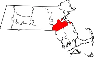 | |
| Towns | ||
| CDPs | ||
| Other villages | ||
| ||
| Authority control |
|---|