National Register of Historic Places listings in Fall River, Massachusetts
The following properties in Fall River, Massachusetts are listed on the Registered Historic Places. This is a subset of the National Register of Historic Places listings in Bristol County, Massachusetts.
- This National Park Service list is complete through NPS recent listings posted January 29, 2021.[1]
| [2] | Name on the Register[3] | Image | Date listed[4] | Location | City or town | Description |
|---|---|---|---|---|---|---|
| 1 | Academy Building | 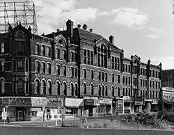 Academy Building |
July 2, 1973 (#73000277) |
S. Main St. 41°42′03″N 71°09′20″W |
Fall River | |
| 2 | Al Mac's Diner-Restaurant | 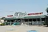 Al Mac's Diner-Restaurant |
December 20, 1999 (#99001119) |
135 President Ave. 41°42′58″N 71°09′17″W |
Fall River | |
| 3 | Algonquin Printing Co. |  Algonquin Printing Co. |
February 16, 1983 (#83000615) |
Bay St. 41°41′42″N 71°10′40″W |
Fall River | |
| 4 | American Printing Co. and Metacomet Mill |  American Printing Co. and Metacomet Mill |
February 16, 1983 (#83000617) |
Anawan St. 41°42′10″N 71°09′42″W |
Fall River | |
| 5 | David M. Anthony House |  David M. Anthony House |
February 16, 1983 (#83000620) |
368 N. Main St. 41°42′25″N 71°09′18″W |
Fall River | |
| 6 | Ashley House | 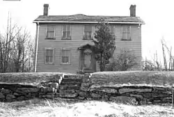 Ashley House |
February 16, 1983 (#83000621) |
3159 Main St. 41°44′21″N 71°07′49″W |
Fall River | Dismantled July, 1983.[5] |
| 7 | Barnard Mills | 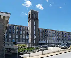 Barnard Mills |
February 16, 1983 (#83000623) |
641–657 Quarry St. 41°41′26″N 71°08′26″W |
Fall River | Includes attached weave shed |
| 8 | Belmont Club/John Young House | 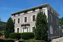 Belmont Club/John Young House |
February 16, 1983 (#83000624) |
34 Franklin St. 41°42′13″N 71°09′17″W |
Fall River | |
| 9 | Barnabus Blossom House | 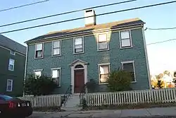 Barnabus Blossom House |
February 16, 1983 (#83000627) |
244 Grove St. 41°42′23″N 71°08′55″W |
Fall River | |
| 10 | Boguslavsky Triple-Deckers |  Boguslavsky Triple-Deckers |
February 16, 1983 (#83000628) |
53–87 Albion St. 41°41′49″N 71°07′59″W |
Fall River | |
| 11 | Borden Flats Light Station | 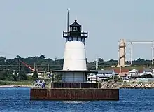 Borden Flats Light Station |
June 15, 1987 (#87001528) |
Taunton River 41°42′18″N 71°10′40″W |
Fall River | |
| 12 | A.J. Borden Building | 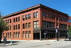 A.J. Borden Building |
February 16, 1983 (#83000629) |
91–111 S. Main St. 41°42′05″N 71°09′30″W |
Fall River | |
| 13 | Ariadne J. and Mary A. Borden House |  Ariadne J. and Mary A. Borden House |
February 16, 1983 (#83000630) |
92 Globe St. 41°41′22″N 71°10′44″W |
Fall River | |
| 14 | N. B. Borden School |  N. B. Borden School |
February 16, 1983 (#83000631) |
43 Morgan St. 41°41′49″N 71°08′53″W |
Fall River | |
| 15 | Borden-Winslow House | 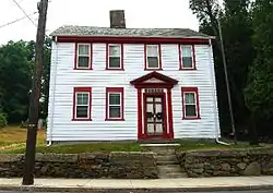 Borden-Winslow House |
February 16, 1983 (#83000632) |
3063 N. Main St. 41°43′34″N 71°08′02″W |
Fall River | |
| 16 | Border City Mill No. 2 | 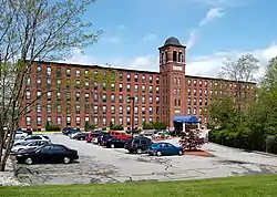 Border City Mill No. 2 |
June 28, 1990 (#90000999) |
One Weaver St. 41°43′40″N 71°08′29″W |
Fall River | Converted into apartments |
| 17 | Brayton Methodist Episcopal Church | 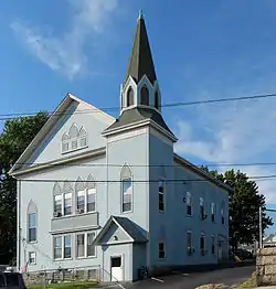 Brayton Methodist Episcopal Church |
February 16, 1983 (#83000635) |
264 Griffin St. 41°41′20″N 71°10′12″W |
Fall River | |
| 18 | Hathaway Brightman House | 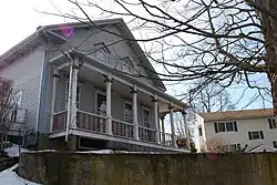 Hathaway Brightman House |
February 16, 1983 (#83000637) |
205 Crescent St. 41°44′04″N 71°08′28″W |
Fall River | |
| 19 | Bristol County Superior Court | 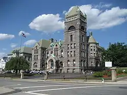 Bristol County Superior Court |
February 16, 1983 (#83000638) |
441 N. Main St. 41°42′29″N 71°09′16″W |
Fall River | |
| 20 | Squire William B. Canedy House | 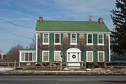 Squire William B. Canedy House |
February 16, 1983 (#83000640) |
2634 N. Main St. 41°42′52″N 71°08′10″W |
Fall River | |
| 21 | Cataract Engine Company No. 3 |  Cataract Engine Company No. 3 |
February 16, 1983 (#83000645) |
116 Rock St. 41°42′12″N 71°09′14″W |
Fall River | |
| 22 | Central Congregational Church | 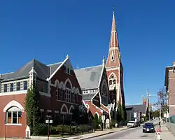 Central Congregational Church |
February 16, 1983 (#83000646) |
100 Rock St. 41°42′10″N 71°09′14″W |
Fall River | Most recently occupied by International Institute of Culinary Arts |
| 23 | Chace Mills | 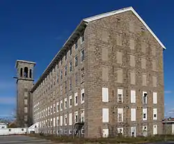 Chace Mills |
February 16, 1983 (#83000648) |
Lewiston and Salem Sts. 41°41′30″N 71°08′47″W |
Fall River | Weave shed burned in 1999, main mill saved |
| 24 | A. B. Chace Rowhouses |  A. B. Chace Rowhouses |
February 16, 1983 (#83000647) |
655–685 Middle St. 41°42′09″N 71°10′00″W |
Fall River | |
| 25 | Oliver Chace's Thread Mill | 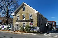 Oliver Chace's Thread Mill |
February 16, 1983 (#83000649) |
505 Bay St. 41°41′38″N 71°10′39″W |
Fall River | oldest remaining mill in Fall River; later part of Connanicut Mills |
| 26 | Charlton Mill | 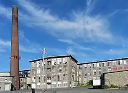 Charlton Mill |
February 16, 1983 (#83000650) |
109 Howe St. 41°40′43″N 71°10′38″W |
Fall River | weave shed demolished |
| 27 | Chase-Hyde Farm |  Chase-Hyde Farm |
February 16, 1983 (#83000651) |
1281–1291 New Boston Rd. 41°43′03″N 71°07′32″W |
Fall River | |
| 28 | Children's Home | 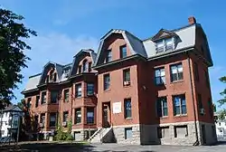 Children's Home |
February 16, 1983 (#83000652) |
427 Robeson St. 41°42′53″N 71°08′39″W |
Fall River | |
| 29 | Church of the Ascension | 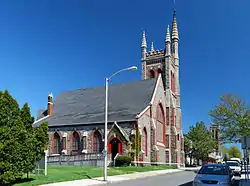 Church of the Ascension |
February 16, 1983 (#83000653) |
160 Rock St. 41°42′04″N 71°09′12″W |
Fall River | |
| 30 | William Collins House | 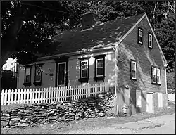 William Collins House |
February 16, 1983 (#83000654) |
3775 N. Main St. 41°43′15″N 71°07′29″W |
Fall River | |
| 31 | William M. Connell School |  William M. Connell School |
February 16, 1983 (#83000655) |
650 Plymouth Ave. 41°42′08″N 71°09′23″W |
Fall River | |
| 32 | Corky Row Historic District |  Corky Row Historic District |
June 23, 1983 (#83000656) |
Roughly bounded by Plymouth Ave. I195 and 2nd St. 41°41′43″N 71°09′23″W |
Fall River | Include Davol Mills & Tecumseh Mills |
| 33 | Cornell Mills | 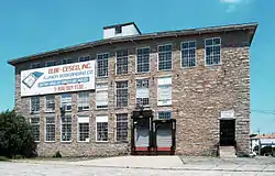 Cornell Mills |
February 16, 1983 (#83000657) |
Alden St. 41°41′03″N 71°08′01″W |
Fall River | |
| 34 | Coughlin School |  Coughlin School |
February 16, 1983 (#83000658) |
1975 Pleasant St. 41°41′04″N 71°07′42″W |
Fall River | |
| 35 | Crescent Mill | 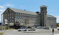 Crescent Mill |
February 16, 1983 (#83000659) |
30 Front St. 41°41′51″N 71°08′49″W |
Fall River | |
| 36 | Davol School | 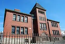 Davol School |
February 16, 1983 (#83000661) |
112 Flint St. 41°41′34″N 71°08′09″W |
Fall River | school closed in June 2008, Now owned by the Flint Neighborhood Association |
| 37 | William C. Davol Jr. House |  William C. Davol Jr. House |
February 16, 1983 (#83004286) |
252 High St. 41°42′50″N 71°09′10″W |
Fall River | |
| 38 | Downtown Fall River Historic District | 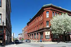 Downtown Fall River Historic District |
February 16, 1983 (#83000662) |
N. and S. Main, Bedford, Granite, Bank, Franklin, and Elm Sts. 41°42′11″N 71°09′21″W |
Fall River | |
| 39 | Durfee Mills |  Durfee Mills |
February 16, 1983 (#83000664) |
359–479 Pleasant St. 41°41′54″N 71°08′59″W |
Fall River | largest mill complex in city |
| 40 | B.M.C. Durfee High School | 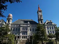 B.M.C. Durfee High School |
June 11, 1981 (#81000109) |
289 Rock St. 41°42′20″N 71°09′08″W |
Fall River | now occupied by Massachusetts Probate Court |
| 41 | John M. Earle House | 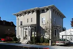 John M. Earle House |
February 16, 1983 (#83000665) |
352 Durfee St. 41°42′58″N 71°09′26″W |
Fall River | |
| 42 | Fall River Bleachery | 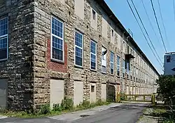 Fall River Bleachery |
February 16, 1983 (#83000667) |
Jefferson St. 41°40′19″N 71°08′44″W |
Fall River | |
| 43 | Fall River Waterworks | 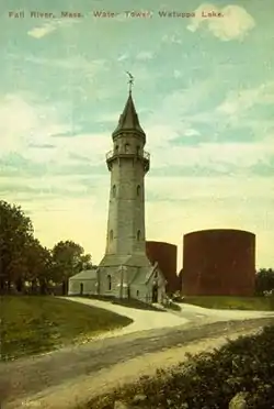 Fall River Waterworks |
December 7, 1981 (#81000714) |
Bedford St. 41°42′07″N 71°07′09″W |
Fall River | |
| 44 | First Baptist Church |  First Baptist Church |
February 16, 1983 (#83000668) |
200–228 N. Main St. 41°42′18″N 71°09′20″W |
Fall River | |
| 45 | Flint Mills | 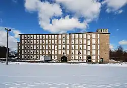 Flint Mills |
February 16, 1983 (#83000669) |
Alden St. 41°41′20″N 71°08′13″W |
Fall River | |
| 46 | Foster Spinning Co. | 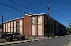 Foster Spinning Co. |
February 16, 1983 (#83000670) |
Cove St. 41°43′27″N 71°08′49″W |
Fall River | |
| 47 | Globe Yarn Mills |  Globe Yarn Mills |
February 16, 1983 (#83000671) |
Globe St. 41°41′20″N 71°10′24″W |
Fall River | |
| 48 | Greany Building |  Greany Building |
February 16, 1983 (#83000674) |
1270–1288 Pleasant St. 41°41′31″N 71°08′10″W |
Fall River | |
| 49 | Hargraves Mill No. 1 |  Hargraves Mill No. 1 |
February 16, 1983 (#83000675) |
Quarry St. 41°41′33″N 71°08′25″W |
Fall River | |
| 50 | James D. Hathaway House | 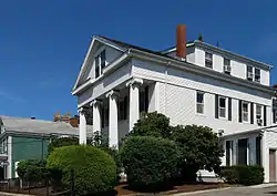 James D. Hathaway House |
February 16, 1983 (#83000676) |
311 Pine St. 41°42′47″N 71°09′15″W |
Fall River | |
| 51 | Highlands Historic District |  Highlands Historic District |
February 16, 1983 (#83000677) |
Roughly bounded by June, Cherry, and Weetamae Sts., Lincoln, Highland, President, N. Main, and Hood Aves. 41°42′37″N 71°09′00″W |
Fall River | |
| 52 | House at 108–112 Quarry Street |  House at 108–112 Quarry Street |
February 16, 1983 (#83000683) |
108–112 Quarry St. 41°42′23″N 71°08′26″W |
Fall River | |
| 53 | Jesus Marie Convent |  Jesus Marie Convent |
February 16, 1983 (#83000685) |
138 St. Joseph's St. 41°41′27″N 71°07′56″W |
Fall River | |
| 54 | Kennedy Park |  Kennedy Park |
February 16, 1983 (#83000686) |
Bounded by S. Main St., Bradford Ave., Middle, and Bay Sts. 41°41′44″N 71°10′12″W |
Fall River | |
| 55 | King Philip Mills |  King Philip Mills |
February 16, 1983 (#83000687) |
Kilburn St. 41°40′55″N 71°10′21″W |
Fall River | Office building destroyed by fire, January 3, 2012[6] |
| 56 | Lafayette-Durfee House |  Lafayette-Durfee House |
April 15, 1982 (#82004959) |
94 Cherry St. 41°42′21″N 71°09′26″W |
Fall River | |
| 57 | William Lindsey House |  William Lindsey House |
February 16, 1983 (#83000690) |
373 N. Main St. 41°42′59″N 71°09′18″W |
Fall River | |
| 58 | Lower Highlands Historic District |  Lower Highlands Historic District |
January 10, 1984 (#84002171) |
Roughly bounded by Cherry, Main, Winter, and Bank Sts. 41°42′15″N 71°08′58″W |
Fall River | |
| 59 | William M. Manley House |  William M. Manley House |
June 26, 1986 (#86001401) |
610 Cherry St. 41°42′17″N 71°08′54″W |
Fall River | |
| 60 | Massasoit Fire House No. 5 |  Massasoit Fire House No. 5 |
February 16, 1983 (#83000692) |
83 Freedom St. 41°41′22″N 71°10′09″W |
Fall River | |
| 61 | Mechanics Mill | 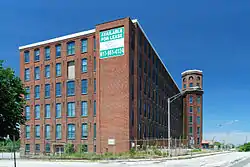 Mechanics Mill |
February 16, 1983 (#83000693) |
1082 Davol St. 41°43′07″N 71°09′21″W |
Fall River | |
| 62 | Narragansett Mills | 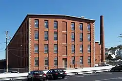 Narragansett Mills |
February 16, 1983 (#83000694) |
1567 N. Main St. 41°43′18″N 71°08′39″W |
Fall River | |
| 63 | North Burial Ground |  North Burial Ground |
February 16, 1983 (#83000695) |
N. Main St. between Brightman and Cory Sts. 41°43′11″N 71°09′00″W |
Fall River | |
| 64 | North Christian Congregational Church | 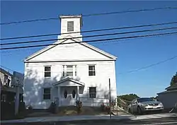 North Christian Congregational Church |
February 16, 1983 (#83000696) |
3538 N. Main St. 41°44′39″N 71°07′40″W |
Fall River | |
| 65 | Notre Dame School | 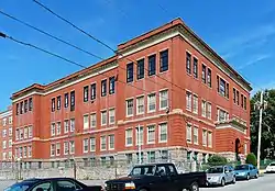 Notre Dame School |
February 16, 1983 (#83000697) |
34 St. Joseph's St. 41°41′28″N 71°08′02″W |
Fall River | school closed in June 2008 |
| 66 | Oak Grove Cemetery |  Oak Grove Cemetery |
February 16, 1983 (#83000698) |
765 Prospect St. 41°42′19″N 71°08′14″W |
Fall River | |
| 67 | Osborn House | 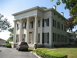 Osborn House |
April 4, 1980 (#80000431) |
456 Rock St. 41°42′27″N 71°09′09″W |
Fall River | aka Carr-Osborn Mansion |
| 68 | Osborn Street School |  Osborn Street School |
February 16, 1983 (#83000699) |
160 Osborn St. 41°41′33″N 71°10′03″W |
Fall River | |
| 69 | Israel Picard House |  Israel Picard House |
February 16, 1983 (#83000702) |
690 County St. 41°42′06″N 71°07′46″W |
Fall River | |
| 70 | Pilgrim Mills |  Pilgrim Mills |
February 16, 1983 (#83000704) |
847 Pleasant St. 41°41′56″N 71°09′05″W |
Fall River | |
| 71 | Pine Street School | 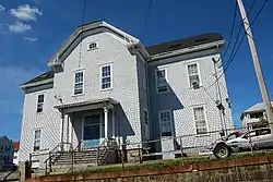 Pine Street School |
February 16, 1983 (#83000705) |
880 Pine St. 41°42′09″N 71°08′39″W |
Fall River | |
| 72 | Pocasset Firehouse No. 7 | 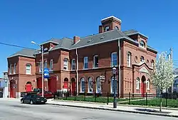 Pocasset Firehouse No. 7 |
February 16, 1983 (#83000706) |
1058 Pleasant St. 41°41′40″N 71°08′19″W |
Fall River | |
| 73 | PT Boat 796 (torpedo boat) | 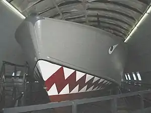 PT Boat 796 (torpedo boat) |
January 14, 1986 (#86000092) |
Battleship Cove 41°42′14″N 71°09′40″W |
Fall River | |
| 74 | Quequechan Club | 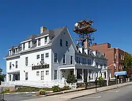 Quequechan Club |
February 16, 1983 (#83000708) |
306 N. Main St. 41°42′57″N 71°09′21″W |
Fall River | |
| 75 | Quequechan Valley Mills Historic District | 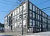 Quequechan Valley Mills Historic District |
February 16, 1983 (#83000709) |
Quequechan, Jefferson, and Stevens Sts. between I-195 and Denver St. 41°40′59″N 71°08′33″W |
Fall River | |
| 76 | Nathan Read House | 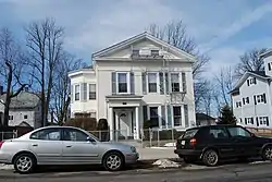 Nathan Read House |
February 16, 1983 (#83000710) |
506 N. Main St. 41°43′05″N 71°09′20″W |
Fall River | |
| 77 | Ruggles Park | 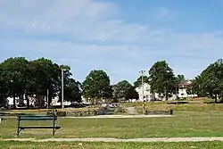 Ruggles Park |
February 16, 1983 (#83000711) |
Bounded by Seabury, Robeson, Pine, and Locust Sts. 41°42′14″N 71°08′46″W |
Fall River | |
| 78 | Sacred Heart School | 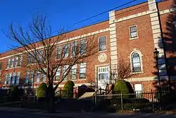 Sacred Heart School |
March 9, 1987 (#87000371) |
90 Linden St. 41°42′11″N 71°08′57″W |
Fall River | |
| 79 | Sagamore Mill No. 2 |  Sagamore Mill No. 2 |
February 16, 1983 (#83000712) |
1822 N. Main St. 41°43′26″N 71°08′39″W |
Fall River | |
| 80 | Sagamore Mills No. 1 and No. 3 | 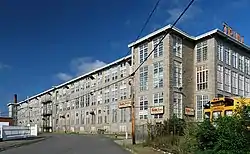 Sagamore Mills No. 1 and No. 3 |
February 16, 1983 (#83000713) |
Ace St. 41°43′33″N 71°08′43″W |
Fall River | |
| 81 | Sanford Spinning Co. |  Sanford Spinning Co. |
February 16, 1983 (#83000714) |
Globe Mills Ave. 41°41′33″N 71°10′45″W |
Fall River | NRHP listing includes Globe Yarn Mills No. 3 |
| 82 | Santo Christo Church | 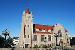 Santo Christo Church |
February 16, 1983 (#83000715) |
240 Columbia St. 41°42′01″N 71°09′48″W |
Fall River | |
| 83 | Seaconnett Mills |  Seaconnett Mills |
February 16, 1983 (#83000716) |
E. Warren St. 41°41′00″N 71°08′10″W |
Fall River | |
| 84 | John Mace Smith House |  John Mace Smith House |
February 16, 1983 (#83000717) |
399 N. Main St. 41°42′57″N 71°09′18″W |
Fall River | |
| 85 | St. Anne's Church and Parish Complex | 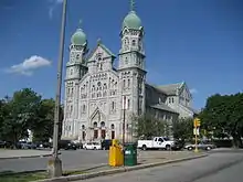 St. Anne's Church and Parish Complex |
February 16, 1983 (#83000719) |
780 S. Main St. 41°41′38″N 71°09′50″W |
Fall River | |
| 86 | St. Joseph's Church |  St. Joseph's Church |
February 16, 1983 (#83000720) |
1355 N. Main St. 41°43′07″N 71°08′52″W |
Fall River | |
| 87 | St. Joseph's Orphanage |  St. Joseph's Orphanage |
February 16, 1983 (#83000721) |
56 St. Joseph's St. 41°41′30″N 71°08′00″W |
Fall River | |
| 88 | St. Louis Church |  St. Louis Church |
February 16, 1983 (#83000722) |
440 Bradford Ave. 41°41′47″N 71°10′02″W |
Fall River | Demolished in April 2010 |
| 89 | St. Mary's Cathedral and Rectory |  St. Mary's Cathedral and Rectory |
February 16, 1983 (#83000723) |
327 Second St. 41°41′55″N 71°09′28″W |
Fall River | |
| 90 | St. Patrick's Church |  St. Patrick's Church |
February 16, 1983 (#83000724) |
1588 S. Main St. 41°41′08″N 71°10′25″W |
Fall River | now known as Good Shepherd Parish |
| 91 | Stafford Mills | 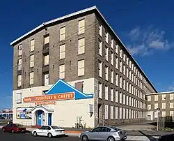 Stafford Mills |
February 16, 1983 (#83000718) |
County St. 41°41′46″N 71°08′21″W |
Fall River | |
| 92 | Torpedo Boat PT-617 |  Torpedo Boat PT-617 |
December 20, 1989 (#89002465) |
Battleship Cove 41°42′14″N 71°09′40″W |
Fall River | |
| 93 | Truesdale Hospital |  Truesdale Hospital |
April 15, 1986 (#86000801) |
1820 Highland Ave. 41°43′41″N 71°08′07″W |
Fall River | |
| 94 | U.S.S. Joseph P. Kennedy Jr. (DD-850) |  U.S.S. Joseph P. Kennedy Jr. (DD-850) |
September 30, 1976 (#76000231) |
Battleship Cove 41°42′21″N 71°09′47″W |
Fall River | |
| 95 | U.S.S. Lionfish | .jpg.webp) U.S.S. Lionfish |
September 30, 1976 (#76000232) |
Battleship Cove 41°42′20″N 71°09′48″W |
Fall River | |
| 96 | U.S.S. Massachusetts | 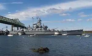 U.S.S. Massachusetts |
September 30, 1976 (#76002269) |
Battleship Cove 41°42′24″N 71°09′48″W |
Fall River | |
| 97 | Union Mills |  Union Mills |
February 16, 1983 (#83000726) |
Pleasant St. 41°41′44″N 71°08′32″W |
Fall River | |
| 98 | The Unitarian Society |  The Unitarian Society |
May 13, 1982 (#82004958) |
309 N. Main St. 41°42′22″N 71°09′17″W |
Fall River | Destroyed by fire in 1983; rebuilt. |
| 99 | Valentine-French House |  Valentine-French House |
February 16, 1983 (#83000727) |
5105 N. Main St. 41°45′36″N 71°06′45″W |
Fall River | |
| 100 | Wampanoag Mills | 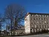 Wampanoag Mills |
February 16, 1983 (#83000729) |
Quequechan St. 41°41′20″N 71°08′19″W |
Fall River | |
| 101 | Woman's Club of Fall River | 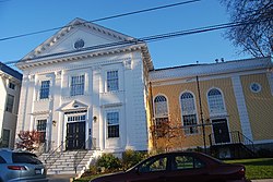 Woman's Club of Fall River |
February 16, 1983 (#83000733) |
1542 Walnut St. 41°42′56″N 71°08′59″W |
Fall River | |
| 102 | Luther Winslow Jr. House |  Luther Winslow Jr. House |
February 16, 1983 (#83000732) |
5225 N. Main St. 41°45′37″N 71°06′42″W |
Fall River |
See also
| Wikimedia Commons has media related to National Register of Historic Places in Fall River, Massachusetts. |
References
- "National Register of Historic Places: Weekly List Actions". National Park Service, United States Department of the Interior. Retrieved on January 29, 2021.
- Numbers represent an alphabetical ordering by significant words. Various colorings, defined here, differentiate National Historic Landmarks and historic districts from other NRHP buildings, structures, sites or objects.
- "National Register Information System". National Register of Historic Places. National Park Service. April 24, 2008.
- The eight-digit number below each date is the number assigned to each location in the National Register Information System database, which can be viewed by clicking the number.
- Giza, Patricia (1984). A Guide Book to Fall River's National Register Properties. Fall River, MA: The City.
- Herald News Article, January 3, 2012

| Topics |  | ||||||||||||||||
|---|---|---|---|---|---|---|---|---|---|---|---|---|---|---|---|---|---|
| Lists by county | |||||||||||||||||
| Lists by city |
| ||||||||||||||||
| Other lists | |||||||||||||||||
| |||||||||||||||||
Boston (capital) | ||
| Topics |
| |
| Society | ||
| Regions |
| |
| Counties | ||
| Cities |
| |
This article is issued from Wikipedia. The text is licensed under Creative Commons - Attribution - Sharealike. Additional terms may apply for the media files.