National Register of Historic Places listings in Lawrence, Massachusetts
The following properties are listed on the National Register of Historic Places in Lawrence, Massachusetts.
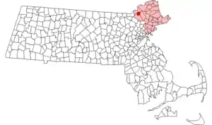
Location of Lawrence in Massachusetts
This is intended to be a complete list of the properties and districts on the National Register of Historic Places in Lawrence, Massachusetts, United States. The locations of National Register properties and districts for which the latitude and longitude coordinates are included below, may be seen in a Google map.[1]
Essex County, of which Lawrence is a part, is the location of 461 properties and districts listed on the National Register. Lawrence itself is the location of 24 of these properties and districts.[2]
- This National Park Service list is complete through NPS recent listings posted February 5, 2021.[3]
Current listings
| [4] | Name on the Register[2] | Image | Date listed[5] | Location | City or town | Description |
|---|---|---|---|---|---|---|
| 1 | American Woolen Company Townhouses | 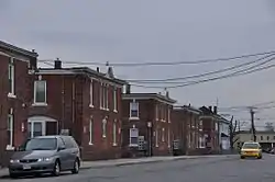 American Woolen Company Townhouses |
March 12, 2012 (#12000098) |
1-14 Wood Way, 1-14 Washington Way, 1-14 Prospect Way 42°42′01″N 71°09′18″W |
||
| 2 | American Woolen Mill Housing District | 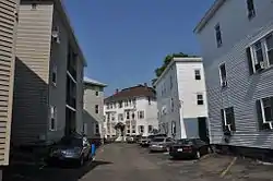 American Woolen Mill Housing District |
April 8, 1982 (#82001990) |
300-328 Market St. 42°41′59″N 71°09′28″W |
||
| 3 | Arlington Mills Historic District | 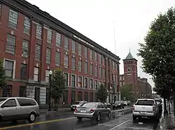 Arlington Mills Historic District |
January 3, 1985 (#85000023) |
Broadway between Manchester, Stafford and Chase Sts. 42°42′56″N 71°10′52″W |
Extends into Methuen | |
| 4 | Arlington-Basswood Historic District | 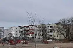 Arlington-Basswood Historic District |
November 13, 1984 (#84000406) |
Roughly bounded by Lawrence, Alder, Arlington, and Juniper Sts. 42°43′08″N 71°10′11″W |
||
| 5 | Bellevue Cemetery | 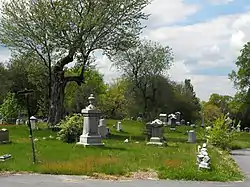 Bellevue Cemetery |
October 3, 2003 (#03000993) |
170 May St. 42°42′38″N 71°11′10″W |
Extends into Methuen | |
| 6 | Blakeley Building | 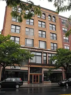 Blakeley Building |
May 4, 2009 (#09000299) |
475-479 Essex St. 42°42′22″N 71°09′55″W |
||
| 7 | Buildings at 24–30 Summer St. | 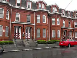 Buildings at 24–30 Summer St. |
December 5, 1985 (#85003067) |
24–30 Summer St. 42°42′37″N 71°09′16″W |
||
| 8 | Downtown Lawrence Historic District | 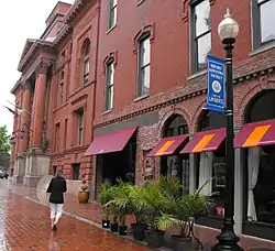 Downtown Lawrence Historic District |
November 1, 1979 (#79000329) |
Roughly bounded by MA 110, Methuen, Lawrence and Jackson Sts. 42°42′32″N 71°09′38″W |
||
| 9 | Engine House No. 6 | 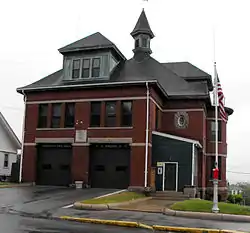 Engine House No. 6 |
June 2, 2004 (#04000533) |
480 Howard St. 42°42′49″N 71°08′59″W |
||
| 10 | Essex Company Machine Shop | 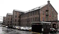 Essex Company Machine Shop |
November 9, 1972 (#72000138) |
Union St. 42°42′34″N 71°09′17″W |
||
| 11 | Essex Company Offices and Yard | 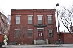 Essex Company Offices and Yard |
April 26, 1979 (#79000330) |
6 Essex St. 42°42′26″N 71°09′15″W |
||
| 12 | Gleason Building | 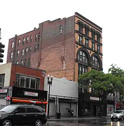 Gleason Building |
April 15, 1982 (#82001880) |
349-351 Essex St. 42°42′27″N 71°09′46″W |
||
| 13 | Grace Episcopal Church | 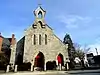 Grace Episcopal Church |
November 7, 1976 (#76001966) |
Common and Jackson Sts. 42°42′31″N 71°09′29″W |
||
| 14 | Great Stone Dam |  Great Stone Dam |
April 13, 1977 (#77000184) |
Merrimack River and MA 28 42°42′03″N 71°10′00″W |
||
| 15 | High Service Water Tower and Reservoir | %252C_Lawrence%252C_Massachusetts.JPG.webp) High Service Water Tower and Reservoir |
November 20, 1978 (#78000450) |
Off MA 110 42°42′26″N 71°11′01″W |
||
| 16 | Jackson Terrace Historic District | 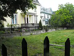 Jackson Terrace Historic District |
November 13, 1984 (#84000414) |
43-59 Jackson St., Jackson Court, Jackson Terr., and 58-62 Newberry St. 42°42′35″N 71°09′26″W |
||
| 17 | Mechanics Block Historic District | 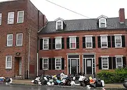 Mechanics Block Historic District |
April 3, 1973 (#73001942) |
107-139 Garden St. and 6-38 Orchard St. 42°42′34″N 71°09′17″W |
||
| 18 | North Canal |  North Canal |
July 29, 1975 (#75000278) |
Parallel to Canal St. 42°42′18″N 71°09′29″W |
||
| 19 | North Canal Historic District | 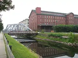 North Canal Historic District |
November 13, 1984 (#84000417) |
Roughly bounded by the Merrimack and Spicket Rivers, North, Canal, and Broadway 42°42′15″N 71°09′40″W |
Boundary increase (listed May 8, 2009)[6] | |
| 20 | Old Public Library | 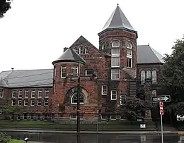 Old Public Library |
November 28, 1978 (#78000452) |
190 Hampshire St. 42°42′34″N 71°10′05″W |
||
| 21 | John R. Rollins School | 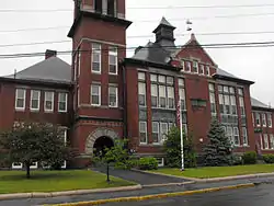 John R. Rollins School |
August 10, 2000 (#00000956) |
451 Howard St. 42°42′49″N 71°08′55″W |
||
| 22 | Sacred Heart Parish Complex | 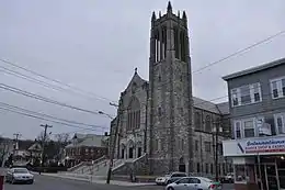 Sacred Heart Parish Complex |
November 29, 2011 (#11000853) |
321 S. Broadway 42°41′22″N 71°09′32″W |
||
| 23 | Daniel Saunders School | 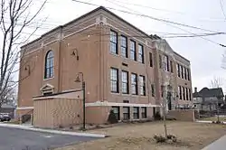 Daniel Saunders School |
May 11, 2011 (#11000266) |
243 S. Broadway 42°41′33″N 71°09′39″W |
||
| 24 | Wood Worsted Mill | 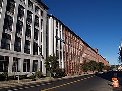 Wood Worsted Mill |
August 12, 2010 (#10000539) |
S. Union St. and Merrimack St. 42°42′09″N 71°09′12″W |
See also
| Wikimedia Commons has media related to National Register of Historic Places in Lawrence, Massachusetts. |
References
- The latitude and longitude information provided in this table was derived originally from the National Register Information System, which has been found to be fairly accurate for about 99% of listings. Some locations in this table may have been corrected to current GPS standards.
- "National Register Information System". National Register of Historic Places. National Park Service. April 24, 2008.
- "National Register of Historic Places: Weekly List Actions". National Park Service, United States Department of the Interior. Retrieved on February 5, 2021.
- Numbers represent an alphabetical ordering by significant words. Various colorings, defined here, differentiate National Historic Landmarks and historic districts from other NRHP buildings, structures, sites or objects.
- The eight-digit number below each date is the number assigned to each location in the National Register Information System database, which can be viewed by clicking the number.
- "Weekly List". National Park Service. May 22, 2009. Retrieved May 24, 2009.
| Topics | |
|---|---|
| Lists by state |
|
| Lists by insular areas | |
| Lists by associated state | |
| Other areas | |
| Related | |
| |
This article is issued from Wikipedia. The text is licensed under Creative Commons - Attribution - Sharealike. Additional terms may apply for the media files.