Happō, Akita
Happō (八峰町, Happō-chō) is a town located in Akita, Japan. As of 31 January 2020, the town had an estimated population of 7,025 in 3064 households,[1] and a population density of 31 persons per km2. The total area of the town is 234.14 square miles (606.4 km2).
Happō
八峰町 | |
|---|---|
 Happō Town Hall | |
 Flag  Seal | |
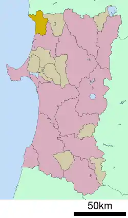 Location of Happō in Akita Prefecture | |
 Happō | |
| Coordinates: 40°17′48.6″N 140°2′3.4″E | |
| Country | Japan |
| Region | Tōhoku |
| Prefecture | Akita |
| District | Yamamoto |
| Area | |
| • Total | 224.14 km2 (86.54 sq mi) |
| Population (January 2020) | |
| • Total | 7,025 |
| • Density | 31/km2 (81/sq mi) |
| Time zone | UTC+9 (Japan Standard Time) |
| City symbols | |
| - Tree | Fagus crenata |
| - Flower | Katakuri |
| - Bird | Common gull |
| - Fish | Hatahata |
| Phone number | 0185-77-2111 |
| Address | 118 Menagata, Minehama-Menagata, Happō-chō, Yamamoto-gun, Akita 018-2502 |
| Website | Official website |
Geography
Happō is located in the mountainous far northwestern corner of Akita Prefecture, bordered by the World Heritage Site Shirakami Mountains to the south, and by Aomori Prefecture to the north and the Sea of Japan to the west. Due to its location, the temperature in Happō can get remarkably cold at night, with snowfall tending to be somewhat greater than that in neighboring municipalities
Neighboring municipalities
- Akita Prefecture
- Aomori Prefecture
History
The area of present-day Happō was part of ancient Dewa Province, dominated by the Satake clan during the Edo period, who ruled Kubota Domain under the Tokugawa shogunate. The modern town of Happō was created on March 27, 2006, by merging the village of Minehama, and the town of Hachimori, both from Yamamoto District.
Demographics
Per Japanese census data,[2] the population of Happō has been in steady decline for the past 70 years.
| Year | Pop. | ±% |
|---|---|---|
| 1960 | 15,421 | — |
| 1970 | 13,083 | −15.2% |
| 1980 | 11,638 | −11.0% |
| 1990 | 10,677 | −8.3% |
| 2000 | 9,698 | −9.2% |
| 2010 | 8,225 | −15.2% |
Climate
Happō has a Humid continental climate (Köppen climate classification Dfa) with large seasonal temperature differences, with warm to hot (and often humid) summers and cold (sometimes severely cold) winters. Precipitation is significant throughout the year, but is heaviest from August to October. The average annual temperature in Happō is 8.8 °C. The average annual rainfall is 1581 mm with September as the wettest month. The temperatures are highest on average in August, at around 22.5 °C, and lowest in January, at around -3.4 °C.[3]
Economy
The economy of Happō is based on agriculture and commercial fishing.
Education
Happō has two public elementary schools and one middle school operated by the town government. Th town does not have a high school.
Transportation
Railway
Highway
Sister city relations
References
- Happō Town official statistics (in Japanese)
- Happō population statistics
- Happō climate data
- "International Exchange". List of Affiliation Partners within Prefectures. Council of Local Authorities for International Relations (CLAIR). Archived from the original on 21 November 2015. Retrieved 21 November 2015.
External links
![]() Media related to Happō, Akita at Wikimedia Commons
Media related to Happō, Akita at Wikimedia Commons
- Official Website (in Japanese)
| Core city | ||
|---|---|---|
| Cities | ||
| Districts | ||