Kazuno, Akita
Kazuno (鹿角市, Kazuno-shi) is a city located in Akita Prefecture, Japan. As of 30 April 2019, the city had an estimated population of 30.715, and a population density of 43 persons per km² in 12.970 households.[1] The total area of the city is 707.52 square kilometres (273.17 square miles).
Kazuno
鹿角市 | |
|---|---|
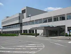 Kazuno City Hall | |
 Flag  Seal | |
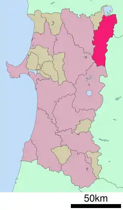 Location of Kazuno in Akita Prefecture | |
 Kazuno | |
| Coordinates: 40°12′56.8″N 140°47′18.16″E | |
| Country | Japan |
| Region | Tōhoku |
| Prefecture | Akita |
| Government | |
| • -Mayor | Hajime Kodama (since July 2005) |
| Area | |
| • Total | 707.52 km2 (273.17 sq mi) |
| Population (April 1, 2019) | |
| • Total | 30,715 |
| • Density | 43/km2 (110/sq mi) |
| Time zone | UTC+9 (Japan Standard Time) |
| - Tree | Rowan |
| - Flower | Sakura |
| - Bird | Rooster |
| Phone number | 0186-30-1111 |
| Address | 4-1 Arata, Hanawa, Kazuno-shi, Akita-ken 018-5292 |
| Website | Official website |
Geography
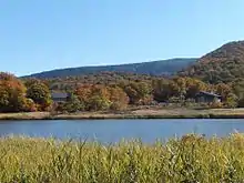
Kazuno is located in a valley in the mountains of far northeastern Akita Prefecture, with the Ōu Mountains and Iwate Prefecture on the east. Much of the city is within the borders of the Towada-Hachimantai National Park. Much of the city area is covered in forest. Due to its inland location, the city is noted for its heavy snowfall in winter. It is also known for the wild deer.
Demographics
Per Japanese census data,[2] the population of Kazuno has declined over the past 40 years.
| Year | Pop. | ±% |
|---|---|---|
| 1960 | 59,593 | — |
| 1970 | 50,346 | −15.5% |
| 1980 | 45,615 | −9.4% |
| 1990 | 42,407 | −7.0% |
| 2000 | 39,144 | −7.7% |
| 2010 | 34,473 | −11.9% |
Climate
Kazuno has a Humid continental climate (Köppen climate classification Dfa) with large seasonal temperature differences, with warm to hot (and often humid) summers and cold (sometimes severely cold) winters with heavy snowfalls. The average annual temperature in Kazuno is 8.9 °C. The average annual rainfall is 1464 mm with July as the wettest month. The temperatures are highest on average in August, at around 23.8 °C, and lowest in January, at around -3.3 °C.[3]
| Climate data for Kazuno, Akita[4](1981-2010) | |||||||||||||
|---|---|---|---|---|---|---|---|---|---|---|---|---|---|
| Month | Jan | Feb | Mar | Apr | May | Jun | Jul | Aug | Sep | Oct | Nov | Dec | Year |
| Average high °C (°F) | 0.6 (33.1) |
1.7 (35.1) |
5.6 (42.1) |
13.9 (57.0) |
19.6 (67.3) |
23.7 (74.7) |
26.6 (79.9) |
28.4 (83.1) |
23.7 (74.7) |
17.3 (63.1) |
10.0 (50.0) |
3.5 (38.3) |
14.5 (58.1) |
| Daily mean °C (°F) | −3.0 (26.6) |
−2.4 (27.7) |
0.9 (33.6) |
7.6 (45.7) |
13.4 (56.1) |
18.1 (64.6) |
21.5 (70.7) |
22.9 (73.2) |
18.0 (64.4) |
11.1 (52.0) |
4.9 (40.8) |
−0.2 (31.6) |
9.4 (48.9) |
| Average low °C (°F) | −7.3 (18.9) |
−6.9 (19.6) |
−3.8 (25.2) |
1.7 (35.1) |
7.6 (45.7) |
13.1 (55.6) |
17.3 (63.1) |
18.5 (65.3) |
13.2 (55.8) |
5.9 (42.6) |
0.4 (32.7) |
−3.9 (25.0) |
4.7 (40.5) |
| Record low °C (°F) | −22.4 (−8.3) |
−19.6 (−3.3) |
−16.8 (1.8) |
−9.9 (14.2) |
−1.8 (28.8) |
3.2 (37.8) |
8.1 (46.6) |
8.6 (47.5) |
1.4 (34.5) |
−2.3 (27.9) |
−11.4 (11.5) |
−16.6 (2.1) |
−22.4 (−8.3) |
| Average precipitation mm (inches) | 57.6 (2.27) |
76.4 (3.01) |
119.8 (4.72) |
155.8 (6.13) |
182.1 (7.17) |
169.3 (6.67) |
154.2 (6.07) |
174.4 (6.87) |
133.4 (5.25) |
124.9 (4.92) |
79.0 (3.11) |
52.4 (2.06) |
1,477.8 (58.18) |
| Average snowfall cm (inches) | 205 (81) |
166 (65) |
110 (43) |
2 (0.8) |
0 (0) |
0 (0) |
0 (0) |
0 (0) |
0 (0) |
0 (0) |
14 (5.5) |
129 (51) |
621 (244) |
| Source: Japan Meteorological Agency[5] | |||||||||||||
History
The area of present-day Kazuno was settled in prehistoric times, and contains major Jōmon period archaeological sites and numerous burial mounds from the Kofun period. The area was part of ancient Mutsu Province and was ruled by the Nambu clan of Morioka Domain during the Edo period. After the start of the Meiji period, the area became briefly part of Rikuchū Province before being transferred to Akita Prefecture in 1871. It was organized as part of Kazuno District, Akita Prefecture in 1878 with the establishment of the modern municipalities system.
The city of Kazuno was founded on April 1, 1972 by the merger of the towns of Hanawa, Towada, and Osarizawa and the village of Hachimantai.
Government
Kazuno has a mayor-council form of government with a directly elected mayor and a unicameral city legislature of 18 members. The city contributes two members to the Akita Prefectural Assembly. In terms of national politics, the city is part of Akita District 2 of the lower house of the Diet of Japan.
Economy
The economy of Kazuno is based on agriculture, forestry and seasonal tourism.
Education
Kazuno has nine public elementary schools and five public middle schools operated by the city government and two public high schools operated by the Akita Prefectural Board of Education. Akita Prefecture also operates one special education school for the hanicapped.
Transportation
Railway
![]() East Japan Railway Company - Hanawa Line
East Japan Railway Company - Hanawa Line
- Yuze-Onsen - Hachimantai - Rikuchū-Ōsato - Kazuno-Hanawa - Shibahira - Towada-Minami - Suehiro - Dobukai
Local attractions
- Chagama Falls – one of the Japan's Top 100 Waterfalls
- Ōyu Stone Circles - Jōmon period archaeological site, Special National Historic Site of Japan
- former Osarizawa Mine
- Hachimantai Onsen
- Ōyu Onsen
- Yuza Onsen
- Dainichido Bugaku - Ritual dance and music held on January 2, UNESCO Intangible cultural heritage[6]
International relations
Kazuno is twinned with:
Noted people from Kazuno
- Junko Asari, Olympic marathon runner
- Kenichi Takahashi, Olympic long-distance runner
- Takayuki Matsumiya, Olympic long-distance runner
- Yasuhiko Okudera, professional soccer player
- Yuta Kimura, professional baseball player
- Naitō Torajirō, historian
- Tomoefuji Toshihide, sumo wrestler
Media
References
- Kazuno city official home page(in Japanese)
- Kazuno population statistics
- Kazunoclimate data
- 鹿角観測地点は1991年7月18日までは毛馬内観測地点のデータ
- "鹿角 1981-2010年". Japan Meteorological Agency. Retrieved 2011-10-18.
- "Dainichido Bugaku". UNESCO Intangible Cultural Heritage. UNESCO. Retrieved 12 March 2016.
- "International Exchange". List of Affiliation Partners within Prefectures. Council of Local Authorities for International Relations (CLAIR). Archived from the original on 21 November 2015. Retrieved 21 November 2015.
External links
| Wikimedia Commons has media related to Kazuno, Akita. |
- Official Website (in Japanese)
| Core city | ||
|---|---|---|
| Cities | ||
| Districts | ||
| Authority control |
|---|