Hetland, South Dakota
Hetland is a town in Kingsbury County, South Dakota, United States. The population was 46 at the 2010 census.
Hetland, South Dakota | |
|---|---|
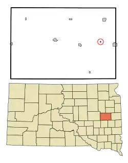 Location in Kingsbury County and the state of South Dakota | |
| Coordinates: 44°22′36″N 97°14′4″W | |
| Country | United States |
| State | South Dakota |
| County | Kingsbury |
| Founded | 1880[1] |
| Area | |
| • Total | 0.11 sq mi (0.30 km2) |
| • Land | 0.11 sq mi (0.30 km2) |
| • Water | 0.00 sq mi (0.00 km2) |
| Elevation | 1,732 ft (528 m) |
| Population | |
| • Total | 46 |
| • Estimate (2019)[4] | 47 |
| • Density | 412.28/sq mi (158.78/km2) |
| Time zone | UTC-6 (Central (CST)) |
| • Summer (DST) | UTC-5 (CDT) |
| ZIP codes | 57212, 57244 |
| Area code(s) | 605 |
| FIPS code | 46-28460[5] |
| GNIS feature ID | 1265247[6] |
History
A post office called Hetland was established in 1888, and remained in operation until it was discontinued in 1997.[7] The town was named for John Hetland, a pioneer settler who was murdered while traveling from Sioux Falls to his homestead near the present site of Hetland.[8][9]
Geography
Hetland is located at 44°22′36″N 97°14′4″W (44.376595, -97.234449).[10]
According to the United States Census Bureau, the town has a total area of 0.11 square miles (0.28 km2), all land.[11]
Hetland has been assigned the ZIP code 57244 and the FIPS place code 28460.
Demographics
| Historical population | |||
|---|---|---|---|
| Census | Pop. | %± | |
| 1900 | 162 | — | |
| 1910 | 223 | 37.7% | |
| 1920 | 248 | 11.2% | |
| 1930 | 250 | 0.8% | |
| 1940 | 199 | −20.4% | |
| 1950 | 123 | −38.2% | |
| 1960 | 107 | −13.0% | |
| 1970 | 81 | −24.3% | |
| 1980 | 66 | −18.5% | |
| 1990 | 53 | −19.7% | |
| 2000 | 43 | −18.9% | |
| 2010 | 46 | 7.0% | |
| 2019 (est.) | 47 | [4] | 2.2% |
| U.S. Decennial Census[12] | |||
2010 census
As of the census[3] of 2010, there were 46 people, 17 households, and 11 families residing in the town. The population density was 418.2 inhabitants per square mile (161.5/km2). There were 24 housing units at an average density of 218.2 per square mile (84.2/km2). The racial makeup of the town was 100.0% White.
There were 17 households, of which 23.5% had children under the age of 18 living with them, 41.2% were married couples living together, 11.8% had a female householder with no husband present, 11.8% had a male householder with no wife present, and 35.3% were non-families. 17.6% of all households were made up of individuals, and 5.9% had someone living alone who was 65 years of age or older. The average household size was 2.71 and the average family size was 2.91.
The median age in the town was 35 years. 34.8% of residents were under the age of 18; 4.3% were between the ages of 18 and 24; 19.5% were from 25 to 44; 30.4% were from 45 to 64; and 10.9% were 65 years of age or older. The gender makeup of the town was 56.5% male and 43.5% female.
2000 census
As of the census[5] of 2000, there were 43 people, 18 households, and 10 families residing in the town. The population density was 374.7 people per square mile (150.9/km2). There were 21 housing units at an average density of 183.0 per square mile (73.7/km2). The racial makeup of the town was 100.00% White.
There were 18 households, out of which 27.8% had children under the age of 18 living with them, 44.4% were married couples living together, 11.1% had a female householder with no husband present, and 44.4% were non-families. 38.9% of all households were made up of individuals, and 16.7% had someone living alone who was 65 years of age or older. The average household size was 2.39 and the average family size was 3.30.
In the town, the population was spread out, with 27.9% under the age of 18, 20.9% from 18 to 24, 23.3% from 25 to 44, 16.3% from 45 to 64, and 11.6% who were 65 years of age or older. The median age was 28 years. For every 100 females, there were 104.8 males. For every 100 females age 18 and over, there were 106.7 males.
The median income for a household in the town was $32,500, and the median income for a family was $32,813. Males had a median income of $21,667 versus $13,750 for females. The per capita income for the town was $9,239. None of the population or families were below the poverty line.
References
- "SD Towns" (PDF). South Dakota State Historical Society. Archived from the original (PDF) on 2010-02-10. Retrieved 2010-02-13.
- "2019 U.S. Gazetteer Files". United States Census Bureau. Retrieved July 30, 2020.
- "U.S. Census website". United States Census Bureau. Retrieved 2012-06-21.
- "Population and Housing Unit Estimates". United States Census Bureau. May 24, 2020. Retrieved May 27, 2020.
- "U.S. Census website". United States Census Bureau. Retrieved 2008-01-31.
- "US Board on Geographic Names". United States Geological Survey. 2007-10-25. Retrieved 2008-01-31.
- "Kingsbury County". Jim Forte Postal History. Retrieved 19 March 2015.
- Chicago and North Western Railway Company (1908). A History of the Origin of the Place Names Connected with the Chicago & North Western and Chicago, St. Paul, Minneapolis & Omaha Railways. p. 83.
- Federal Writers' Project (1940). South Dakota place-names, v.1-3. University of South Dakota. p. 41.
- "US Gazetteer files: 2010, 2000, and 1990". United States Census Bureau. 2011-02-12. Retrieved 2011-04-23.
- "US Gazetteer files 2010". United States Census Bureau. Archived from the original on 2012-01-25. Retrieved 2012-06-21.
- "Census of Population and Housing". Census.gov. Retrieved June 4, 2015.
Municipalities and communities of Kingsbury County, South Dakota, United States | ||
|---|---|---|
| Cities | 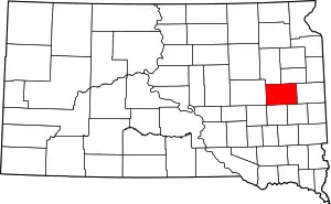 | |
| Towns | ||
| Unincorporated communities | ||
| Ghost town | ||
| Footnotes | ‡This populated place also has portions in an adjacent county or counties | |
| ||
| Authority control |
|
|---|