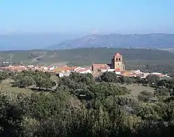
Higuera
Higuera, also known as Higuera de Albalat, is a Spanish municipality of the Province of Cáceres, in the autonomous community of Extremadura. The municipality covers an area of 40.54 square kilometres (15.65 sq mi) and as of 2011 had a population of 115 people.[2]
Higuera
Higuera de Albalat | |
|---|---|
 | |
.svg.png.webp) Flag .svg.png.webp) Coat of arms | |
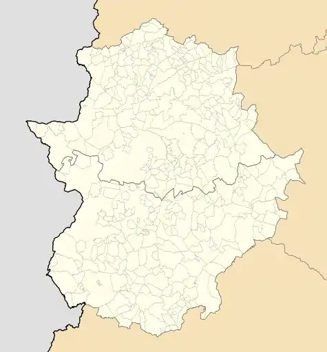 Higuera Location in Extremadura | |
| Coordinates: 39°43′40.78″N 5°39′17.47″W | |
| Country | |
| Community | |
| Province | |
| Comarca | Campo Arañuelo |
| Government | |
| • Mayor | Victorino González Fernández[1] |
| Area | |
| • Total | 40.54 km2 (15.65 sq mi) |
| Elevation | 480 m (1,570 ft) |
| Population (2018)[3] | |
| • Total | 102 |
| • Density | 2.5/km2 (6.5/sq mi) |
| Demonym(s) | Higuereño/a |
| Postal code | 10359 |
| Website | Official website |
History
Its name comes from the old Arab medina of Makhada Albalat (or Madinat Albalat, meaning "way" or "road"), an archaeological site located next to the town.[4] Among its historical attractions, Higuera has the ruins of an Islamic watchtower and its citadel, dating back to the 10th/11th centuries, located on Castil Oreja mountain.
Geography
The municipality, part of the judicial district of Navalmoral de la Mata, is located in the Monfragüe National Park and crossed by the river Tagus in its northern corner. It borders with the municipalities of Almaraz, Campillo de Deleitosa, Casas de Miravete, Deleitosa, Romangordo and Valdecañas de Tajo.[5]
The town is 55 km far from Trujillo, 79 from Plasencia, 82 from Guadalupe, 100 from Cáceres, 141 from Mérida and 216 from Madrid.
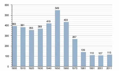
Demographics
References
- (in Spanish) An interview with the mayor of Higuera (municipal website)
- "Cáceres: Población por municipios y sexo:Cifras oficiales de población resultantes de la revisión del Padrón municipal a 1 de enero de 2011". Instituto Nacional de Estadística. Archived from the original on 21 May 2012. Retrieved 26 May 2012.
- Municipal Register of Spain 2018. National Statistics Institute.
- (in Spanish) Madinat Albalat (municipal website)
- 346288 Higuera on OpenStreetMap
External links
 Media related to Higuera de Albalat at Wikimedia Commons
- (in Spanish) Higuera official website