Hubbard, Texas
Hubbard is a city in Hill County, Texas, United States. It was named for Texas Governor Richard B. Hubbard. The city is 72 miles (116 km) by road south of Dallas. The population was 1,423 at the 2010 census,[5] down from 1,586 at the 2000 census.
Hubbard, Texas | |
|---|---|
.jpg.webp) Buildings in downtown Hubbard | |
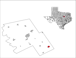
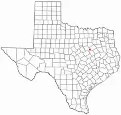 Location of Hubbard, Texas | |
 | |
| Coordinates: 31°50′51″N 96°47′50″W | |
| Country | United States |
| State | Texas |
| County | Hill |
| Area | |
| • Total | 1.99 sq mi (5.17 km2) |
| • Land | 1.96 sq mi (5.07 km2) |
| • Water | 0.04 sq mi (0.10 km2) |
| Elevation | 650 ft (198 m) |
| Population (2010) | |
| • Total | 1,423 |
| • Estimate (2019)[2] | 1,406 |
| • Density | 718.81/sq mi (277.55/km2) |
| Time zone | UTC-6 (Central (CST)) |
| • Summer (DST) | UTC-5 (CDT) |
| ZIP code | 76648 |
| Area code(s) | 254 |
| FIPS code | 48-35180[3] |
| GNIS feature ID | 1338201[4] |
| Website | hubbardcity |
History
Hubbard was named after Richard B. Hubbard, the 16th governor of Texas. He was on hand at the sales of the first town lots on August 11, 1881. The city was organized when the railroads were built through this section of the state. Its first bank was organized in 1881. In 1895 mineral water was discovered in Hubbard. This spawned several bath houses and a sanitarium. Hubbard's reputation as a health resort contributed to its population increase.
Geography
Hubbard is located in southeastern Hill County at 31°50′51″N 96°47′50″W (31.847593, -96.797352).[6] Texas State Highway 31 passes through the center of town, leading northeast 26 miles (42 km) to Corsicana and southwest 29 miles (47 km) to Waco. State Highway 171 crosses Highway 31 in the center of Hubbard, leading northwest 24 miles (39 km) to Hillsboro, the Hill county seat, and southeast 23 miles (37 km) to Mexia.
According to the United States Census Bureau, Hubbard has a total area of 2.0 square miles (5.2 km2), of which 0.04 square miles (0.1 km2), or 1.92%, are water.[5]
Demographics
| Historical population | |||
|---|---|---|---|
| Census | Pop. | %± | |
| 1890 | 894 | — | |
| 1900 | 1,608 | 79.9% | |
| 1910 | 1,843 | 14.6% | |
| 1920 | 2,072 | 12.4% | |
| 1930 | 1,855 | −10.5% | |
| 1940 | 1,871 | 0.9% | |
| 1950 | 1,768 | −5.5% | |
| 1960 | 1,628 | −7.9% | |
| 1970 | 1,572 | −3.4% | |
| 1980 | 1,676 | 6.6% | |
| 1990 | 1,589 | −5.2% | |
| 2000 | 1,586 | −0.2% | |
| 2010 | 1,423 | −10.3% | |
| 2019 (est.) | 1,406 | [2] | −1.2% |
| U.S. Decennial Census[7] | |||
As of the census[3] of 2000, there were 1,586 people, 625 households, and 406 families residing in the city. The population density was 800.8 people per square mile (309.3/km2). There were 715 housing units at an average density of 361.0/sq mi (139.4/km2). The racial makeup of the city was 74.46% White, 20.81% African American, 0.25% Native American, 0.19% Asian, 1.39% from other races, and 2.90% from two or more races. Hispanic or Latino of any race were 3.97% of the population.
There were 625 households, out of which 30.9% had children under the age of 18 living with them, 44.6% were married couples living together, 17.1% had a female householder with no husband present, and 35.0% were non-families. 32.0% of all households were made up of individuals, and 20.0% had someone living alone who was 65 years of age or older. The average household size was 2.42 and the average family size was 3.10.
In the city, the population was spread out, with 27.5% under the age of 18, 6.8% from 18 to 24, 24.0% from 25 to 44, 19.9% from 45 to 64, and 21.9% who were 65 years of age or older. The median age was 39 years. For every 100 females, there were 78.4 males. For every 100 females age 18 and over, there were 73.7 males.
The median income for a household in the city was $25,950, and the median income for a family was $34,083. Males had a median income of $30,795 versus $16,696 for females. The per capita income for the city was $15,311. About 20.4% of families and 24.5% of the population were below the poverty line, including 36.7% of those under age 18 and 15.1% of those age 65 or over.
Photo gallery
.jpg.webp) Wood-Taylor House
Wood-Taylor House.jpg.webp) Hot Well Sanatorium
Hot Well Sanatorium.jpg.webp) Onstott-Scott-Hill House
Onstott-Scott-Hill House.jpg.webp) First United Methodist Church
First United Methodist Church.jpg.webp) Stroud-Niece-Copper House
Stroud-Niece-Copper House.jpg.webp) Liberty Hall
Liberty Hall.jpg.webp) Hubbard High School
Hubbard High School.jpg.webp) Wilkes-Niece-Barnett House
Wilkes-Niece-Barnett House
Education
The city is served by the Hubbard Independent School District.
Notable people
- Mark English, illustrator and painter
- Samuel D. Johnson, Jr., federal judge
- J. Frank Norris, fundamentalist Baptist pastor
- Ron Shanklin, NFL player
- Tris Speaker, baseball Hall of Famer
See also
References
- "2019 U.S. Gazetteer Files". United States Census Bureau. Retrieved August 7, 2020.
- "Population and Housing Unit Estimates". United States Census Bureau. May 24, 2020. Retrieved May 27, 2020.
- "U.S. Census website". United States Census Bureau. Retrieved 2008-01-31.
- "US Board on Geographic Names". United States Geological Survey. 2007-10-25. Retrieved 2008-01-31.
- "Geographic Identifiers: 2010 Census Summary File 1 (G001): Hubbard city, Texas". American Factfinder. U.S. Census Bureau. Archived from the original on February 13, 2020. Retrieved February 23, 2018.
- "US Gazetteer files: 2010, 2000, and 1990". United States Census Bureau. 2011-02-12. Retrieved 2011-04-23.
- "Census of Population and Housing". Census.gov. Retrieved June 4, 2015.
External links
| Wikimedia Commons has media related to Hubbard, Texas. |
Municipalities and communities of Hill County, Texas, United States | ||
|---|---|---|
| Cities | 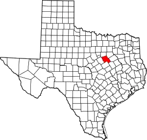 Hill County map | |
| Towns | ||
| Unincorporated communities | ||
| ||