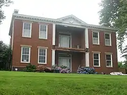
Hunter's Bottom Historic District
Hunter's Bottom Historic District is a 2,810 acres (11.4 km2) historic district in Kentucky's Carroll and Trimble counties, spanning the area known as Hunter's Bottom. It was listed on the National Register of Historic Places in 1976. The listing included 21 contributing buildings and a contributing site.[1]
Hunter's Bottom Historic District | |
 | |
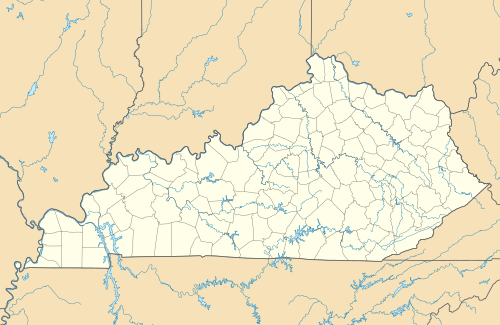  | |
| Nearest city | Carrollton, Kentucky |
|---|---|
| Coordinates | 38°43′23″N 85°17′31″W |
| Area | 2,810 acres (11.4 km2) |
| Built | 1801 |
| Architectural style | Late Victorian, Georgian, Federal |
| NRHP reference No. | 76000862[1] |
| Added to NRHP | August 11, 1976 |
Hunter's Bottom runs seven miles along the Ohio River, with the river forming the north boundary, and with the base of hills forming the south boundary. The district stops on the east at Locust Creek in Carroll County, and on the west at Canip Creek in Trimble County.[2]
References
- "National Register Information System". National Register of Historic Places. National Park Service. November 2, 2013.
- Walter Langsam; Mary Cronan (March 8, 1976). "National Register of Historic Places Inventory/Nomination: Hunter's Bottom Historic District / Hunter's Bottom". National Park Service. Retrieved May 1, 2018. With accompanying 45 photos from 1976
| Topics | |
|---|---|
| Lists by state |
|
| Lists by insular areas | |
| Lists by associated state | |
| Other areas | |
| Related | |
| |
This article is issued from Wikipedia. The text is licensed under Creative Commons - Attribution - Sharealike. Additional terms may apply for the media files.