Ibigawa
Ibigawa (揖斐川町, Ibigawa-chō) is a town located in Ibi District, Gifu Prefecture, Japan. As of 1 December 2018, the town had an estimated population of 21,319 in 8,015 households [1] and a population density of 27 persons per km2, in 8,032 households. The total area of the town was 803.44 square kilometres (310.21 sq mi).
Ibigawa
揖斐川町 | |
|---|---|
.jpg.webp) Ibigawa Town Hall | |
 Flag  Seal | |
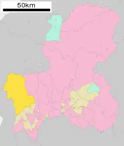 Location of Ibigawa in Gifu Prefecture | |
 Ibigawa | |
| Coordinates: 35°29′14.2″N 136°34′6.9″E | |
| Country | Japan |
| Region | Chūbu |
| Prefecture | Gifu |
| District | Ibi |
| Government | |
| • Mayor | Takao Sōmiya |
| Area | |
| • Total | 803.44 km2 (310.21 sq mi) |
| Population (December 1, 2018) | |
| • Total | 21,319 |
| • Density | 27/km2 (69/sq mi) |
| Time zone | UTC+9 (Japan Standard Time) |
| City symbols | |
| - Tree | Japanese Zelkova |
| - Flower | Prunus persica |
| Phone number | 0585-22-2111 |
| Address | Miwa 133, Ibigawa-chō, Ibi-gun, Gifu-ken 501-0692 |
| Website | Official website |
Geography
Ibigawa is located in far western Gifu Prefecture, bordering on Shiga Prefecture to the west and Fukui Prefecture to the north. The Ibi River flows through the town, which is located in a hilly to mountainous area. Parts of the town are within the borders of the Ibi-Sekigahara-Yōrō Quasi-National Park. The town has a climate characterized by characterized by hot and humid summers, and mild winters (Köppen climate classification Cfa). The average annual temperature in Ibigawa is 14.9 °C. The average annual rainfall is 2039 mm with September as the wettest month. The temperatures are highest on average in August, at around 27.4 °C, and lowest in January, at around 4.9 °C.[2] The mountainous areas of the town are noted for extremely heavy snow in winter.
| Climate data for Ibigawa(former Ibigawa Town) | |||||||||||||
|---|---|---|---|---|---|---|---|---|---|---|---|---|---|
| Month | Jan | Feb | Mar | Apr | May | Jun | Jul | Aug | Sep | Oct | Nov | Dec | Year |
| Record high °C (°F) | 16.7 (62.1) |
19.6 (67.3) |
25.1 (77.2) |
30.6 (87.1) |
34.2 (93.6) |
36.4 (97.5) |
38.4 (101.1) |
39.6 (103.3) |
38.2 (100.8) |
32.6 (90.7) |
25.6 (78.1) |
20.1 (68.2) |
39.6 (103.3) |
| Average high °C (°F) | 7.9 (46.2) |
9.8 (49.6) |
12.8 (55.0) |
19.3 (66.7) |
24.0 (75.2) |
27.4 (81.3) |
30.8 (87.4) |
32.5 (90.5) |
28.4 (83.1) |
22.8 (73.0) |
16.8 (62.2) |
10.9 (51.6) |
20.3 (68.5) |
| Average low °C (°F) | −0.2 (31.6) |
0.2 (32.4) |
3.1 (37.6) |
8.4 (47.1) |
13.6 (56.5) |
18.2 (64.8) |
22.3 (72.1) |
23.5 (74.3) |
19.6 (67.3) |
13.2 (55.8) |
7.0 (44.6) |
2.1 (35.8) |
10.9 (51.7) |
| Record low °C (°F) | −7.0 (19.4) |
−8.2 (17.2) |
−6.2 (20.8) |
−0.4 (31.3) |
4.4 (39.9) |
11.4 (52.5) |
16.1 (61.0) |
16.4 (61.5) |
10.7 (51.3) |
2.7 (36.9) |
−1.3 (29.7) |
−5.9 (21.4) |
−8.2 (17.2) |
| Average precipitation mm (inches) | 111.2 (4.38) |
116.6 (4.59) |
186.9 (7.36) |
227.2 (8.94) |
285.6 (11.24) |
352.1 (13.86) |
360.4 (14.19) |
202.3 (7.96) |
288.4 (11.35) |
146.1 (5.75) |
115.5 (4.55) |
96.5 (3.80) |
2,488.8 (97.97) |
| Average precipitation days (≥ 1.0 mm) | 13.0 | 11.7 | 12.2 | 10.7 | 11.3 | 13.0 | 14.4 | 11.4 | 12.6 | 9.1 | 10.1 | 12.5 | 142 |
| Mean monthly sunshine hours | 122.2 | 135.4 | 173.4 | 190.3 | 184.7 | 146.1 | 157.9 | 188.4 | 150.3 | 161.3 | 137.0 | 125.9 | 1,872.9 |
| Source: Meteorological Agency | |||||||||||||
Neighbouring municipalities
- Gifu Prefecture
- Fukui Prefecture
- Shiga Prefecture
Demographics
Per Japanese census data,[3] the population of Ibigawa has declined over the past 40 years.
| Census Year | Population |
|---|---|
| 1970 | 29,979 |
| 1980 | 31,171 |
| 1990 | 29,156 |
| 2000 | 27,453 |
| 2010 | 23,708 |
History
The area around Ibigawa was part of traditional Mino Province. During the Edo period, it initially part of a 30,000 koku domain controlled by the Nishio clan, but from 1623 was divided between territory controlled by Owari Domain and tenryō holdings directly controlled by the Tokugawa shogunate. During the post-Meiji restoration cadastral reforms, the area was organised into Ibi District, Gifu Prefecture. The town of Ibigawa was formed on July 1, 1889 with the establishment of the modern municipalities system.
On January 31, 2005 the former villages of Fujihashi, Kasuga, Kuze, Sakauchi, and Tanigumi merged with Ibigawa, resulting in a nearly 20-fold increase in area.
Education
Ibigawa has six public elementary schools and five public middle school operated by the town government. The town has one public high school operated by the Gifu Prefectural Board of Education.
Transportation
Railway
Highway
References
External links
![]() Media related to Ibigawa, Gifu at Wikimedia Commons
Media related to Ibigawa, Gifu at Wikimedia Commons
- Official website (in Japanese)
| Core city | ||
|---|---|---|
| Cities | ||
| Districts | ||
| Authority control |
|---|
