Interior, South Dakota
Interior (Lakota: makȟóšiča otȟúŋwahe;[7] "Badlands village") is a town in Jackson County, South Dakota, United States. The population was 94 at the 2010 census.
Interior, South Dakota
makȟóšiča otȟúŋwahe | |
|---|---|
 Interior School Building | |
 Location in Jackson County and the state of South Dakota | |
| Coordinates: 43°43′31″N 101°58′59″W | |
| Country | United States |
| State | South Dakota |
| County | Jackson |
| Incorporated | 1907[1] |
| Area | |
| • Total | 1.34 sq mi (3.48 km2) |
| • Land | 1.34 sq mi (3.47 km2) |
| • Water | 0.01 sq mi (0.01 km2) |
| Elevation | 2,382 ft (726 m) |
| Population | |
| • Total | 94 |
| • Estimate (2019)[4] | 106 |
| • Density | 79.16/sq mi (30.58/km2) |
| Time zone | UTC-7 (Mountain (MST)) |
| • Summer (DST) | UTC-6 (MDT) |
| ZIP code | 57750 |
| Area code(s) | 605 |
| FIPS code | 46-31620[5] |
| GNIS feature ID | 1261866[6] |
Interior got its start in 1907 when the Milwaukee Railroad was extended to that point.[8]
History
Norwegian immigrants George and Louis Johnson moved from Chamberlain, South Dakota to the banks of the White River just north of the Pine Ridge Reservation in 1883 to establish a way-station for freighting between Chamberlain and the Black Hills. In 1886, the area was connected by rail to Gordon, Nebraska. In 1891, the former way-station was called Black with Mary Johnson as its first postmaster. In 1893, the town was renamed "Interior" by George Johnson because he did not think the name "Black" fit the description of the White River that surrounded the town. In 1907 and 1908, the town was moved two miles and half northwest along the White River to meet the Milwaukee Railroad. The former location of the town became known as "old Interior".
The town went through major developments in the 1910s: in 1910, an efficient water system transporting water directly from the White River to Interior was installed and an electric grid was installed in 1912. Now with unlimited freshwater combined with being situated along the Milwaukee Railroad and near the Badlands, local committees seized the opportunity to use the town's advantage. In 1919, 21 and 22, the town hosted roundups that tourists traveled by train as far from Minneapolis to see. The events hosted cowboys from across the country and Native Americans in traditional clothing also participating.[9]
Geography

Interior is located along the White River and situated at 43°43′31″N 101°58′59″W (43.725197, -101.983114),[10] approximately one mile from Badlands National Park.
According to the United States Census Bureau, the town has a total area of 1.35 square miles (3.50 km2), of which 1.34 square miles (3.47 km2) is land and 0.01 square miles (0.03 km2) is water.[11]
Interior has been assigned the ZIP code 57750 and the FIPS place code 31620.
Demographics
| Historical population | |||
|---|---|---|---|
| Census | Pop. | %± | |
| 1930 | 144 | — | |
| 1940 | 182 | 26.4% | |
| 1950 | 126 | −30.8% | |
| 1960 | 179 | 42.1% | |
| 1970 | 81 | −54.7% | |
| 1980 | 62 | −23.5% | |
| 1990 | 67 | 8.1% | |
| 2000 | 77 | 14.9% | |
| 2010 | 94 | 22.1% | |
| 2019 (est.) | 106 | [4] | 12.8% |
| U.S. Decennial Census[12] | |||
2010 census
As of the census[3] of 2010, there were 94 people, 40 households, and 24 families residing in the town. The population density was 70.1 inhabitants per square mile (27.1/km2). There were 55 housing units at an average density of 41.0 per square mile (15.8/km2). The racial makeup of the town was 70.2% White, 19.1% Native American, and 10.6% from two or more races.
There were 40 households, of which 27.5% had children under the age of 18 living with them, 45.0% were married couples living together, 12.5% had a female householder with no husband present, 2.5% had a male householder with no wife present, and 40.0% were non-families. 27.5% of all households were made up of individuals, and 10% had someone living alone who was 65 years of age or older. The average household size was 2.35 and the average family size was 3.00.
The median age in the town was 41.5 years. 24.5% of residents were under the age of 18; 3.1% were between the ages of 18 and 24; 26.6% were from 25 to 44; 32.9% were from 45 to 64; and 12.8% were 65 years of age or older. The gender makeup of the town was 46.8% male and 53.2% female.
2000 census
As of the census[5] of 2000, there were 77 people, 35 households, and 22 families residing in the town. The population density was 57.3 people per square mile (22.2/km2). There were 53 housing units at an average density of 39.4 per square mile (15.3/km2). The racial makeup of the town was 61.04% White, 35.06% Native American, and 3.90% from two or more races. Hispanic or Latino of any race were 1.30% of the population.
There were 35 households, out of which 20.0% had children under the age of 18 living with them, 54.3% were married couples living together, 5.7% had a female householder with no husband present, and 37.1% were non-families. 31.4% of all households were made up of individuals, and 14.3% had someone living alone who was 65 years of age or older. The average household size was 2.20 and the average family size was 2.77.
In the town, the population was spread out, with 22.1% under the age of 18, 6.5% from 18 to 24, 27.3% from 25 to 44, 32.5% from 45 to 64, and 11.7% who were 65 years of age or older. The median age was 40 years. For every 100 females, there were 108.1 males. For every 100 females age 18 and over, there were 93.5 males.
The median income for a household in the town was $31,719, and the median income for a family was $32,500. Males had a median income of $11,250 versus $21,750 for females. The per capita income for the town was $27,247. There were no families and 8.8% of the population living below the poverty line, including no residents younger than eighteen and none over 64.
Religion
Most people of Interior are Christian. The two dominant sects are Roman Catholicism and Protestantism.
External links
| Wikimedia Commons has media related to Interior, South Dakota. |
References
- "SD Towns" (PDF). South Dakota State Historical Society. Archived from the original (PDF) on 2010-02-10. Retrieved 2010-02-13.
- "2019 U.S. Gazetteer Files". United States Census Bureau. Retrieved July 30, 2020.
- "U.S. Census website". United States Census Bureau. Retrieved 2012-06-21.
- "Population and Housing Unit Estimates". United States Census Bureau. May 24, 2020. Retrieved May 27, 2020.
- "U.S. Census website". United States Census Bureau. Retrieved 2008-01-31.
- "US Board on Geographic Names". United States Geological Survey. 2007-10-25. Retrieved 2008-01-31.
- Ullrich, Jan F. (2014). New Lakota Dictionary (2nd ed.). Bloomington, IN: Lakota Language Consortium. ISBN 978-0-9761082-9-0. Archived from the original on 2016-10-18. Retrieved 2014-02-12.
- Federal Writers' Project (1940). South Dakota place-names, v.1-3. University of South Dakota. p. 43.
- Lewis, Mary. Interior, the Badland Town (2 ed.). Wasta, SD: Lewis Publishing, Inc.
- "US Gazetteer files: 2010, 2000, and 1990". United States Census Bureau. 2011-02-12. Retrieved 2011-04-23.
- "US Gazetteer files 2010". United States Census Bureau. Archived from the original on 2012-07-02. Retrieved 2012-06-21.
- "Census of Population and Housing". Census.gov. Retrieved June 4, 2015.
Municipalities and communities of Jackson County, South Dakota, United States | ||
|---|---|---|
| City | 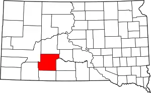 | |
| Towns | ||
| CDP | ||
| Former CDP | ||
| Unincorporated communities | ||
| Indian reservation | ||
| Ghost town | ||
| Footnotes | ‡This populated place also has portions in an adjacent county or counties | |
| ||