Irbid
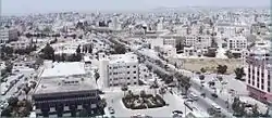
Irbid (Arabic: إرْبِد), known in ancient times as Arabella or Arbela (Άρβηλα in Ancient Greek), is the capital and largest city of the Irbid Governorate. It also has the second largest metropolitan population in Jordan after Amman, with a population of around 1,911,600. [3] Irbid is located about 70 kilometres (43 mi) north of Amman on the northern ridge of the Gilead, equidistant from Pella, Beit Ras (Capitolias), and Um Qais, and approximately 20 kilometres (12 mi) south of the Syrian border.
Irbid
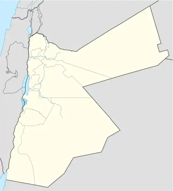
إربد | |
|---|---|
City | |
 | |
| Nickname(s): Bride of the North | |
 Irbid | |
| Coordinates: 32°33′0″N 35°51′0″E | |
| Grid position | 230/217 |
| Country | |
| Governorate | Irbid Governorate |
| Founded | 7000 BC |
| Government | |
| • Type | Municipality |
| • Mayor | Hussein Bani Hani |
| Area | |
| • City | 410 km2 (160 sq mi) |
| • Metro | 1,572 km2 (607 sq mi) |
| Elevation | 620 m (2,034 ft) |
| Population (2018)[2] | |
| • City | 907,675 |
| • Density | 2,200/km2 (5,700/sq mi) |
| Time zone | GMT +2 |
| • Summer (DST) | +3 |
| Area code(s) | +(962)2 |
| Website | www |
Irbid was built on successive Early Bronze Age settlements and was possibly the biblical Beth Arbel and the Arbila of the Decapolis, a Hellenistic league of the 1st century BCE through the 2nd century CE. The population of Irbid swelled in the late 19th century, and prior to 1948 it served as a significant centre of transit trade.[4]
Irbid is the second largest metropolitan in Jordan by population after Amman. But as a city Irbid is the third largest one after Amman and Az Zarqa. The province of Irbid Governorate has the second largest population, and the highest population density in the kingdom.
The city is a major ground transportation hub between Amman, Syria to the north, and Mafraq to the east.
The Irbid region is also home to several colleges and universities. The two most prominent universities are Jordan University of Science and Technology and Yarmouk University.
History
Artifacts and graves in the area show that Irbid was inhabited in the Bronze Age. Pieces of pottery and wall stones found at Tell Irbid were estimated to be made in the year 3200 B.C.[5] In the Hellenistic period, Irbid, then known as Arabella was a major trade center. Before the advent of Islam, Arabella was famous for producing some of the best wines in the ancient world. The area in the region had extremely fertile soil and moderate climate, allowing the growing of high quality grapes.
After the Muslim conquests, the city came under the rule of the Muslim Empire and became known as Irbid, at which time it shifted from wine to olive oil production. Wheat was also an important product in the area.[6]
In 1596 it appeared in the Ottoman tax registers named as Irbid, situated in the nahiya (subdistrict) of Bani Juhma, part of the Sanjak of Hawran. It had 72 households and 35 bachelors; all Muslims. The villagers paid a fixed tax-rate of 25% on agricultural products; including wheat (22,500 akçe), barley, summer crops, fruit trees, goats and bee-hives; in addition to a market toll. The total tax was 38,116 akçe.[7]
Present-day
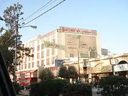
Irbid today combines the bustle of a provincial Middle Eastern town and the youthful nightlife of a typical college town.The city is home to four major universities: Yarmouk University, Jordan University of Science and Technology, Irbid National University and Jadara University. In addition, it is home for two campuses of Balqa Applied University and several private colleges. University Street, which defines the western border of the Yarmouk University campus, is popular with locals as well as with the occasional foreign visitors who stop by to relax in any of its numerous restaurants and cafés that open late into the night.
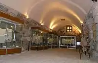
Though not usually a major tourist destination itself, Irbid is home to two notable museums: the Museum of Jordanian Heritage and the Jordan Natural History Museum, both on the campus of Yarmouk University. Furthermore, Irbid's strategic location in northern Jordan makes it a convenient starting point for tourists interested in seeing the northern Jordan Valley; visiting Umm Qais, Beit Ras (Capitolias), Pella, Ajloun, Umm el-Jimal, and other historical sites; or traveling on to Syria.
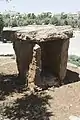 Irbid Museum Of Jordanian Heritage Dolmen
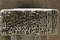 Irbid Museum Of Jordanian Heritage Decorated stone
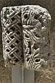 Irbid Museum Of Jordanian Heritage Decorated stone
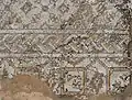 Irbid Museum Of Jordanian Heritage Mosaic
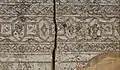 Irbid Museum Of Jordanian Heritage Mosaic
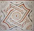 Irbid Museum Of Jordanian Heritage Mosaic
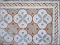 Irbid Museum Of Jordanian Heritage Mosaic
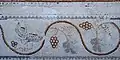 Irbid Museum Of Jordanian Heritage Mosaic
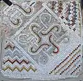 Irbid Museum Of Jordanian Heritage Mosaic
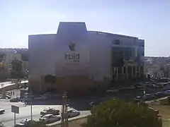
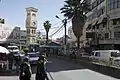 Jordan Irbid Centre
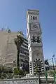 Jordan Irbid Clock tower
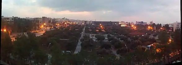
Geography
Situated in northern Jordan, in a fertile plateau. As of 2010, the city limits of Irbid had an area of 30 km2 of which most of it is classified as Residential areas making up 74.3% of the total area, followed by the Services areas occupying 9.5%, then Empty or unoccupied areas of 7.7%, then 4.2% is classified as Commercial areas, and 3.3% as Industrial areas, and finally Green areas (gardens) occupied 1% of the total city area.
Climate
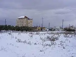
Irbid has a hot-summer Mediterranean climate (Köppen: Csa), common in the Levant region. Summers are hot at days with warm nights while winters are cool and wet with two snowy days in average
| Climate data for Irbid (1985-2014) | |||||||||||||
|---|---|---|---|---|---|---|---|---|---|---|---|---|---|
| Month | Jan | Feb | Mar | Apr | May | Jun | Jul | Aug | Sep | Oct | Nov | Dec | Year |
| Average high °C (°F) | 13.4 (56.1) |
14.3 (57.7) |
17.7 (63.9) |
22.8 (73.0) |
27.2 (81.0) |
30.0 (86.0) |
31.5 (88.7) |
31.8 (89.2) |
30.1 (86.2) |
26.7 (80.1) |
20.7 (69.3) |
15.5 (59.9) |
23.5 (74.3) |
| Daily mean °C (°F) | 9.35 (48.83) |
10.0 (50.0) |
12.85 (55.13) |
17.9 (64.2) |
21.05 (69.89) |
23.95 (75.11) |
25.8 (78.4) |
26.15 (79.07) |
24.55 (76.19) |
21.25 (70.25) |
15.6 (60.1) |
11.1 (52.0) |
18.30 (64.93) |
| Average low °C (°F) | 5.3 (41.5) |
5.7 (42.3) |
8.0 (46.4) |
11.3 (52.3) |
14.9 (58.8) |
17.9 (64.2) |
20.1 (68.2) |
20.5 (68.9) |
19.0 (66.2) |
15.8 (60.4) |
10.5 (50.9) |
6.7 (44.1) |
13 (55) |
| Average precipitation mm (inches) | 101.5 (4.00) |
110.5 (4.35) |
69.6 (2.74) |
20 (0.8) |
6.4 (0.25) |
1.6 (0.06) |
0.0 (0.0) |
0.0 (0.0) |
0.7 (0.03) |
13.9 (0.55) |
58.4 (2.30) |
81.9 (3.22) |
464.5 (18.3) |
| Average precipitation days | 11.3 | 10.6 | 9.4 | 4.6 | 2.0 | 0.2 | 0.0 | 0.0 | 0.2 | 3.2 | 6.0 | 9.6 | 57.1 |
| Source: Jordan Meteorological Department[8] | |||||||||||||
Districts of Greater Irbid Municipality
Irbid is divided into 23 city districts forming smaller cities within the metropolitan sphere of influence of Irbid:
.jpg.webp)
| District | District | District | |||
|---|---|---|---|---|---|
| 1 | Al'al | 9 | Foa'ra | 17 | Maru |
| 2 | Al Husn | 10 | Hakama | 18 | Mughayer |
| 3 | Al-Rabia | 11 | Hashemiyah | 19 | Naser |
| 4 | Al-Sareeh | 12 | Hawar | 20 | Rowdah |
| 5 | Barha | 13 | Huwwarah | 21 | Sal Area |
| 6 | Beit Ras | 14 | Kitim | 22 | Nu'aimah |
| 7 | Bushra (Jordan) | 15 | Kufr Jayez | 23 | Nuzha |
| 8 | Edun | 16 | Manarah ( hatim ) |
Cities, Towns, and Villages Many villages surround the city of Irbid including:
- Birqish-Kufr Rakeb (برقش - كفر راكب)
- Irbid
- Aṭ-Ṭaībah (الطيبة)
- Natfeh (ناطفه)
- Habaka (حبكا)
- Kufr-Rahta (كفررحتا)
- Al-Mazar Al-Shamali (المزار الشمالي)
- Hareema (حريما)
- Al'aal (علعال)
- Kufr Asad (كفرأسد)
- Kufr Aan (كفرعان)
- Jumha (جمحة)
- Kufryuba (كفر يوبا)
- Zahar (زحر)
- Qum (قمّ)
- Sammou' (سمّوع)
- Izmal (زمال)
- Kufrelma (كفر الماء)
- Sawm (سوم)
- Saydoor (صيدور)
- Kufr Soom (كفر سوم)
- Sama al-Rousan (سما الروسان)
- Ibser Abu Ali
- Assarieh (الصريح)
- Aidoon (ايدون)
- Al Husn (الحصن)
- Baleela (بليلة)
- Beit Ras (بيت راس)
- Dowgarah (دوقرة)
- En-Nu`aymeh (النعيمة)
- Habaka (حبكا)
- Houfa Al-Westiyyah
- Qumaim (قميم)
- Bushra (Jordan) (بشرى)
- Huwwarah (حوارة)
- Imrawah
- Al Ramtha (الرمثا)
- Sal (سال)
- Samad (صمد)
- Al Shajara (الشجرة)
- Al Turrah (الطرة)
- Fou'ara (فوعرة)
- Zoubia ( زوبيا)
- Jdaita (جديتا)
- Rehaba (رحابا)
- Kufor Alma (كفرالماء )
- Kharja (خرجا)
- Dair Yousef (دير يوسف)
- Dair Abos'eed (دير أبو سعيد)
- Kufor Kefia
- Summer (سمر)
- E'nbeh (عنبة)
- Bayt Yafa (بيت يافا)
- Dair Esse'neh (دير السعنة)
- Mandah
- Maru (Irbid) (مرو)
- Zabda (زبدة)
- Bait Idis (بيت ايدس)
- Makhraba (مخربا)
- Al-Murajjam
Hospitals
This is a list of hospitals in Irbid. (sorted by hospital name)
- Abu Obaida Hospital
- Al-Najah Hospital
- Al-Qawasmi Hospital
- Al-Ramtha Hospital
- Al-Yarmouk Hospital
- Ibn-Alnafees Hospital
- Irbid Islamic Hospital
- Irbid Speciality Hospital
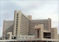
- King Abdullah University Hospital
- Muaath Bin Jabal Hospital
- Princess Badeea Hospital
- Princess Basma Hospital
- Princess Rahma Hospital
- Princess Raya Hospital
- Rahbat Al-Wardieh Hospital
- Roman Catholic Hospital
Education
As of 2007, there were 70,000 registered students in Irbid's 10 universities, community colleges and institutes, of whom 8,000 were international students from 47 countries.[9] This high concentration of institutions of higher education has played a key role in carving a unique identity of the city. The largest universities in Irbid are:
- Yarmouk University[10]
- Jordan University of Science and Technology[11]
- Irbid National University[12]
- Al-Balqa` Applied University (Irbid campus)[13]
- Jadara University[14]
Private Schools in Irbid (sorted by alphabetical order):
- Adventist School
- Al-Arabiya Model School
- Al-Manara Schools [P]
- Al-Nahda Private School [P]
- Alwatany center
- American University School of the Middle East [15]
- Dar Al Uloum Schools [P]
- Greek Catholic School
- Irbid International Schools
- Irbid Model School [P]
- Islamic School [P] (Al-Madares Al-Islamiya)
- Jeel Al Jadeed School
- Jordan National Schools [P]
- Khawla Bint Alazwar [P]
- Rosary Sisters School
- Shoa'a Alammel School [P]
- Yarmouk University Model School [P]
Economy
Most of the city's economy is based on the services sector, that is directly or indirectly related to the higher education institutions in the city, as an example there are 26 book publishing companies in the city. The number of internet cafes per capita is the highest in the world that took Irbid to the Guinness Book of World Records. Irbid is considered the cultural capital of Jordan.[16] There is one Qualifying Industrial Zone in Irbid.
Sports
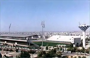
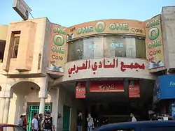
The Irbid-based club Al-Hussein (Irbid) was ranked fourth in the Jordanian football premier league in 2008. Its home matches are held in Prince Hasan Youth City's Stadium. The other major football club in Irbid is Al-Arabi. Established in 1945, it is one of the oldest athletic clubs in the country. As of 2008, there are 22 cultural and sport clubs registered in Irbid. Irbid hosted the 1999 Pan Arab Games.
Notable people
References
- http://dosweb.dos.gov.jo/ar/
- http://dosweb.dos.gov.jo/DataBank/Population_Estimares/Municipalities.pdf
- http://dosweb.dos.gov.jo/DataBank/Population_Estimares/Municipalities.pdf
- Britannica Archived 21 April 2019 at the Wayback Machine
- [Lenzen, C. J.; Gordon, R. L.; and Mcquitty, A. M. 1985; Excavation at Tell Irbid and Beit Ras, 1985. ADAJ. Vol 29, Pp 151 – 159]
- Haitham Mahmoud El-Hurani, Mohamed (1975). "Economic analysis of the development of the wheatsubsector of Jordan". Iowa State University Digital Repository. Retrieved 17 September 2020.
- Hütteroth and Abdulfattah, 1977, p. 203
- "Weather Information for Irbid". Jordan Meteorological. Retrieved 27 November 2016.
- تقرير اÙ"ØØ· اÙ"اساسي اÙ"اقتصادي Ù"اربد-2007
- Yarmouk University
- "Jordan University of Science and Technology". Retrieved 24 November 2016.
- Irbid National University
- Balqa' Applied University
- Al-Issa, Mohammad Omar. "Jadara University". Retrieved 24 November 2016.
- "American University School Of The Middle East". www.sau.edu.jo. Retrieved 10 December 2019.
- Greater Irbid Municipality Archived 1 April 2009 at the Wayback Machine
- "Kardeş Şehirlerimiz" (PDF). gaziantep.bel.tr (in Turkish). Gaziantep. 2013. p. 43. Retrieved 30 June 2020.
- "友好城市". zhengzhou.gov.cn (in Chinese). Zhengzhou. Retrieved 30 June 2020.
Bibliography
- Hütteroth, Wolf-Dieter; Abdulfattah, Kamal (1977). Historical Geography of Palestine, Transjordan and Southern Syria in the Late 16th Century. Erlanger Geographische Arbeiten, Sonderband 5. Erlangen, Germany: Vorstand der Fränkischen Geographischen Gesellschaft. ISBN 3-920405-41-2.
- El-Khouri, Lamia, "Roman and Byzantine Settlements in the Region of West Irbid," Palestine Exploration Quarterly, 139,3 (2007), 166-185.
External links
| Wikivoyage has a travel guide for Irbid. |
- Irbid - Jordan Tourism Board
- Beautiful Natural Scenes From Al-Koura Department - Irbid
- Irbid News
- Greater Irbid Municipality
- Irbid Guide
- Irbid Discussion Forum (in Arabic)
- Al Husun FM Radio Station
| Capital | |
|---|---|
| Departments |
|
| Cities and towns | |
| Others | |
| Authority control |
|---|