Istanbul Metro
The Istanbul Metro (Turkish: İstanbul metrosu) is a rapid transit railway network that serves the city of Istanbul, Turkey. It is operated by Metro Istanbul (known as İstanbul Ulaşım A.Ş. before 2016[3]), a public enterprise, controlled by the Istanbul Metropolitan Municipality. The oldest section of the metro is the M1 line, which opened in 1989; it now includes 104 stations in service,[1] with 64 more under construction.
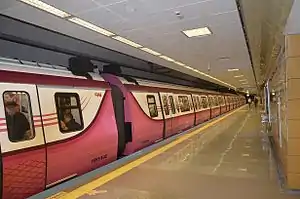
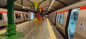 Two trains waiting at Bogazici Universitesi on the M6 line | |
| Overview | |
|---|---|
| Native name | |
| Owner | Istanbul Metropolitan Municipality |
| Locale | Istanbul, Turkey |
| Transit type | Rapid transit |
| Number of lines | 7 (6 more under construction) |
| Number of stations | 104 in service;[1] 64 under construction |
| Daily ridership | 1,36 million |
| Annual ridership | 495 million (2019)[2] |
| Website | Metro Istanbul (in English) |
| Operation | |
| Began operation | 3 September 1989 |
| Operator(s) | |
| Number of vehicles | 647[1] |
| Technical | |
| System length | 133 km (82.6 mi)[1] |
| Track gauge | 1,435 mm (4 ft 8 1⁄2 in) (standard gauge) |
The system consists of seven lines named M1, M2, M3, M4, M5, M6 and the M7. More lines are under construction or planned: M8 (Bostancı-Dudullu) will be on the Asian side, while M7 (Kabataş-Mahmutbey), M9 (Ataköy-İkitelli) will be on the European side.[4]
Istanbul Metro is connected with the underground systems of the Marmaray tunnel (which connects the lines on the city's European and Asian sides) and the F1 funicular, and with the surface network of the T1 and T4 tram systems as well as the T5 tram.[5]
History

The oldest underground urban rail line in Istanbul is the Tünel, which entered service on January 17, 1875.[6] It is the world's second-oldest underground urban rail line after the London Underground which was built in 1863,[7] and the first underground urban rail line in continental Europe.
The first master plan for a full metro network in Istanbul, titled Avant Projet d'un Métropolitain à Constantinople and conceived by the French engineer L. Guerby, dates to January 10, 1912.[8] The plan comprised a total of 24 stations between the Topkapı and Şişli districts and included a connection through the Golden Horn. Each station would have a 75-metre platform next to the rail line, while the distance between stations varied from 220 to 975 metres. The blueprints of the project, which was never realized, are today displayed at the Istanbul Technical University Museum.
In 1936 the French urban planner Henri Prost proposed a metro network between the districts of Taksim and Beyazıt, to the north and south of the Golden Horn, respectively.[9][10] In October 1951 the Dutch firm Nedeco proposed a similar route between Taksim and Beyazıt, and in September 1952 the Director of the Paris Transportation Department, Marc Langevin, prepared a 14-chapter report together with his associate Louis Meizzonet for the implementation of the project and its integration with the other means of public transportation in the city. However, these plans never came into effect and all proposals were put on hold until 1987, when the planning for the current Istanbul Metro was made.
Construction works for the first 'modern' mass transit railway system started in 1989. The M1 was initially called "Hafif Metro" (which literally translates as "light metro"). Although it was built as a fully grade separated line, the M1 line operates with shorter trainsets and shorter station platforms than is standard on a traditional metro line, hence its "light metro" designation. The M1 line was later extended from Aksaray towards the western suburbs, reaching Atatürk Airport in the southwest in 2002.[11] Construction of the M2, began on September 11, 1992, but faced many challenges due to the numerous archaeological sites that were discovered during the drilling process, which slowed down or fully stopped the construction of many stations especially at south. Taking into account the seismic activity in Istanbul, the entire network was built with the cut-and-cover method to withstand an earthquake of up to 9.0 on the Richter magnitude scale.[12][13]
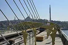
The first section between Taksim and 4. Levent entered service, after some delays, on September 16, 2000. This line is 8.5 km (5.3 mi) long and has 6 stations, which all look similar but are in different colours. In 2000, there were 8 Alstom-built 4-car train sets in service, which ran every 5 minutes on average and transported 130,000 passengers daily. On January 30, 2009, the first train sets built by Eurotem entered service.[14] Eurotem will build a total of 92 new wagons for the M2 line.[14][15] As of January 30, 2009, a total of 34 trainsets, each with 4 cars, were being used on the M2 line.[15] A northern extension from 4. Levent to Maslak was opened on January 30, 2009.[16] On September 2, 2010 the northern (temporary) terminus Darüşşafaka followed.[17] The southern extension of the M2 line from Taksim to Yenikapı, across the Golden Horn via Haliç station on the bridge and underground through the historic peninsula, entered service on 15 February 2014. The Taksim-Yenikapı extension is 5.2 km long, with four stations. The total cost of the extension was $593 million.[18] At Yenikapı it will intersect with the extended M1 line and the Marmaray commuter line.
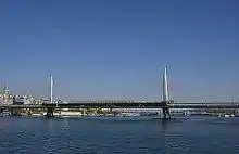
The trip between the Şişhane station in Beyoğlu and the Haciosman station in Maslak is 20 km (12.4 mi) long and takes 27 minutes; including Şişhane - Taksim (1.65 km, 2 minutes), Taksim - 4. Levent (8.5 km, 12 minutes), and 4. Levent - Haciosman (8.1 km, 12 minutes.)[19][20] The total length of the European side of the M2 line will reach 23 km (14.3 mi) when all 16 stations from Hacıosman to Yenikapı will be completed;[21][22][23] not including the 936-metre-long Golden Horn Metro Bridge,[24] the 0.6 km long Taksim-Kabataş tunnel connection with the Seabus port,[25] and the 0.6 km long Yenikapı-Aksaray tunnel connecting the M1 line to the Yenikapı Transfer Center.[23]
On the Asian side, construction is in progress of the remaining portion of the 26.5 km (16.5 mi) long M4 line from Kadıköy to Kaynarca, yielding a total of 19 stations. It cost € 751 million and was built by the Astaldi / Makyol / Gülermak consortium.[26] The first section opened on August 17, 2012, terminating in Kartal. Construction of the 20 km (12.4 mi) long M5 line from Üsküdar via Ümraniye to Sancaktepe started in March 2012.[27]

Operations
The Metro operates from 06:00 a.m. to 00.00 a.m. every 6–10 minutes. M2 Yenikapı - Hacıosman operates from 06:00 a.m. to 00.00 a.m. line During peak-hours the intervals reduce to 3 minutes. There is a flat fare – 3.50 TL with Istanbulkart only (7 TL with token), paid in tokens (which are also valid on the funicular, modern tram, buses and trans-Bosporus ferry boats). The Marmaray fare is 7.75TL, but it refunds a portion of it depending on the number of stops you traveled through. The Metrobüs works in a similar way and the fare is 3.85TL with refunds. The refunds can be collected from the refund machines that can be found on each station. All means of transport provide discount for interchanges except Metrobüs.[28] Akbil tickets/cards are also valid, which is the most popular method for long distance traveling. The Akbil ticket is valid on all metros, trams, funiculars, ferry boats and buses. Ferryboat and bus fares are not flat, so the price of this transfer ticket also varies depending on the distance to be covered on bus or ferryboat.
Night operations
In August 2019, the Mayor of Istanbul Ekrem İmamoğlu, announced that most lines of the Istanbul are going to provide 24 hours service.[29] As per 31 August, the Istanbul metro provide 24 hours service at weekends and public holidays. M1A Yenikapi-Ataturk Airport, M1B Yenikapi-Kirazli, M2 Yenikapi-Haciosman, M4 Kadikoy-Tavsantepe, M5 Uskudar-Cekmekoy and M6 Levent-Bogazici University/Hisarustu.[30]
Lines

This table lists the metro lines currently in service on the Istanbul Metro. An additional five lines are under-construction or planned.
| Line | Route | Opened | Length | Stations | Notes[31] |
|---|---|---|---|---|---|
| Yenikapı ↔ Atatürk Airport / Kirazlı | 1989[32] | 26.1 km[32] | 23[32] | The 0.7 km extension to Yenikapi opened on 9 November 2014.[33] Operates from 06:00 a.m. to 00.00 a.m. | |
| Yenikapı ↔ Hacıosman | 2000[34] | 23.5 km[34] | 16[34] | Southern extension (3.5 km stretch to Yenikapı, with 3 stations) completed in February 2014. Operates from 06:15 a.m. to 00.00 a.m. | |
| Kirazlı ↔ Metrokent–Olimpiyat | 2013[35] | 15.9 km[35] | 11[35] | A southern extension (9.0 km to Bakırköy, with 7 stations) is under construction. Operates from 06:00 a.m. to 00.00 a.m. | |
| Kadıköy ↔ Tavşantepe | 2012[36] | 26.5 km[36] | 19[36] | An extension 7.4 km to Sabiha Gökçen International Airport with 4 more stations is under construction. Operates from 06:00 a.m. to 00.00 a.m. | |
| Üsküdar ↔ Çekmeköy | 2017[37] | 20 km[37] | 16[37] | Opened on 15 December 2017. Operates from 06:00 a.m. to 00.00 a.m. Time from Üsküdar to Çekmeköy is 27 min. | |
| Levent ↔ Boğaziçi Üniversitesi/Hisarüstü | 2015[38] | 3.3 km[38] | 4[38] | The Mini-Metro is actually a light metro line. | |
| Mecidiyeköy ↔ Mahmutbey | 2020[39] | 18 km[39] | 15[39] | Opened partially on 28 October 2020. Mecidiyeköy-Kabataş section is still under construction. | |
| TOTAL: | 133 km[1] | 104[1] | |||
Stations

The Istanbul Metro system has a total of 89 stations in operation with 50 more under construction. Since the majority of the system is underground, stations are generally accessed going down from street level. At every entrance to the metro is a post with the Istanbul metro "M" logo and the station name underneath it. Entrances are usually built into sidewalks along a street, although many stations of newer lines have their entrances from street level on small plazas.
Out of the 89 operating stations of the Istanbul Metro,
- 73 are fully underground
- 5 are elevated stations
- 9 are on an embankment or at-grade
- 2 are partially underground
Mezzanines
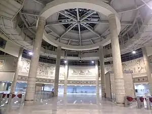
Most stations have a mezzanine directly below street level, which allow passengers to enter the stations from multiple locations and proceed to the correct platform without having to cross any streets. Inside the mezzanines are ticket machines and turnstiles, where passengers must pay to enter fare control zones and proceed to the trains.
In some stations, mezzanines connect directly to nearby buildings and structures, such as shopping malls or business centers. Each station concourse or mezzanine are patrolled by Istanbul Metro security guards to prevent fare evasion and crime.
Stations with large walkways toward different exits, such as Taksim also have travelators to cover the long walking distances.
Upon entering the station, passenger may use ticket vending machines or manned ticket booths to purchase their fare, which can be stored on the Istanbulkart contactless smart card. After entering the fare-controlled area, via the turnstiles, passengers may continue further down to the platform level.
Platforms
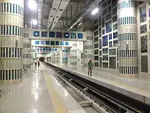
Since the different lines of the Istanbul Metro have different specifications, most notably car length, there is no uniform length for platforms. The oldest platforms of the network, built between 1989 and 2002 on the M1 line, are 100 m (330 ft) and can accommodate trains up to 4 cars long. Platforms on the M2, M3 and M4 lines span about 150 m (490 ft) and can each accommodate trains up to 8 cars long. Platforms on the M5 line can accommodate up to 6-car trains, whiles platforms on the M6 line accommodate 4-car trains.
Sections of platforms are subject to close during off-peak hours, especially on the M2 line. While platforms on the M2 line are open fully during peak hours, capacity is reduced to 4-car trains during off-peak hours. Platforms on the M5 line are protected by platform edge doors. Except on funicular lines, most platforms of the Istanbul Metro consist of two side platforms or one island platform. Five stations consist of two island platforms, serving three tracks. These stations are Otogar on the M1 line, Yenikapı and Sanayi on the M2 line, Olimpiyat on the M3 line, and Bostancı on the M4 line.
Technical specifications

This table lists technical characteristics of the metro lines that are currently in service or under construction.
| Line | Route | Gauge | Voltage | Conductor system | Notes |
|---|---|---|---|---|---|
| Yenikapı ↔ Atatürk Airport / Kirazlı | 1,435 mm (4 ft 8 1⁄2 in) standard gauge | 750 V DC | Overhead line | ||
| Yenikapı ↔ Hacıosman | 1,435 mm (4 ft 8 1⁄2 in) standard gauge | 750 V DC | Third rail | ||
| Kirazlı ↔ Metrokent–Olimpiyat | 1,435 mm (4 ft 8 1⁄2 in) standard gauge | 1,500 V DC | Overhead line | ||
| Kadıköy ↔ Tavşantepe | 1,435 mm (4 ft 8 1⁄2 in) standard gauge | 1,500 V DC | Overhead line | ||
| Üsküdar ↔ Çekmeköy | 1,435 mm (4 ft 8 1⁄2 in) standard gauge | 1,500 V DC | Overhead line | ||
| Levent ↔ Boğaziçi Üniversitesi/Hisarüstü | 1,435 mm (4 ft 8 1⁄2 in) standard gauge | 750 V DC | Third rail | Line branching from | |
| Kabataş ↔ Mahmutbey | 1,435 mm (4 ft 8 1⁄2 in) standard gauge | 1,500 V DC | Overhead line | ||
| Bostancı ↔ Dudullu | 1,435 mm (4 ft 8 1⁄2 in) standard gauge | 1,500 V DC | Overhead line | Under construction | |
| Ataköy ↔ Olimpiyat | 1,435 mm (4 ft 8 1⁄2 in) standard gauge | 1,500 V DC | Overhead line | Under construction | |
| Pendik Çarşı ↔ Sabiha Gökçen Airport | 1,435 mm (4 ft 8 1⁄2 in) standard gauge | 1,500 V DC | Overhead line | Under construction | |
| Gayrettepe ↔ Istanbul Airport | 1,435 mm (4 ft 8 1⁄2 in) standard gauge | 1,500 V DC | Overhead line | Under construction | |
| Göztepe ↔ Ümraniye | 1,435 mm (4 ft 8 1⁄2 in) standard gauge | 1,500 V DC | Overhead line | Under construction | |
| Hastane ↔ Yenidoğan | 1,435 mm (4 ft 8 1⁄2 in) standard gauge | 1,500 V DC | Overhead line | Under construction |
Alignment and interchanges

The lines have no connection between them. Apart from the Haliç station on the M2 line and about half of the M1 (mostly M1A) line, the lines are fully underground. All station names are on the bus lines as well.
The M2 line has an interchange between F1 in Taksim and an interchange tunnel with the Zincirlikuyu Metrobus station at the Gayrettepe station.[40] There is also a transfer station at Yenikapı with Marmaray, M1 line and İDO Ferry Port; from where it is possible to take the high-speed catamaran Seabus departing for Bursa, Bandırma or Yalova; as well as the other Seabus ports of İstanbul such as Bostancı, Kadıköy, Bakırköy and Kabataş.
The M3 line has an interchange with the M1B line at the Kirazlı station.
The M4 line has a vapur (traditional ferry), motorboat, İDO and nostalgic tram interchange at Kadıköy which is the heart of İstanbul's Asian side. One can also interchange to Marmaray at the Ayrılık Ceşmesi station. Also at Ünalan / Uzunçayır, the line has a Metrobus interchange just like Gayrettepe in M2.
The M5 line has an interchange with the Marmaray and İDO at the Üsküdar station. Also at Altunizade the line has a Metrobus interchange.
The M6 line has an interchange with the M2 line at the Levent station.
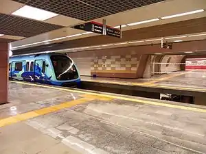
Rolling stock
Although line M1 is a (light) metro line, its rolling stock—in use since 1989—is made up of typical ABB light rail vehicles (LRVs). These are partly the same as those used on the T4 tramway line.
The first Istanbul full metro rolling stocks, which entered service on September 16, 2000 on the Taksim - 4. Levent line, were built by Alstom. These trains are air conditioned and equipped with LCD screens, and share a similar exterior design to the first three generations of rolling stock used on the Caracas Metro in Venezuela.
On January 30, 2009, the first 8 trains (each with 4 wagons) built by Eurotem (the Turkish factory of Hyundai Rotem) entered service.[41] Today the system has 268 trains.[1] These trains are also air conditioned and equipped with LCD screens, as well as dynamic route map showing the location and direction of the train.[42]
In September 2009, CAF signed a contract to supply 144 units for the M4 line, amounting to 1.156.159 euros. These metro units are formed with 4 cars for a total length of 90 meters and have a maximum transport capacity of 1300 passengers.[43]
Future extensions
As part of the Istanbul Metropolitan Municipality's goal of expanding the size of the city's rail transportation network to 630 km (390 mi) by 2030,[44] the Istanbul Metro has several lines that, as of 2018, are under construction or planned. Since the city does not have a widespread railway network, the Metropolitan Municipality aims to connect urban areas of the city that do not have access the Istanbul's two coastal railways with metro lines.
None of the current Istanbul Metro lines cross the Bosphorus; lines are wholly located either on the European side or the Asian side of the city. In 2019, The Ministry of Transport and Infrastructure began the planning of a 30.2 km (18.8 mi) line that would link İncirli with Söğütlüçeşme via a tunnel under the Bosphorus also designed to accommodate road traffic.[45]
The following metro lines are under construction:
| Line | Route | Length | Stations | Notes[46] |
|---|---|---|---|---|
| Bakırköy-İDO ↔ Kirazlı | 9.0 km (under construction) | 7 (under construction) | Line under construction, opening: 2022. | |
| Tavşantepe ↔ Sabiha Gökçen Airport | 7.4 km (under construction) | 4 (under construction) | Line under construction, opening: 2021. | |
| Tavşantepe ↔ Tuzla | 7.90 km (under construction) | 7 (under construction) | Line under construction, opening: 2023. | |
| Çekmeköy–Sancaktepe ↔ Sultanbeyli | 10.90 km (under construction) | 9 (under construction) | Line under construction, opening: 2022. | |
| Kabataş ↔ Mecidiyeköy | 6.5 km (under construction) | 4 (under construction) | Line under construction, partially (Mecidiyeköy-Mahmutbey) opened: 2020. | |
| Bostancı-İDO ↔ Dudullu | 14.27 km (under construction) | 13 (under construction) | Line under construction, opening: 2021. | |
| Ataköy ↔ İkitelli | 13.0 km (under construction) | 12 (under construction) | Line under construction, partially (İkitelli Sanayi-Bahariye) opening: 2021. | |
| Gayrettepe ↔ İstanbul New Airport | 37.2 km (under construction) | 9 (under construction) | Line under construction, opening: 2021. | |
| Göztepe ↔ Ümraniye | 13.03 km (under construction) | 11 (under construction) | Line under construction, opening: 2023. | |
| TOTAL: | 105.37 km[1] | 64[1] | ||
Construction of the following metro lines are planned or on hold:
| Line | Route | Length | Stations | Notes[46] |
|---|---|---|---|---|
| Kirazlı ↔ Halkalı | 9.70 km (on hold) | 9 (on hold) | Line on hold. | |
| Yenikapı ↔ Sefaköy | 14 km (tender phase) | 11 (tender phase) | Line in the tender phase. | |
| Başakşehir ↔ Kayaşehir | 6.20 km (on hold) | 5 (on hold) | Line on hold. | |
| Mahmutbey ↔ Esenyurt | 18.50 km (on hold) | 12 (on hold) | Line on hold. | |
| Pendik Sahil ↔ Kaynarca Merkez | 5.10 km (on hold) | 2 (on hold) | Line on hold. | |
| Hastane ↔ Yenidoğan | 6.90 km (on hold) | 6 (on hold) | Line on hold. | |
European side

- M3 metro line extension
- Bakırköy–Kirazlı metro line. The 9 km extension project will integrate the line with Marmaray in its Özgürlük Meydanı Station, and ido ferry station with Bakrköy İdo station.[47]
- M7 metro line extension
- The M7 Kabataş-Mecidiyeköy metro line extension is under construction.The extension will have 4 new stations, and is expected to go into service in 2022.It will interchange with ferries at Beşiktaş and Kabataş stations,and with T1 trams line at Kabataş station.
- M9 metro line
- M9 Ataköy-İkitelli:
- Ataköy (under construction)
- Yenibosna (under construction)
- Çobançeşme (under construction)
- Kuyumcukent (under construction)
- Doğu Sanayi (under construction)
- Mimar Sinan Avenue (under construction)
- Evren District (under construction)
- İkitelli Junction (under construction)
- Mehmet Akif (under construction)
- Bahariye (under construction)
- MASKO (under construction)
- İkitelli Sanayi (under construction)
- Istanbul Airport metro line
- The Gayrettepe-Tayakadın metro line is under construction tender in 2016. The new airport will be connected with a metro system via a line starting from Gayrettepe station, with a total length of 33 km that will only be a 26-minute ride.[48] A partial opening is expected in the second half of 2020,[49] but it does not seem to be realistic.
Asian side
The Üsküdar–Beykoz metro line will run parallel to the Bosporus shoreline.
- M4 metro line
- M4 Kadıköy–Tavşantepe is being extended, and will eventually connect Sabiha Gökçen International Airport:
- Hastane (under construction)
- Şeyhli (under construction)
- Kurtköy (under construction)
- Sabiha Gökçen International Airport (under construction)
- M8 Metro Line (Bostancı-Dudullu) (under construction)
- Bostancı İDO
- Suadiye
- Üstbostancı
- Kozyatağı
- Küçükbakkalköy
- İçerenköy
- Kayışdağı
- Türkiş Blokları
- İMES
- MODOKO
- Dudullu
- Yukarı Dudullu
- Depot
- M12 Metro Line (Göztepe-Ataşehir-Ümraniye) (under construction)
This line will connect the underserved Ataşehir district with the regional centres of densely populated Ümraniye and integrate those districts into the İstanbul rapid rail system.
- 60. Yıl Parkı
- Tütüncü Mehmet Efendi (Marmaray Interchange)
- Sahrayıcedit
- Yenisahra (M4 Line Interchange)
- Ataşehir
- Finans Merkezi
- Site
- Atakent
- Çarşı (M5 Line Interchange)
- SBÜ Hastanesi
- Kazım Karabekir
Network overview
Subway, commuter line (Marmaray), light-rail, cable car, ropeway and Metrobus (as at January 2021):
- In operation: 309.5 km / 282 stations
- Under construction: 113.9 km / 72 stations
- Planned: 100.3 km / 53 stations
- Sum: 523.7 km / 407 stations
| In operation | Under construction
(new lines or extensions) |
In Planning, project on hold or
in revision | |||||||||||
|---|---|---|---|---|---|---|---|---|---|---|---|---|---|
| Line | Length | Opening
Date |
Length
km |
Stat. | under-
ground |
Notes | Length
km |
Stat. | Notes | Length
km |
Stat. | Notes | |
| METRO | Yenikapı ↔ Atatürk Havalimanı | Sep 3, 1989 | 20.3 | 18 | 14 | ||||||||
| Yenikapı ↔ Kirazlı | Mar 31, 2013 | 5.8 | 5 | 14 km/ 13 stations
to Yenikapi in total |
9.7 | 9 | Kirazlı ↔ Halkalı | ||||||
| Yenikapı ↔ Hacıosman bzw. Seyrantepe | Sep 16, 2000 | 23.5 | 16 | 15 | 14 | 10 | Yenikapı ↔ Sefaköy | ||||||
| Kirazlı ↔ Metrokent bzw. Olimpiyat | Mar 31, 2013 | 15.9 | 11 | 11 | 9 | 7 | Bakırköy-İDO ↔ Kirazlı | 6.2 | 4 | Başakşehir ↔ Kayaşehir | |||
| Kadıköy ↔ Tavşantepe | Aug 17, 2012 | 26.5 | 19 | 19 | 7.4 | 4 | Tavşantepe ↔ Sabiha-Gökçen Airport | 7.9 | 6 | Tavşantepe ↔ Tuzla | |||
| Üsküdar ↔ Çekmeköy-Sancaktepe | Oct 21, 2018 | 20.0 | 16 | 16 | 10.9 | 8 | Çekmeköy–Sancaktepe ↔ Sultanbeyli | ||||||
| Levent ↔ Hisarüstü | Apr 19, 2015 | 3.3 | 4 | 4 | |||||||||
| Şişli Mecidiyeköy ↔ Mahmutbey | Oct 28, 2020 | 18.0 | 15 | 13 | 6.5 | 4 | Kabataş ↔ Mecidiyeköy | 18.5 | 9 | Mahmutbey ↔ Esenyurt | |||
| Dudullu ↔ Bostancı IDO | - | 14.3 | 13 | ||||||||||
| Ataköy ↔ İkitelli | - | 13.4 | 12 | ||||||||||
| Pendik ↔ Sabiha-Gökçen Airport | - | 5.1 | 2 | 9.01 km/ 6 stations to Sabiha-Gökçen in total | |||||||||
| Gayrettepe ↔ Istanbul Airport | - | 37.2 | 9 | 32 | 7 | Istanbul Airport ↔ Halkalı | |||||||
| Göztepe ↔ Ümraniye | - | 13.0 | 11 | ||||||||||
| Hastane ↔ Yenidoğan | - | 6.9 | 6 | ||||||||||
| SUBTOTAL: | 133.3 | 104 | 92 | 111.7 | 68 | 100.3 | 53 | ||||||
| Suburban | Halkalı ↔ Gebze | Oct 29, 2013 | 76.6 | 43 | 3 | operated by TCDD | |||||||
| SUBTOTAL: | 76.6 | 43 | 3 | ||||||||||
| TROLLEY | Kabataş ↔ Bağcilar | Jun 13, 1992 | 18.2 | 31 | 0 | ||||||||
| Taksim ↔ Tünel | Dec 29, 1990 | 1.6 | 5 | 0 | operated by IETT | ||||||||
| Kadıköy-Moda ring line | Nov 1, 2003 | 2.6 | 10 | 0 | |||||||||
| Topkapı ↔ Mescid-i Selam | Sep 12, 2007 | 15.3 | 22 | 7 | |||||||||
| Cibali ↔ Alibeyköy | Jan 1,
2021 |
8.8 | 12 | 0 | 1.3 | 2 | Eminönü ↔ Cibali | ||||||
| SUBTOTAL: | 46.5 | 80 | 7 | 1.3 | 2 | ||||||||
| CABLE
CAR |
Taksim ↔ Kabataş | Jun 30, 2006 | 0.6 | 2 | 2 | ||||||||
| Tünel ↔ Karaköy | Jan 17,
1875 |
0.6 | 2 | 0 | operated by IETT | ||||||||
| Vadistanbul ↔ Seyrantepe | Oct 29, 2017 | 0.8 | 2 | 0 | |||||||||
| Boğaziçi Üni. ↔ Hisarüstü–Aşiyan | - | 0.85 | 2 | ||||||||||
| SUBTOTAL: | 1.9 | 6 | 2 | 0.9 | 2 | ||||||||
| ROPEWAY | Maçka ↔ Taşkışla | Apr 11,
1993 |
0.3 | 2 | 0 | ||||||||
| Eyüp ↔ Piyerloti | Nov 30, 2005 | 0.4 | 2 | 0 | |||||||||
| SUBTOTAL: | 0.7 | 4 | 0 | ||||||||||
| METROBUS | Beylikdüzü ↔ Söğütlüçeşme | Sep 17, 2017 | 50.5 | 45 | 0 | operated by IETT | |||||||
| SUBTOTAL: | 50.5 | 45 | 0 | ||||||||||
| TOTAL | 309.5 | 282 | 104 | 113.9 | 72 | 100.3 | 53 | ||||||

Network map

See also
References
- "Lines in Operation" [Rail Systems]. Metro İstanbul. 2020. Retrieved 2020-05-13.
- "Istanbul Metro Passenger Statistics" (PDF). Istanbul Metro (in Turkish). January 6, 2020. Retrieved 2020-01-16.
- "Archived copy". Archived from the original on 2018-01-12. Retrieved 2017-12-06.CS1 maint: archived copy as title (link)
- Rayli Sistemler. Ibb.gov.tr. Retrieved on 2013-08-12.
- "Cibali-Alibeyköy Cep Otogarı Tramvay Hattı". www.metro.istanbul. Retrieved 2021-01-04.
- "Tunnel". IETT. Retrieved 2014-12-18.
- "A brief history of the Underground - London Underground milestones". Transport for London. Retrieved 2014-06-06.
- CONSORTIUM DE CONSTANTINOPLE, Bruxelles (French)
- "TMMOB: "İstanbul Ulaştırmasının Dünü, Bugünü" (Güngör Evren)" (PDF).
- "Yıldız Technical University Faculty of Architecture Magazine (Megaron): "İki Fransız mimarı Henri Prost ve August Perret'nin İstanbul ile ilgili çalışmaları" (Işık Aydemir)" (PDF). Archived from the original (PDF) on 2016-03-04. Retrieved 2012-07-25.
- "Europe > Turkey > ISTANBUL Metro". UrbanRail.Net. Retrieved 2013-08-12.
- "10 soruda İstanbul Metrosu..." arsiv.ntv.com.tr.
- "Istanbul Metropolitan Municipality: "İstanbul Metrosu: Taksim – 4. Levent"". Archived from the original on June 26, 2009.
- "Istanbul Metropolitan Municipality: Taksim-Yenikapı Metro Hattı". Ibb.gov.tr. 2002-01-23. Archived from the original on 2009-05-05. Retrieved 2009-07-21.
- "İstanbul Ulaşım: Metro Şişhane'den Maslak'a uzandı". Istanbululasim.com. 2009-01-30. Retrieved 2009-07-21.
- "Metro, Şişhane'den Maslak'a uzadı". Istanbul Metropolitan Municipality. 2009-01-30. Retrieved 2009-07-20.
- "ist-M.04:02 » M2 Yenikapı-Hacıosman Metro Hattı - Sayfa 11 - Ulaşım Türkiye". www.istanbululasim.net.
- "Taksim-Yenikapı Metro Hattı". Istanbul Metropolitan Municipality. Archived from the original on 2009-04-24. Retrieved 2009-07-20.
- "Anasayfa - Raytürk". Archived from the original on 2018-06-12. Retrieved 2010-09-18.
- "METRO İSTANBUL". www.metro.istanbul.
- "Istanbul Metropolitan Municipality: Taksim - 4. Levent metro hattı". Archived from the original on June 26, 2009.
- "Istanbul Metropolitan Municipality: Taksim-Ayazağa-Hacıosman metro hattı". Archived from the original on May 6, 2009.
- "Istanbul Metropolitan Municipality: Taksim-Yenikapı metro hattı". Archived from the original on April 24, 2009.
- "Istanbul Metropolitan Municipality: Golden Horn metro bridge". Archived from the original on December 13, 2013.
- "FUNİKÜLER SİSTEM Taksim - Kabataş". İstanbul Ulaşım. Archived from the original on 2008-08-20. Retrieved 2009-06-20.
- "Kadiköy - Kartal metro opened by Prime Minister". Railway Gazette International. Retrieved 2012-08-19.
- İstanbul Büyükşehir Belediyesi. Ibb.gov.tr. Retrieved on 2013-08-12.
- Istanbul Ulasim. Istanbul Ulasim. Retrieved on 2013-08-12.
- "Mayor İmamoğlu Announces 24-Hour Public Transport in Istanbul". www.ibb.istanbul.
- https://www.metro.istanbul/en/news/detail/metro-night-trips-begin
- "Istanbul Railway Network Map (complete, including under construction sections)". Istanbul-ulasim.com.tr. İstanbul Ulaşim A.Ş. 2014. Retrieved 2014-04-13.
- "M1 Yenikapı - Atatürk Havalimanı / Kirazlı Metro Hattı" [M1 Yenikapı - Atatürk Airport / Kirazlı Metro Line]. Istanbul-ulasim.com.tr (in Turkish). İstanbul Ulaşim A.Ş. Archived from the original on 2016-03-04. Retrieved 2015-04-14.
- "PM Davutoğlu inaugurates İstanbul's Aksaray-Yenikapı metro". Today's Zaman. 9 November 2014. Retrieved 9 November 2014.
- "M2 Yenikapı- Hacıosman Metro Hattı" [M2 Yenikapı- Hacıosman Metro Line]. Istanbul-ulasim.com.tr (in Turkish). İstanbul Ulaşım. Archived from the original on 2015-10-18. Retrieved 2015-04-14.
- "M3 Başakşehir Metro Hattı" [M3 Başakşehir Metro Line]. Istanbul-ulasim.com.tr (in Turkish). İstanbul Ulaşım. Retrieved 2015-04-14.
- "M4 Kadıköy-Kartal Metro Hattı" [M4 Kadikoy-Kartal Metro Line]. Istanbul-ulasim.com.tr (in Turkish). İstanbul Ulaşım. Archived from the original on 2015-04-23. Retrieved 2015-04-14.
- "M5 Üsküdar-Çekmeköy Metro Hattı" [M5 Üsküdar – Çekmeköy Metro Line]. www.metro.istanbul (in Turkish). Metro Istanbul. Retrieved 2018-10-21.
- "M6 Levent – Boğaziçi Üniversitesi/Hisarüstü Metro Hattı" [M6 Levent – Boğaziçi Üniversitesi/Hisarüstü Metro Line]. Istanbul-ulasim.com.tr (in Turkish). İstanbul Ulaşım. Retrieved 2015-04-20.
- "M7 Mecidiyeköy – Mahmutbey Metro Hattı" [M7 Mecidiyeköy – Mahmutbey Metro Line]. Istanbul-ulasim.com.tr (in Turkish). İstanbul Ulaşım. Retrieved 2020-10-28.
- İstanbul Büyükşehir Belediyesi. Ibb.gov.tr. Retrieved on 2013-08-12.
- "Istanbul Metropolitan Municipality: Taksim-Yenikapı Metro Hattı". Archived from the original on May 5, 2009.
- İstanbul Ulaşım: Metro Şişhane'den Maslak'a uzandı
- İstanbul Büyükşehir Belediyesi Archived 2013-10-12 at the Wayback Machine. Ibb.gov.tr. Retrieved on 2013-08-12.
- "EBRD co-finances the Istanbul Metro's expansion". www.ebrd.com. Retrieved 2019-02-12.
- "Istanbul plans cross-Bosporus metro line". Railway Gazette International. 23 April 2019. Retrieved 8 September 2020.
- "İSTANBULUN METROSU - Raylı Sistemler". istanbulunmetrosu.ibb.gov.tr. Retrieved 2020-12-12.
- www.metro.istanbul https://www.metro.istanbul/Hatlarimiz/ProjeHalindekiHatlar?projeInsaat=0&q=37. Retrieved 2020-05-12. Missing or empty
|title=(help) - "Subway running to 3rd Istanbul airport to be put out to tender in 2016". Daily Sabah Istanbul. 2015-08-09. Retrieved 2017-03-29.
- "İstanbul Havalimanı metro açılış tarihi belli oldu". www.airporthaber.com (in Turkish). 2019-11-02. Retrieved 2020-05-12.
External links
| Wikimedia Commons has media related to Istanbul Metro. |
- Metro İstanbul – official website of Metro operator (in Turkish)
- Istanbul Metro System Map
- Istanbul Metro Map on Google Maps with Geolocation
- Istanbul Metro Map
- Istanbul Metro Guide
| M1 | |
|---|---|
| M2 | |
| M3 | |
| M4 | |
| M5 | |
| M6 | |
| M7 |
|
| F1 | |
| F3 | |
| |||||
| |
| ||||
| |||||
| |||||
| |||||
| Operators |
| ||||
Lines in italic are under construction with planned opening year in parentheses. | |||||
| Suburban rail |
|  | ||||
|---|---|---|---|---|---|---|
| Rapid transit |
| |||||
| BRT | ||||||
| Tram | ||||||
| Ferry | ||||||
Members of international metro organizations | |||||||||||
|---|---|---|---|---|---|---|---|---|---|---|---|
| |||||||||||
| |||||||||||