Ümraniye
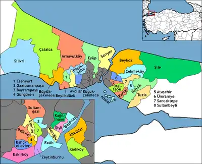
Ümraniye (pronounced [ymˈɾaːnije]) is a district of Istanbul. It was separated from Üsküdar in 1987. It gained the villages of Ömerli, Koçullu, Sırapınar and Hüseyinli from Beykoz in the same year. Finally, Nişantepe quarter passed from Samandıra, where bound to Kartal, to Alemdar, where bound to Ümraniye in 2002. It is bordered by Çekmeköy to the northeast, Sancaktepe to the east, Ataşehir to the south, Üsküdar to the west and Beykoz to the northwest.
Ümraniye | |
|---|---|
district | |
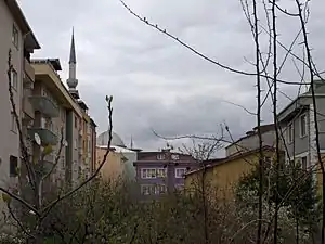
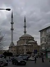
 View of Ümraniye from Kirişhane Cd. On the left, the minaret and the dome of the Hazreti Ömer Mosque | |
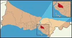
 Location of Ümraniye in Istanbul | |
 Ümraniye Location of Ümraniye in Istanbul | |
| Coordinates: 41°01′52″N 29°06′29″E | |
| Country | Turkey |
| City | Istanbul |
| province | Istanbul |
| Government | |
| • Mayor | Hasan Can (AKP) |
| • Governor | Mehmet Ali Yıldırım |
| Area | |
| • District | 163.09 km2 (62.97 sq mi) |
| Population (2012)[2] | |
| • District | 645,238 |
| • District density | 4,000/km2 (10,000/sq mi) |
| Time zone | UTC+3 (EET) |
| • Summer (DST) | UTC+3 (EEST) |
| Area code(s) | 0-216 |
| Website | www |
History
Ümraniye is located on high ground just inland from Üsküdar. It began as a small village of under 900 people mainly immigrated from Black Sea Region, but in the early 1950s. Its population grew far beyond its capacity during the 1970s and 1980s due to migration to the cities from rural areas of Anatolia.
On 17 March 1978, 5 workers were massacred by Communist militants in the district.
The growth of Ümraniye was better controlled than other districts that also attracted workers on the European side (such as Esenler or Gaziosmanpaşa); there are better, wider roads through the district, more space between the blocks and more green space in general. And better amenities, a large commercial district grew up to support this large population, the main road through the centre has shiny public buildings, big shops, shopping centres, branches of all the banks etc. And Ümraniye has high schools, a courthouse, cultural amenities such as cinema and all the other infrastructure of an urban area. And the traffic of course. Although it used to be a little village,Ümraniye now gives high class opportunities to its elites.
Ümraniye became famous after an arms cache allegedly belonging to conspiratorial Ergenekon network was discovered here in 2007.
Ümraniye today

With its natural landscape and urban design, Ümraniye was chosen as the cleanest district of Istanbul by ISTAC. Recently there has been a great deal of change in Ümraniye. Large shopping malls and entertainment centers have opened everywhere. Many housing projects have been developed in Umraniye to address the needs of all classes. Ümraniye is one of the fastest growing areas in Istanbul.
In the last few decades, Ümraniye has built a lively shopping and business district. Numerous international businesses are now based in Umraniye, which attract young, well-educated people from all over Turkey. At Ümraniye, you can find 34 kindergarten, 61 primary School and 9 high schools, as well as 22 sport-centers, and 29 hospitals and clinics. There are numerous athletic and cultural activities in Umraniye at 40 parks, 3 movie theaters and 3 theaters.
Recent building projects include the construction of large shopping malls (including Istanbul's first branch of IKEA), and modern apartments complexes have made parts of Ümraniye attractive places for people to buy real estate, especially as Ümraniye is on a main highway that leads to one of the two bridges linking the Asian and European sides of Istanbul. A car ride from Ümraniye to Mecidiyeköy, a business center on the European side of the city, may only take around 20 minutes in good traffic. Ümraniye also provides easy access to Üsküdar, Kadıköy and Ataşehir, the business capital of the Asian side of Istanbul.
Sports
The women's football club Dudullu Spor was promoted to the Women's First League for the 2020-21 League season.[3]
Politics
Ümraniye has seen its fair share of political violence between left- and right-wingers over the years, and during the 70s and 80s law enforcement was problematic in parts of the area. In this way it was considered the Asian side's equivalent of Gaziosmanpaşa on the European side. This violence was concentrated in a small quarter of Ümraniye, a vast district. In recent times however, Ümraniye has been relatively calm, and the most dangerous crimes in the area are those typical of urban areas, such as pick-pocketing or theft and those political crime involved districts are now in limits of Ataşehir.
The people of Ümraniye usually vote in large numbers for conservative parties. The AK Party does well in this district.
Places of importance
In between Üsküdar and Ümraniye there is a 'çilehane' of the Sufi saint Aziz Mahmud Hudayi. A çilehane (cheelay-hahnay, lit. 'despair house') was where Sufis would go to pray in seclusion.
The Haldun Alagaş Sports Hall is located here, which is named after the multiple world and European champion of Karate. The venue hosts both national and international basketball, volleyball, handball games and martial art competitions.[4]
There is a newly made forestress where people can have walk and picnic. In some parts of Ümraniye, the full scene of Istanbul, including Bosphorus and European Side, can be seen easily. Also,Çamlıca hill is very close.
References
- "Area of regions (including lakes), km²". Regional Statistics Database. Turkish Statistical Institute. 2002. Retrieved 2013-03-05.
- "Population of province/district centers and towns/villages by districts - 2012". Address Based Population Registration System (ABPRS) Database. Turkish Statistical Institute. Retrieved 2013-02-27.
- "2019-2020 Sezonu Kadın Ligleri Yönetim Kurulu Kararı - 2- Kadınlar 2. Ligi" (in Turkish). Türkiye Futbol Federasyonu. 13 July 2020. Retrieved 10 October 2020.
- "Haldun Alagaş Spor Kompleksi" (in Turkish). Spor AŞ. Retrieved 2012-11-27.
