Kaniere
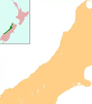
Kaniere is a small town in the Westland District of the West Coast region of New Zealand's South Island. Hokitika lies to the north-west, and the Hokitika River flows past to the south-west.[1][2]
Kaniere | |
|---|---|
 Kaniere | |
| Coordinates: 42°44′53″S 171°0′26″E | |
| Country | New Zealand |
| Region | West Coast |
| District | Westland District |
| Electorates | West Coast-Tasman Te Tai Tonga |
| Population (2013) | |
| • Total | 483 |
| Time zone | UTC+12 (NZST) |
| • Summer (DST) | UTC+13 (NZDT) |
| Postcode | 7811 |
| Area code(s) | 03 |
| Local iwi | Ngāi Tahu |
According to the 2013 New Zealand census, Kaniere has a population of 483, an increase of 24 people since the 2006 census.[3]
The locality began about 1865 as one of the main alluvial gold fields of the West Coast gold rush.[4][5] The Hokitika & Kanieri Tramway laid with wooden rails was established from Hokitika by 1868, with cars drawn by horses.[6] A road followed by 1873.[7]
Kaniere often seen written Kanieri, official spelling of the town is Kaniere [8]
Locality on the Hokitika River, 5km southeast of Hokitika. Kaniere Survey District.
History/Origin/Meaning:
Reeds[9] Dictionary of New Zealand Place Names gives the following explanation, "Kani is the act of sawing greenstone preparatory to making tools, weapons or ornaments, a long wearisome process. The name was formerly and incorrectly spelt Kanieri. The terminal ere or eri is inexplicable. There is just a possibility that it was originally oro, literally to grind or sharpen on a stone. It may be significant that, according to legend, Kanioro was the fabled guardian of greenstone". Instead of Kanieri. This decision confirms and supersedes the decision of 1930. (Gaz 1948, p939)[./Https://gazetteer.linz.govt.nz/place/2381
Education
Kaniere School is a coeducational contributing primary (years 1–6) school with a roll of 106 students as of March 2020.[10]*Education Counts: Kaniere School
Notes
- Peter Dowling (editor) (2004). Reed New Zealand Atlas. Reed Books. pp. map 69. ISBN 0-7900-0952-8.CS1 maint: extra text: authors list (link)
- Roger Smith, GeographX (2005). The Geographic Atlas of New Zealand. Robbie Burton. pp. map 156. ISBN 1-877333-20-4.
- 2013 Census QuickStats about a place : Kaniere
- Rogers, Anna (2005). Illustrated History of the West Coast. p. 49. ISBN 0-7900-1022-4.
- "Hokitika River". Encyclopedia of New Zealand (1966).
- Rogers, p 63
- Rogers, p 67
- "Otago Daily Times". paperspast.natlib.govt.nz. 6 January 1949. Retrieved 26 September 2020.
- "Gazetteer". Linz.govt.nz. 1950.
- "New Zealand Schools Directory". New Zealand Ministry of Education. Retrieved 26 April 2020.
